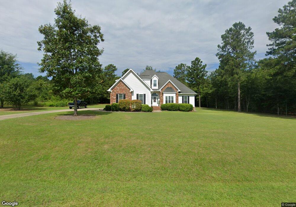
320 Buckskin Dr Macon, GA 31216
Estimated Value: $295,000 - $315,950
4
Beds
3
Baths
2,205
Sq Ft
$138/Sq Ft
Est. Value
About This Home
This home is located at 320 Buckskin Dr, Macon, GA 31216 and is currently estimated at $304,988, approximately $138 per square foot. 320 Buckskin Dr is a home located in Bibb County with nearby schools including Heard Elementary School, Rutland Middle School, and Rutland High School.
Ownership History
Date
Name
Owned For
Owner Type
Purchase Details
Closed on
Mar 7, 2018
Sold by
Maxwell Ricky
Bought by
Williams Patti Jo and Williams Mark T
Current Estimated Value
Purchase Details
Closed on
Jan 27, 2017
Bought by
Williams Mark T and Williams Patti J
Home Financials for this Owner
Home Financials are based on the most recent Mortgage that was taken out on this home.
Original Mortgage
$126,000
Interest Rate
4.32%
Mortgage Type
New Conventional
Purchase Details
Closed on
Jul 20, 2009
Sold by
Mike L Moon Enterprises Llc
Bought by
Bob St John Construction Llc
Home Financials for this Owner
Home Financials are based on the most recent Mortgage that was taken out on this home.
Original Mortgage
$181,432
Interest Rate
5.37%
Mortgage Type
Future Advance Clause Open End Mortgage
Purchase Details
Closed on
Jan 19, 2007
Bought by
Moon Mike L Enterprises Llc
Create a Home Valuation Report for This Property
The Home Valuation Report is an in-depth analysis detailing your home's value as well as a comparison with similar homes in the area
Purchase History
| Date | Buyer | Sale Price | Title Company |
|---|---|---|---|
| Williams Patti Jo | $8,800 | None Available | |
| Williams Mark T | $140,000 | -- | |
| Bob St John Construction Llc | $28,500 | None Available | |
| Moon Mike L Enterprises Llc | $1,171,700 | -- |
Source: Public Records
Mortgage History
| Date | Status | Borrower | Loan Amount |
|---|---|---|---|
| Previous Owner | Williams Mark T | $126,000 | |
| Previous Owner | Bob St John Construction Llc | $181,432 |
Source: Public Records
Tax History
| Year | Tax Paid | Tax Assessment Tax Assessment Total Assessment is a certain percentage of the fair market value that is determined by local assessors to be the total taxable value of land and additions on the property. | Land | Improvement |
|---|---|---|---|---|
| 2025 | $2,479 | $107,888 | $12,800 | $95,088 |
| 2024 | $2,528 | $106,532 | $12,800 | $93,732 |
| 2023 | $1,920 | $100,607 | $9,600 | $91,007 |
| 2022 | $2,689 | $84,663 | $12,000 | $72,663 |
| 2021 | $2,444 | $71,313 | $12,000 | $59,313 |
| 2020 | $2,497 | $71,313 | $12,000 | $59,313 |
| 2019 | $2,518 | $71,313 | $12,000 | $59,313 |
| 2018 | $3,118 | $63,618 | $8,000 | $55,618 |
| 2017 | $2,012 | $63,189 | $8,000 | $55,189 |
| 2016 | $2,223 | $64,262 | $8,000 | $56,262 |
| 2015 | $3,147 | $64,262 | $8,000 | $56,262 |
| 2014 | $4,061 | $82,795 | $15,280 | $67,515 |
Source: Public Records
Map
Nearby Homes
- 412 Gray Wolf Dr
- 319 Hawk Ct
- 317 Hawk Ct
- 312 Hawk Ct
- 1419 Griffin Rd
- 1850 Barnes Ferry Rd
- 120 Abberley Ln
- 137 Abberley Ln
- 341 Stockton Cir
- 337 Stockton Cir
- 301 Stockton Cir
- 7070 Sofkee Place
- 2165 Griffin Rd
- 2154 Allen Rd
- 4057 Liberty Estates Dr
- 297 Amanda Dr
- 8410 Hawkinsville Rd Unit LOT 42
- 268 Amanda Dr
- 261 Amanda Dr
- 344 Browning Pointe Rd
- 319 Buckskin Dr
- 314 Buckskin Dr
- 312 Buckskin Dr Unit 250
- 403 Gray Wolf Dr
- 310 Buckskin Dr
- 1357 Barnes Ferry Rd
- 405 Gray Wolf Dr Unit 76
- 1355 Barnes Ferry Rd
- 0 Gray Wolf Dr Unit 147157
- 0 Gray Wolf Dr Unit 147156
- 406 Gray Wolf Dr
- 0 Buckskin Dr Unit 7460806
- 306 Buckskin Dr
- 1353 Barnes Ferry Rd
- 407 Gray Wolf Dr
- 408 Gray Wolf Dr
- 1351 Barnes Ferry Rd
- 304 Buckskin Dr
- 411 Gray Wolf Dr
- 1349 Barnes Ferry Rd
Your Personal Tour Guide
Ask me questions while you tour the home.