Estimated Value: $82,095 - $150,000
2
Beds
1
Bath
1,060
Sq Ft
$109/Sq Ft
Est. Value
About This Home
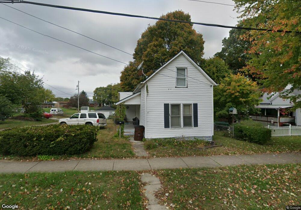
This home is located at 320 Cincinnati Ave, Xenia, OH 45385 and is currently estimated at $115,524, approximately $108 per square foot. 320 Cincinnati Ave is a home located in Greene County with nearby schools including Xenia High School, Summit Academy Community School for Alternative Learners - Xenia, and Legacy Christian Academy.
Ownership History
Date
Name
Owned For
Owner Type
Purchase Details
Closed on
Nov 6, 2024
Sold by
Kigar Rick
Bought by
Godawski Eugene S
Current Estimated Value
Purchase Details
Closed on
Jan 4, 2011
Sold by
Brown Cathy Jo
Bought by
Brown Bryson E
Home Financials for this Owner
Home Financials are based on the most recent Mortgage that was taken out on this home.
Original Mortgage
$52,800
Interest Rate
4.85%
Mortgage Type
New Conventional
Purchase Details
Closed on
Sep 12, 1997
Sold by
Martin Dawn M
Bought by
Brown Bryson E and Brown J
Home Financials for this Owner
Home Financials are based on the most recent Mortgage that was taken out on this home.
Original Mortgage
$54,950
Interest Rate
7.44%
Mortgage Type
VA
Create a Home Valuation Report for This Property
The Home Valuation Report is an in-depth analysis detailing your home's value as well as a comparison with similar homes in the area
Home Values in the Area
Average Home Value in this Area
Purchase History
| Date | Buyer | Sale Price | Title Company |
|---|---|---|---|
| Godawski Eugene S | $46,300 | Ohio Real Estate Title | |
| Godawski Eugene S | $46,300 | Ohio Real Estate Title | |
| Brown Bryson E | -- | First American | |
| Brown Bryson E | $53,900 | -- |
Source: Public Records
Mortgage History
| Date | Status | Borrower | Loan Amount |
|---|---|---|---|
| Previous Owner | Brown Bryson E | $52,800 | |
| Previous Owner | Brown Bryson E | $54,950 |
Source: Public Records
Tax History Compared to Growth
Tax History
| Year | Tax Paid | Tax Assessment Tax Assessment Total Assessment is a certain percentage of the fair market value that is determined by local assessors to be the total taxable value of land and additions on the property. | Land | Improvement |
|---|---|---|---|---|
| 2024 | $1,309 | $30,030 | $5,220 | $24,810 |
| 2023 | $1,309 | $30,030 | $5,220 | $24,810 |
| 2022 | $1,112 | $22,730 | $4,180 | $18,550 |
| 2021 | $1,127 | $22,730 | $4,180 | $18,550 |
| 2020 | $1,078 | $22,730 | $4,180 | $18,550 |
| 2019 | $1,116 | $22,140 | $4,760 | $17,380 |
| 2018 | $1,120 | $22,140 | $4,760 | $17,380 |
| 2017 | $588 | $22,140 | $4,760 | $17,380 |
| 2016 | $1,073 | $20,830 | $4,760 | $16,070 |
| 2015 | $1,076 | $20,830 | $4,760 | $16,070 |
| 2014 | $1,030 | $20,830 | $4,760 | $16,070 |
Source: Public Records
Map
Nearby Homes
- 302 Cincinnati Ave
- 330 Cincinnati Ave Unit 330-338-342
- 330 Cincinnati Ave
- 294 Cincinnati Ave
- 311 Sacramento St
- 358 Cincinnati Ave
- 241 California Dr
- 259 California Dr
- 0 Sacramento St
- 231 California Dr
- 341 Cincinnati Ave
- 349 Cincinnati Ave
- 7 Sacremento St
- 287 Cincinnati Ave
- 378 Cincinnati Ave
- 378 Cincinnati Ave
- 365 Cincinnati Ave
- 276 California St
- 276 California Dr
- 255 Charles St