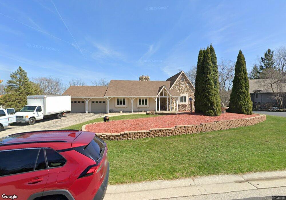
320 Concord Dr Brookfield, WI 53005
Estimated Value: $633,000 - $716,000
About This Home
This home is located at 320 Concord Dr, Brookfield, WI 53005 and is currently estimated at $672,509, approximately $362 per square foot. 320 Concord Dr is a home located in Waukesha County with nearby schools including Swanson Elementary School, Wisconsin Hills Middle School, and Brookfield Central High School.
Ownership History
We collect this data history from publicly available records. To have your information removed, we recommend requesting removal directly through your county’s website.
Purchase Details
Home Financials for this Owner
Home Financials are based on the most recent Mortgage that was taken out on this home.Home Values in the Area
Average Home Value in this Area
Purchase History
We collect this data history from publicly available records. To have your information removed, we recommend requesting removal directly through your county’s website.
| Date | Buyer | Sale Price | Title Company |
|---|---|---|---|
| -- | -- |
Mortgage History
We collect this data history from publicly available records. To have your information removed, we recommend requesting removal directly through your county’s website.
| Date | Status | Borrower | Loan Amount |
|---|---|---|---|
| Closed | $300,000 |
Tax History
We collect this data history from publicly available records. To have your information removed, we recommend requesting removal directly through your county’s website.
| Year | Tax Paid | Tax Assessment Tax Assessment Total Assessment is a certain percentage of the fair market value that is determined by local assessors to be the total taxable value of land and additions on the property. | Land | Improvement |
|---|---|---|---|---|
| 2025 | $6,148 | $533,100 | $145,000 | $388,100 |
| 2024 | $5,974 | $533,100 | $145,000 | $388,100 |
| 2023 | $5,978 | $533,100 | $145,000 | $388,100 |
| 2022 | $6,431 | $447,500 | $140,000 | $307,500 |
| 2021 | $6,813 | $447,500 | $140,000 | $307,500 |
| 2020 | $7,096 | $447,500 | $140,000 | $307,500 |
| 2019 | $6,820 | $447,500 | $140,000 | $307,500 |
| 2018 | $6,311 | $403,600 | $140,000 | $263,600 |
| 2017 | $6,307 | $403,600 | $140,000 | $263,600 |
| 2016 | $6,398 | $403,600 | $140,000 | $263,600 |
| 2015 | $6,361 | $403,600 | $140,000 | $263,600 |
| 2014 | $6,598 | $403,600 | $140,000 | $263,600 |
| 2013 | $6,598 | $403,600 | $140,000 | $263,600 |
Map
- 365 Sheffield Dr
- 305 Leanore Ln
- 215 Leanore Ln
- 14420 Woodridge Cir
- 530 Park Cir
- 825 Lone Tree Rd
- 345 N Elm Grove Rd Unit B
- 738 Elm Grove Rd Unit 738
- 575 Kenmar Rd
- 1005 Lone Tree Rd
- 1065 Lower Ridgeway
- 13050 W Bluemound Rd Unit 203
- 12990 W Bluemound Rd Unit 103
- 13060 W Bluemound Rd Unit 201
- 15200 Briaridge Ct
- 13335 Watertown Plank Rd Unit 105
- 13335 Watertown Plank Rd Unit 303
- 13335 Watertown Plank Rd Unit 110
- 13335 Watertown Plank Rd Unit 109
- 1260 Lakeside Dr
- 300 Concord Dr
- 295 Bunker Hill Dr
- 325 Bunker Hill Dr
- 315 Concord Dr
- 275 Bunker Hill Dr
- 360 Concord Dr
- 355 Bunker Hill Dr
- 355 Concord Dr
- 255 Bunker Hill Dr
- 300 Bunker Hill Dr
- 265 N Eastmoor Ave
- 390 Concord Dr
- 14430 Mount Vernon Ave
- 330 Bunker Hill Dr
- 185 Stockton Ct
- 260 Bunker Hill Dr
- 235 N Eastmoor Ave
- 315 N Eastmoor Ave
- 385 Bunker Hill Dr
- 385 Concord Dr
Ask me questions while you tour the home.