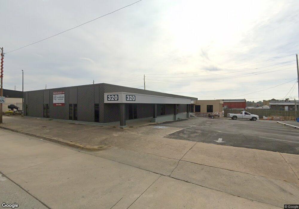
320 E Carl Albert Pkwy McAlester, OK 74501
--
Bed
2
Baths
8,060
Sq Ft
0.54
Acres
About This Home
This home is located at 320 E Carl Albert Pkwy, McAlester, OK 74501. 320 E Carl Albert Pkwy is a home located in Pittsburg County with nearby schools including McAlester High School and Mcalester Christian Academy.
Ownership History
Date
Name
Owned For
Owner Type
Purchase Details
Closed on
Aug 30, 2018
Sold by
Mcbee Ellen E and Ford Sharon M
Bought by
Sure Group Llc
Home Financials for this Owner
Home Financials are based on the most recent Mortgage that was taken out on this home.
Original Mortgage
$312,000
Outstanding Balance
$269,828
Interest Rate
4.5%
Mortgage Type
Commercial
Purchase Details
Closed on
Aug 29, 2018
Sold by
Edward Jones Trust Co
Bought by
Sure Group Llc
Home Financials for this Owner
Home Financials are based on the most recent Mortgage that was taken out on this home.
Original Mortgage
$312,000
Outstanding Balance
$269,828
Interest Rate
4.5%
Mortgage Type
Commercial
Create a Home Valuation Report for This Property
The Home Valuation Report is an in-depth analysis detailing your home's value as well as a comparison with similar homes in the area
Home Values in the Area
Average Home Value in this Area
Purchase History
| Date | Buyer | Sale Price | Title Company |
|---|---|---|---|
| Sure Group Llc | $260,000 | None Available | |
| Sure Group Llc | $130,000 | None Available |
Source: Public Records
Mortgage History
| Date | Status | Borrower | Loan Amount |
|---|---|---|---|
| Open | Sure Group Llc | $312,000 |
Source: Public Records
Tax History Compared to Growth
Tax History
| Year | Tax Paid | Tax Assessment Tax Assessment Total Assessment is a certain percentage of the fair market value that is determined by local assessors to be the total taxable value of land and additions on the property. | Land | Improvement |
|---|---|---|---|---|
| 2025 | $3,728 | $42,415 | $7,780 | $34,635 |
| 2024 | $3,728 | $43,166 | $7,780 | $35,386 |
| 2023 | $3,785 | $46,895 | $7,780 | $39,115 |
| 2022 | $4,106 | $46,895 | $7,780 | $39,115 |
| 2021 | $4,085 | $46,895 | $7,780 | $39,115 |
| 2020 | $3,948 | $45,045 | $7,780 | $37,265 |
| 2019 | $3,456 | $42,900 | $7,780 | $35,120 |
| 2018 | $2,765 | $34,255 | $4,714 | $29,541 |
| 2017 | $2,658 | $32,623 | $5,892 | $26,731 |
| 2016 | $2,519 | $31,069 | $5,611 | $25,458 |
| 2015 | $2,201 | $29,590 | $5,344 | $24,246 |
| 2014 | $2,096 | $28,182 | $8,633 | $19,549 |
Source: Public Records
Map
Nearby Homes
- 342 E Adams Ave
- 511 E Washington Ave
- 531 E Washington Ave
- Pittsburg County
- 425 N 2nd St
- 515 E Wyandotte
- 517 N 2nd St
- 35 E Jefferson Ave
- 28 E Jefferson Ave
- 204 W Washington Ave
- 331 E Monroe Ave
- 220 W Washington
- 1311 S George Nigh Expy
- 11 E Washington Ave
- 803 E Delaware Ave
- 209 W Jefferson Ave
- 215 E Jackson Ave
- 903 E Wyandotte
- 602 E Comanche Ave
- 525 E Seminole Ave
- 315 E Choctaw Ave
- 301 E Choctaw Ave
- 325 E Choctaw Ave
- 312 E Choctaw Ave
- 225 E Carl Albert Pkwy
- 216 E Choctaw Ave
- 300 E Washington Ave
- 220 E Choctaw Ave
- 347 E Choctaw Ave
- 345 E Choctaw Ave
- 10 NW Degiacomo Cir
- 214 E Choctaw Ave
- 100 N 2nd St
- 206 E Choctaw Ave
- 126 E Choctaw Ave
- 352 E Washington Ave
- 125 E Choctaw Ave
- 211 N 5th St
- 302 E Washington Ave
- 343 E Washington Ave