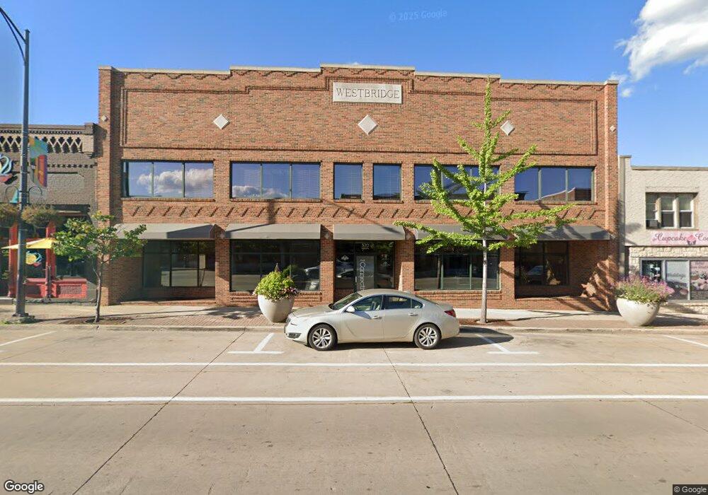
320 Main Ave de Pere, WI 54115
--
Bed
--
Bath
6,824
Sq Ft
9,583
Sq Ft Lot
About This Home
This home is located at 320 Main Ave, de Pere, WI 54115. 320 Main Ave is a home located in Brown County with nearby schools including Westwood Elementary School, West De Pere Middle School, and West De Pere High School.
Ownership History
Date
Name
Owned For
Owner Type
Purchase Details
Closed on
Aug 9, 2018
Sold by
Oconnor Bridget Krage
Bought by
The Connective Llc
Home Financials for this Owner
Home Financials are based on the most recent Mortgage that was taken out on this home.
Original Mortgage
$295,000
Outstanding Balance
$256,196
Interest Rate
4.5%
Mortgage Type
Commercial
Purchase Details
Closed on
Jul 23, 2018
Sold by
Garot Keith E
Bought by
Connor Bridget Krage O
Home Financials for this Owner
Home Financials are based on the most recent Mortgage that was taken out on this home.
Original Mortgage
$295,000
Outstanding Balance
$256,196
Interest Rate
4.5%
Mortgage Type
Commercial
Purchase Details
Closed on
May 29, 1998
Sold by
City Of De Pere
Bought by
Garot Burkard Investments Llp
Create a Home Valuation Report for This Property
The Home Valuation Report is an in-depth analysis detailing your home's value as well as a comparison with similar homes in the area
Home Values in the Area
Average Home Value in this Area
Purchase History
| Date | Buyer | Sale Price | Title Company |
|---|---|---|---|
| The Connective Llc | -- | None Available | |
| Connor Bridget Krage O | $360,001 | None Available | |
| Garot Burkard Investments Llp | -- | -- |
Source: Public Records
Mortgage History
| Date | Status | Borrower | Loan Amount |
|---|---|---|---|
| Open | The Connective Llc | $295,000 |
Source: Public Records
Tax History Compared to Growth
Tax History
| Year | Tax Paid | Tax Assessment Tax Assessment Total Assessment is a certain percentage of the fair market value that is determined by local assessors to be the total taxable value of land and additions on the property. | Land | Improvement |
|---|---|---|---|---|
| 2024 | $11,800 | $693,500 | $57,800 | $635,700 |
| 2023 | $10,622 | $603,000 | $57,800 | $545,200 |
| 2022 | $10,019 | $523,800 | $57,800 | $466,000 |
| 2021 | $9,298 | $446,100 | $57,800 | $388,300 |
| 2020 | $9,818 | $446,100 | $57,800 | $388,300 |
| 2019 | $14,365 | $657,700 | $57,800 | $599,900 |
| 2018 | $14,759 | $657,700 | $57,800 | $599,900 |
| 2017 | $15,042 | $657,700 | $57,800 | $599,900 |
| 2016 | $15,148 | $657,700 | $57,800 | $599,900 |
| 2015 | $15,451 | $657,700 | $57,800 | $599,900 |
| 2014 | $14,717 | $657,700 | $57,800 | $599,900 |
| 2013 | $14,717 | $657,700 | $57,800 | $599,900 |
Source: Public Records
Map
Nearby Homes
- 555 Main Ave Unit 110
- 555 Main Ave Unit 104
- 555 Main Ave Unit 111
- 555 Main Ave Unit 206
- 555 Main Ave Unit 113
- 200 William St Unit 402
- 634 Grant St
- 717 4th St
- 657 Reid St
- 416 Lansdowne St
- 410 Battery Ave
- 363 Battery Ave
- 1611 N Honeysuckle Cir
- 305 Battery Ave
- 385 Battery Ave
- 413 Brookline Ave
- 337 Battery Ave
- 400 Battery Ave
- 806 4th St
- 721 Cedar St