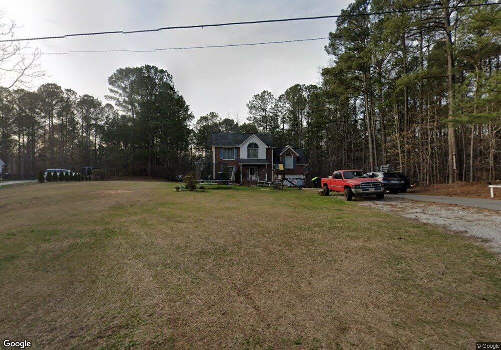
320 McDonald Rd Tallapoosa, GA 30176
Estimated Value: $282,382 - $328,000
3
Beds
3
Baths
1,862
Sq Ft
$162/Sq Ft
Est. Value
About This Home
This home is located at 320 McDonald Rd, Tallapoosa, GA 30176 and is currently estimated at $302,096, approximately $162 per square foot. 320 McDonald Rd is a home located in Haralson County with nearby schools including Haralson County High School.
Ownership History
Date
Name
Owned For
Owner Type
Purchase Details
Closed on
Nov 30, 2018
Sold by
Patel Tushar
Bought by
Amaca Properties Corp
Current Estimated Value
Purchase Details
Closed on
Dec 7, 2010
Sold by
Williams David
Bought by
C W Greenwood Family Limited P
Purchase Details
Closed on
Apr 21, 2004
Sold by
Worthy Michelle Greenwood
Bought by
Williams David and Williams Donna
Purchase Details
Closed on
Aug 7, 2001
Sold by
York Travis L and York Suzanne
Bought by
Worthy Michelle Greenwood
Purchase Details
Closed on
Feb 15, 1999
Sold by
Greenwood C W
Bought by
York Travis L and York Suza
Purchase Details
Closed on
Nov 7, 1997
Sold by
Robinson Ricky W
Bought by
Greenwood C W
Purchase Details
Closed on
May 30, 1996
Sold by
Cohran James M and Cohran Mar
Bought by
Robinson Ricky W
Purchase Details
Closed on
Mar 1, 1987
Sold by
Mcdonald Frances L
Bought by
Cohran James M and Cohran Mar
Create a Home Valuation Report for This Property
The Home Valuation Report is an in-depth analysis detailing your home's value as well as a comparison with similar homes in the area
Home Values in the Area
Average Home Value in this Area
Purchase History
| Date | Buyer | Sale Price | Title Company |
|---|---|---|---|
| Amaca Properties Corp | -- | -- | |
| Patel Tushar | $1,000,900 | -- | |
| C W Greenwood Family Limited P | $126,525 | -- | |
| Williams David | $139,900 | -- | |
| Worthy Michelle Greenwood | -- | -- | |
| York Travis L | $125,500 | -- | |
| Greenwood C W | $8,000 | -- | |
| Robinson Ricky W | $5,000 | -- | |
| Cohran James M | $3,000 | -- |
Source: Public Records
Tax History Compared to Growth
Tax History
| Year | Tax Paid | Tax Assessment Tax Assessment Total Assessment is a certain percentage of the fair market value that is determined by local assessors to be the total taxable value of land and additions on the property. | Land | Improvement |
|---|---|---|---|---|
| 2024 | $2,098 | $66,588 | $7,200 | $59,388 |
| 2023 | $2,593 | $79,262 | $7,200 | $72,062 |
| 2022 | $1,663 | $64,441 | $7,200 | $57,241 |
| 2021 | $1,658 | $61,526 | $7,200 | $54,326 |
| 2020 | $1,683 | $62,241 | $7,200 | $55,041 |
| 2019 | $1,175 | $59,222 | $7,200 | $52,022 |
| 2018 | $1,663 | $58,570 | $7,200 | $51,370 |
| 2017 | $1,623 | $52,145 | $7,200 | $44,945 |
| 2016 | $1,325 | $45,483 | $7,200 | $38,283 |
| 2015 | $1,334 | $45,544 | $7,200 | $38,344 |
| 2014 | $1,697 | $47,340 | $5,700 | $41,640 |
Source: Public Records
Map
Nearby Homes
- 871 Cherokee Dr
- --- Steadman #32 Rd
- 0 Cherokee Dr Unit 148037
- --- Steadman Rd Unit 32
- 0 Steadman Rd Unit 10608314
- 0 Creek Dr Unit 148038
- 174 Faye St
- 194 Faye St
- 35 James St
- 711 Kay St
- 77 McDonald Rd
- 0 N Ridge Dr Unit 7657923
- 0 N Ridge Dr Unit 10615294
- 135 Oakland Ct
- 171 James St
- 28 McDonald Ridge
- 154 Bethany St
- 622 Cedartown Ave
- 324 Bethany St
- 78 Pine Dr
- 300 McDonald Rd
- 383 McDonald Rd
- 280 McDonald Rd
- 376 McDonald Rd
- 0 Mc Donald Rd Unit 7518440
- 0 Mc Donald Rd Unit 7351119
- 0 Mc Donald Rd Unit 8313129
- 0 Mc Donald Rd Unit 8182972
- 0 Mc Donald Rd Unit 8031307
- 0 Mc Donald Rd Unit 7583141
- 0 Mc Donald Rd Unit 8444799
- 0 Mc Donald Rd Unit 7239486
- 0 Mc Donald Rd Unit 7182600
- 0 Mc Donald Rd Unit 3134607
- 0 Mc Donald Rd
- 405 McDonald Rd
- 275 McDonald Rd
- 218 Mohawk Dr Unit 7.67AC
- 218 Mohawk Dr
- 34 Woodstream Ln