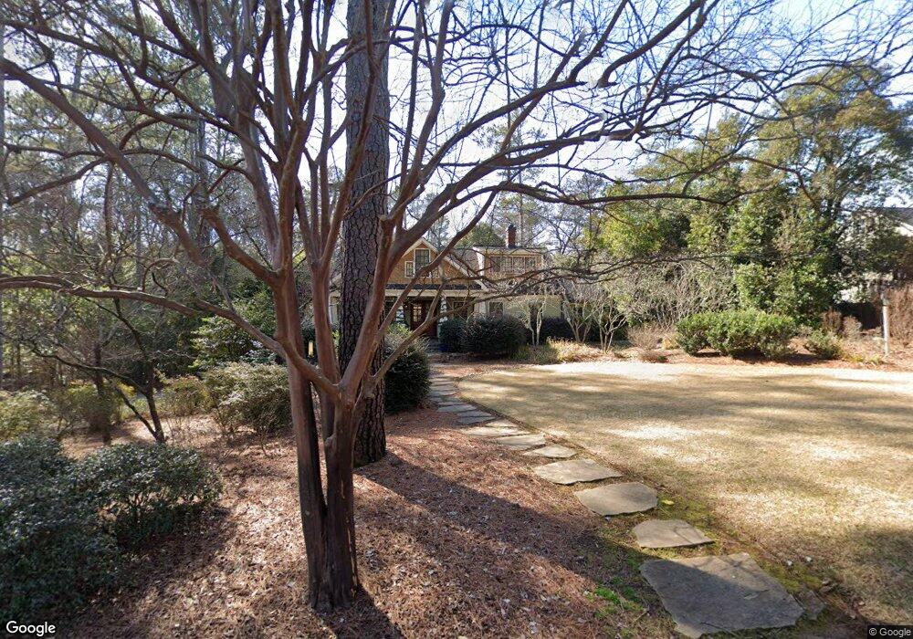
320 Mcwhorter Dr Athens, GA 30606
Five Points NeighborhoodEstimated Value: $1,294,000 - $1,870,705
4
Beds
4
Baths
3,971
Sq Ft
$400/Sq Ft
Est. Value
About This Home
This home is located at 320 Mcwhorter Dr, Athens, GA 30606 and is currently estimated at $1,589,902, approximately $400 per square foot. 320 Mcwhorter Dr is a home located in Clarke County with nearby schools including Barrow Elementary School, Clarke Middle School, and Clarke Central High School.
Ownership History
Date
Name
Owned For
Owner Type
Purchase Details
Closed on
Jun 17, 2005
Sold by
Felker Julia Ray
Bought by
Martin Aimee T and Toon Kevin D
Current Estimated Value
Home Financials for this Owner
Home Financials are based on the most recent Mortgage that was taken out on this home.
Original Mortgage
$400,000
Interest Rate
5.24%
Mortgage Type
New Conventional
Purchase Details
Closed on
Nov 2, 1993
Sold by
Trust Co Bk Trust For Julia
Bought by
Felker Julia Ray
Create a Home Valuation Report for This Property
The Home Valuation Report is an in-depth analysis detailing your home's value as well as a comparison with similar homes in the area
Home Values in the Area
Average Home Value in this Area
Purchase History
| Date | Buyer | Sale Price | Title Company |
|---|---|---|---|
| Martin Aimee T | $500,000 | -- | |
| Felker Julia Ray | -- | -- |
Source: Public Records
Mortgage History
| Date | Status | Borrower | Loan Amount |
|---|---|---|---|
| Closed | Martin Aimee T | $400,000 |
Source: Public Records
Tax History Compared to Growth
Tax History
| Year | Tax Paid | Tax Assessment Tax Assessment Total Assessment is a certain percentage of the fair market value that is determined by local assessors to be the total taxable value of land and additions on the property. | Land | Improvement |
|---|---|---|---|---|
| 2025 | $20,352 | $684,892 | $96,000 | $588,892 |
| 2024 | $19,832 | $650,615 | $88,800 | $561,815 |
| 2023 | $19,832 | $579,018 | $88,800 | $490,218 |
| 2022 | $13,986 | $448,447 | $84,000 | $364,447 |
| 2021 | $12,796 | $389,714 | $84,000 | $305,714 |
| 2020 | $12,001 | $366,122 | $84,000 | $282,122 |
| 2019 | $11,508 | $348,955 | $84,000 | $264,955 |
| 2018 | $9,745 | $297,036 | $84,000 | $213,036 |
| 2017 | $8,886 | $271,724 | $84,000 | $187,724 |
| 2016 | $8,302 | $254,537 | $84,000 | $170,537 |
| 2015 | $6,713 | $207,433 | $72,000 | $135,433 |
| 2014 | $6,184 | $191,603 | $64,800 | $126,803 |
Source: Public Records
Map
Nearby Homes
- 490 Mcwhorter Dr
- 590 Highland Ave
- 169 Fortson Cir
- 495 Woodlawn Ave
- 577 W Cloverhurst Ave
- 224 Fortson Dr
- 206 Fortson Dr
- 1055 Baxter St Unit 504
- 589 W Lake Dr
- 175 Tillman Ln
- 338 Springdale St
- 104 W Lake Ct
- 265 Springdale St
- 997 S Milledge Ave Unit 2
- 997 S Milledge Ave Unit 3
- 997 S Milledge Ave Unit 1
- 997 S Milledge Ave Unit 4
- 275 Westview Dr
- 164 Plum Nelly Rd
- 2019 S Lumpkin St
- 310 Mcwhorter Dr
- 330 Mcwhorter Dr
- 823 Bobbin Mill Rd
- 827 Bobbin Mill Rd
- 293 Mcwhorter Dr
- 0 Bobbin Mill Rd Unit 7392884
- 0 Bobbin Mill Rd Unit 7309498
- 0 Bobbin Mill Rd Unit 8528841
- 0 Bobbin Mill Rd Unit 8227945
- 0 Bobbin Mill Rd Unit 8725805
- 0 Bobbin Mill Rd Unit 7101613
- 840 Bobbin Mill Rd Unit ID1302846P
- 840 Bobbin Mill Rd Unit ID1302856P
- 840 Bobbin Mill Rd Unit ID1302841P
- 840 Bobbin Mill Rd Unit ID1302820P
- 840 Bobbin Mill Rd Unit ID1302818P
- 840 Bobbin Mill Rd Unit ID1247983P
- 840 Bobbin Mill Rd Unit ID1247977P
- 840 Bobbin Mill Rd Unit ID1247967P
- 840 Bobbin Mill Rd Unit ID1247986P