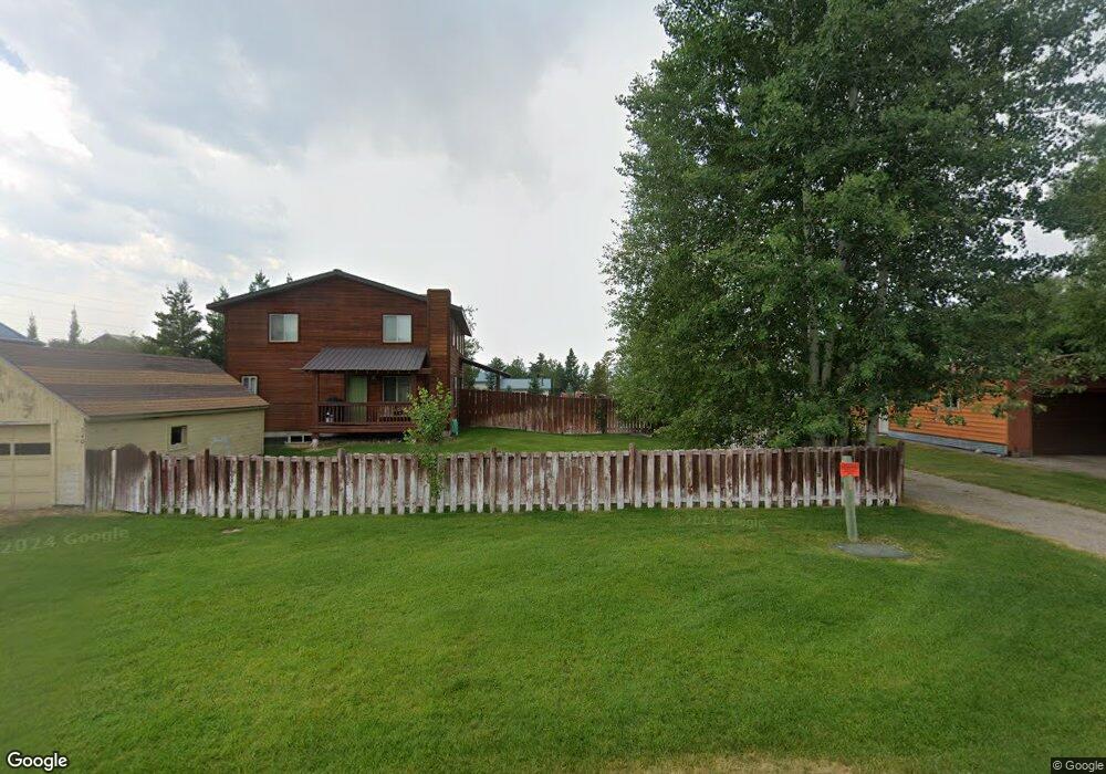
320 N 4th E Driggs, ID 83422
Estimated Value: $388,000 - $668,000
2
Beds
2
Baths
2,148
Sq Ft
$270/Sq Ft
Est. Value
About This Home
This home is located at 320 N 4th E, Driggs, ID 83422 and is currently estimated at $580,356, approximately $270 per square foot. 320 N 4th E is a home located in Teton County with nearby schools including Driggs Elementary School, Teton High School, and The Learning Academy Of Teton Valley.
Ownership History
Date
Name
Owned For
Owner Type
Purchase Details
Closed on
Oct 5, 2023
Sold by
Hervig Mark and Hervig Carlen
Bought by
Munro Janet
Current Estimated Value
Home Financials for this Owner
Home Financials are based on the most recent Mortgage that was taken out on this home.
Original Mortgage
$100,000
Outstanding Balance
$98,034
Interest Rate
7.12%
Mortgage Type
New Conventional
Estimated Equity
$482,322
Create a Home Valuation Report for This Property
The Home Valuation Report is an in-depth analysis detailing your home's value as well as a comparison with similar homes in the area
Home Values in the Area
Average Home Value in this Area
Purchase History
| Date | Buyer | Sale Price | Title Company |
|---|---|---|---|
| Munro Janet | -- | Flying S Title |
Source: Public Records
Mortgage History
| Date | Status | Borrower | Loan Amount |
|---|---|---|---|
| Open | Munro Janet | $100,000 |
Source: Public Records
Tax History
| Year | Tax Paid | Tax Assessment Tax Assessment Total Assessment is a certain percentage of the fair market value that is determined by local assessors to be the total taxable value of land and additions on the property. | Land | Improvement |
|---|---|---|---|---|
| 2025 | $2,290 | $538,250 | $131,702 | $406,548 |
| 2024 | $2,231 | $517,398 | $110,850 | $406,548 |
| 2023 | $2,231 | $516,300 | $109,752 | $406,548 |
| 2022 | $1,563 | $413,101 | $74,016 | $339,085 |
| 2021 | $1,452 | $288,880 | $54,538 | $234,342 |
| 2020 | $2,323 | $222,189 | $41,995 | $180,194 |
| 2019 | $2,000 | $192,424 | $42,262 | $150,162 |
| 2018 | $1,937 | $172,308 | $38,420 | $133,888 |
| 2017 | $1,727 | $166,819 | $32,931 | $133,888 |
| 2016 | $1,610 | $143,319 | $29,403 | $113,916 |
| 2015 | $1,492 | $118,331 | $19,210 | $99,121 |
| 2011 | -- | $142,118 | $25,933 | $116,185 |
Source: Public Records
Map
Nearby Homes
- 570 Easy St
- 201 E Ross Ave Unit B103
- 201 E Ross Ave Unit A103
- 624 Easy St
- 290 N 1st E
- 525 N First St Unit F102
- 525 N First St Unit F204
- 525 N First St Unit B203
- 525 N First St Unit G103
- 525 N First St Unit B102
- 525 N First St Unit B101
- 525 N First St Unit B104
- 525 N First St Unit F101
- 525 N First St Unit F104
- 525 N First St Unit F201
- 525 N First St Unit C101
- 525 N First St Unit F202
- 525 N First St Unit C103
- 525 N First St Unit C102
- 525 N First St Unit F103
- 342 N 4th St
- 380 N 4th St
- 340 N 4th St Unit ID1310721P
- 310 N 4th St
- 345 E Howard Ave
- 390 E Harper Ave
- 345 N 4th St
- 525 W 4
- 650 E Howard Ave
- 0 E Howard Ave
- 340 E Howard Ave
- HANGER Driggs Reed Memorial Airport Unit LOT3-7
- 385 N 4th St
- 320 E Howard Ave
- 365 E Harper Ave
- 265 N 3rd E
- 335 & 355 E Harper
- 410 N 4th E
- 410 N 4th St
- 445 E Howard Ave
Your Personal Tour Guide
Ask me questions while you tour the home.