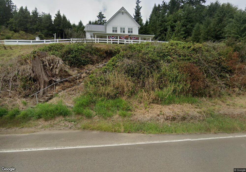
320 Netarts Hwy W Tillamook, OR 97141
Estimated Value: $853,000 - $1,118,135
3
Beds
3
Baths
3,212
Sq Ft
$297/Sq Ft
Est. Value
About This Home
This home is located at 320 Netarts Hwy W, Tillamook, OR 97141 and is currently estimated at $952,712, approximately $296 per square foot. 320 Netarts Hwy W is a home located in Tillamook County with nearby schools including Tillamook High School, Little Clipper Preschool, and Tillamook Adventist School.
Ownership History
Date
Name
Owned For
Owner Type
Purchase Details
Closed on
Aug 20, 2018
Sold by
Stetzig Ruth and Estate Of Henry A Gruber
Bought by
Jenck Joseph and Jenck Lonnie
Current Estimated Value
Purchase Details
Closed on
Feb 9, 2010
Sold by
Gruber Henry A
Bought by
Gruber Richard Henry
Home Financials for this Owner
Home Financials are based on the most recent Mortgage that was taken out on this home.
Original Mortgage
$40,000
Interest Rate
4%
Mortgage Type
Seller Take Back
Create a Home Valuation Report for This Property
The Home Valuation Report is an in-depth analysis detailing your home's value as well as a comparison with similar homes in the area
Home Values in the Area
Average Home Value in this Area
Purchase History
| Date | Buyer | Sale Price | Title Company |
|---|---|---|---|
| Jenck Joseph | $280,000 | Ticor Title | |
| Gruber Richard Henry | $40,000 | None Available |
Source: Public Records
Mortgage History
| Date | Status | Borrower | Loan Amount |
|---|---|---|---|
| Previous Owner | Gruber Richard Henry | $40,000 |
Source: Public Records
Tax History Compared to Growth
Tax History
| Year | Tax Paid | Tax Assessment Tax Assessment Total Assessment is a certain percentage of the fair market value that is determined by local assessors to be the total taxable value of land and additions on the property. | Land | Improvement |
|---|---|---|---|---|
| 2024 | $6,430 | $641,880 | $108,310 | $533,570 |
| 2023 | $6,394 | $623,190 | $105,160 | $518,030 |
| 2022 | $6,170 | $605,040 | $102,100 | $502,940 |
| 2021 | $5,988 | $587,420 | $99,130 | $488,290 |
| 2020 | $4,787 | $467,370 | $96,240 | $371,130 |
| 2019 | $975 | $96,130 | $93,440 | $2,690 |
| 2018 | $1,562 | $152,270 | $85,600 | $66,670 |
| 2017 | $1,524 | $147,840 | $83,110 | $64,730 |
| 2016 | $1,464 | $143,540 | $80,700 | $62,840 |
| 2015 | $1,437 | $139,360 | $78,350 | $61,010 |
| 2014 | $1,416 | $135,310 | $76,080 | $59,230 |
| 2013 | -- | $131,370 | $73,870 | $57,500 |
Source: Public Records
Map
Nearby Homes
- 605 Cottonwood Ave
- 412 Birch Ave
- 1209 6th St
- 315 Birch Ave
- 1412 9th St
- 1307 3rd St
- 1009/1011 Grove Ave Unit 1009-11
- 1003 Grove Ave
- 1703 4th St
- 1706 5th St
- 1708 4th St
- 1806 8th St
- 1010 Ivy Ave
- 02600 12th St
- Lot 2405 12th St
- 2105 9th St
- 17805 U S 101 S
- 2305 7th St
- 2375 Bayocean Rd NW
- 00201 Wilson River Hwy
- 400 Netarts Hwy W
- 130 Netarts Hwy W
- 0 Deer Rd Unit Lot26 22178637
- 0 Lot 26 Deer Rd Unit 22-557
- Lot 26 Deer Rd
- 1720 Deer Rd
- 1720 Deer Rd Unit Deer Road
- 1640 Deer Rd
- 1640 Deer Ridge Rd
- 1720 Deer Ridge Rd
- 1765 Deer Ridge Rd
- 75 Netarts Hwy W
- 210 Tone Rd
- 1620 Deer Ridge Rd
- 1645 Deer Ridge Rd
- 1645 Deer Rd
- 1645 Deer Rd Unit Deer Ridge
- 220 Tone Rd
- 1785 Deer Rd
- 1610 Deer Rd