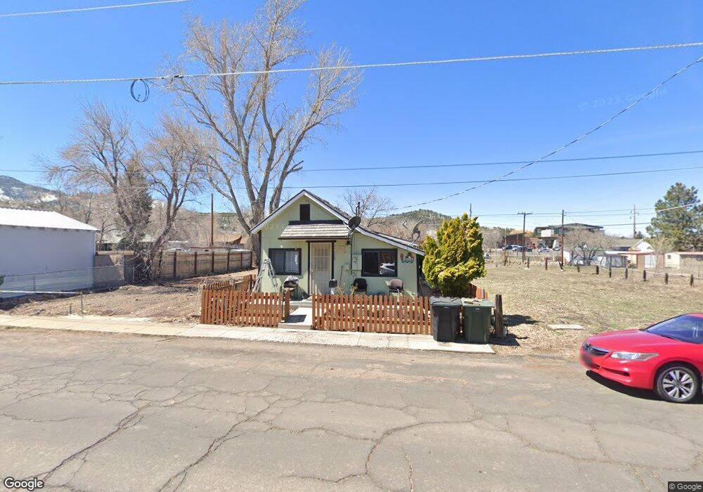
320 S 5th St Williams, AZ 86046
Estimated Value: $251,863 - $368,000
--
Bed
--
Bath
1,454
Sq Ft
$225/Sq Ft
Est. Value
About This Home
This home is located at 320 S 5th St, Williams, AZ 86046 and is currently estimated at $327,466, approximately $225 per square foot. 320 S 5th St is a home located in Coconino County with nearby schools including Williams Elementary/Middle School, Williams High School, and Heritage Elementary - Williams.
Ownership History
Date
Name
Owned For
Owner Type
Purchase Details
Closed on
May 13, 1996
Sold by
Rico Gustavo and Rico Guadalupe H
Bought by
Rico Jaime C and Bencomo Teresa
Current Estimated Value
Purchase Details
Closed on
Aug 25, 1994
Sold by
Granillo Gloria and Curz Gloria
Bought by
Rico Gustavo and Rico Guadalupe H
Home Financials for this Owner
Home Financials are based on the most recent Mortgage that was taken out on this home.
Original Mortgage
$6,000
Interest Rate
8.37%
Mortgage Type
Seller Take Back
Create a Home Valuation Report for This Property
The Home Valuation Report is an in-depth analysis detailing your home's value as well as a comparison with similar homes in the area
Home Values in the Area
Average Home Value in this Area
Purchase History
| Date | Buyer | Sale Price | Title Company |
|---|---|---|---|
| Rico Jaime C | -- | -- | |
| Rico Gustavo | $8,000 | Transamerica Title Co |
Source: Public Records
Mortgage History
| Date | Status | Borrower | Loan Amount |
|---|---|---|---|
| Previous Owner | Rico Gustavo | $6,000 |
Source: Public Records
Tax History
| Year | Tax Paid | Tax Assessment Tax Assessment Total Assessment is a certain percentage of the fair market value that is determined by local assessors to be the total taxable value of land and additions on the property. | Land | Improvement |
|---|---|---|---|---|
| 2025 | $624 | $16,679 | -- | -- |
| 2024 | $624 | $15,832 | -- | -- |
| 2023 | $604 | $12,132 | $0 | $0 |
| 2022 | $569 | $10,037 | $0 | $0 |
| 2021 | $554 | $9,004 | $0 | $0 |
| 2020 | $271 | $4,617 | $0 | $0 |
| 2019 | $263 | $4,081 | $0 | $0 |
| 2018 | $252 | $3,603 | $0 | $0 |
| 2017 | $249 | $3,185 | $0 | $0 |
| 2016 | $245 | $3,171 | $0 | $0 |
| 2015 | $243 | $3,073 | $0 | $0 |
Source: Public Records
Map
Nearby Homes
- 304 S 4th St
- 215 W Hancock Ave
- 241 W Grant Ave
- 500 W Meade Ave
- 401 S 1st St
- 920 W Sheridan Ave
- 911 W Oak St
- 1011 W Sheridan Ave
- 1021 W Sheridan Ave
- 1007 W Oak St
- 1111 W Sheridan Ave
- 344 E Route 66
- 118 Pinecrest Trail
- 162 Pinecrest Trail
- 00 S Pine St
- 147 Pinecrest Trail
- 216 Pinecrest Trail
- 218 E Edison Ave
- 224 N Morse Ave
- 1105 W Morse Ave
- 324 S 5th St
- 326 S 5th St
- 308 S 5th St
- 315 S 5th St
- 311 S 5th St
- 511 W Sherman Ave
- 327 S 5th St
- 503 W Sherman Ave
- 509 W Sheridan Ave
- 501 W Sheridan Ave
- 517 W Sheridan Ave
- 539 W Sherman Ave
- 521 W Sheridan Ave
- 445 W Sherman Ave
- 541 W Sherman Ave
- 433 W Sheridan Ave
- 541 W Sheridan Ave
- 228 S 5th St
- 425 W Sherman Ave
- 220 S 5th St
Your Personal Tour Guide
Ask me questions while you tour the home.