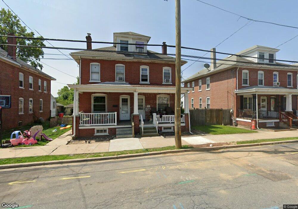
320 W Race St Pottstown, PA 19464
Estimated Value: $180,597 - $223,000
3
Beds
1
Bath
1,120
Sq Ft
$178/Sq Ft
Est. Value
About This Home
This home is located at 320 W Race St, Pottstown, PA 19464 and is currently estimated at $199,866, approximately $178 per square foot. 320 W Race St is a home located in Montgomery County with nearby schools including Lower Pottsgrove Elementary School, Pottsgrove Middle School, and Pottsgrove Senior High School.
Ownership History
Date
Name
Owned For
Owner Type
Purchase Details
Closed on
Jun 2, 2011
Sold by
Wells Fargo Bank Na
Bought by
Costello Christa and Costello Keith
Current Estimated Value
Purchase Details
Closed on
Nov 29, 2010
Sold by
Miller Thomas P and Miller Joanna J
Bought by
Wells Fargo Bank Na
Purchase Details
Closed on
Oct 8, 2004
Sold by
Melnyk Dennis and Melnyk Mary
Bought by
Miller Ii Thomas P and Miller Joanna J
Create a Home Valuation Report for This Property
The Home Valuation Report is an in-depth analysis detailing your home's value as well as a comparison with similar homes in the area
Home Values in the Area
Average Home Value in this Area
Purchase History
| Date | Buyer | Sale Price | Title Company |
|---|---|---|---|
| Costello Christa | $50,000 | None Available | |
| Wells Fargo Bank Na | $1,558 | None Available | |
| Miller Ii Thomas P | $115,000 | -- |
Source: Public Records
Mortgage History
| Date | Status | Borrower | Loan Amount |
|---|---|---|---|
| Closed | Miller Ii Thomas P | $0 |
Source: Public Records
Tax History Compared to Growth
Tax History
| Year | Tax Paid | Tax Assessment Tax Assessment Total Assessment is a certain percentage of the fair market value that is determined by local assessors to be the total taxable value of land and additions on the property. | Land | Improvement |
|---|---|---|---|---|
| 2025 | $2,631 | $54,800 | -- | -- |
| 2024 | $2,631 | $54,800 | -- | -- |
| 2023 | $2,548 | $54,800 | $0 | $0 |
| 2022 | $2,574 | $56,200 | $0 | $0 |
| 2021 | $2,536 | $56,200 | $0 | $0 |
| 2020 | $2,498 | $56,200 | $0 | $0 |
| 2019 | $2,485 | $56,200 | $0 | $0 |
| 2018 | $2,485 | $56,200 | $0 | $0 |
| 2017 | $2,476 | $56,200 | $0 | $0 |
| 2016 | $2,455 | $56,200 | $0 | $0 |
| 2015 | $2,745 | $65,100 | $0 | $0 |
| 2014 | $2,745 | $65,100 | $0 | $0 |
Source: Public Records
Map
Nearby Homes
- 0 Ash St Unit PAMC2144590
- 536 & 538 W Vine St
- 601 W High St
- 501 and 507 E Race St
- 530 E Howard St
- 703 Holly Dr
- 160 Linden St Unit 69
- 8 Ryan St
- 145 Random Rd
- 150 Random Rd
- 25 Random Rd
- 94 Random Rd
- 86 Westin Rd
- 104 Pulaski St
- 131 Squirrel Hollow Rd
- 356 W Beech St Unit 160
- 39 Westin Rd
- 0 Squirrel Hollow Rd
- 1209 Grosstown Rd
- 377 Circle of Progress Dr