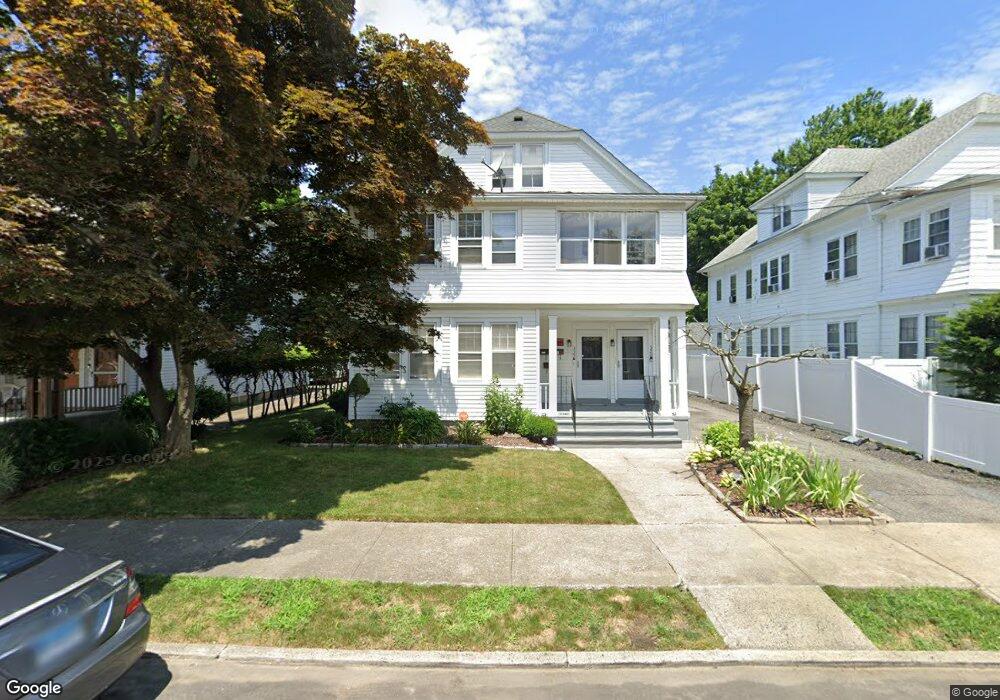
320 Wade St Bridgeport, CT 06604
Brooklawn-Saint Vincent NeighborhoodEstimated Value: $498,000 - $649,000
6
Beds
3
Baths
3,419
Sq Ft
$169/Sq Ft
Est. Value
About This Home
This home is located at 320 Wade St, Bridgeport, CT 06604 and is currently estimated at $576,317, approximately $168 per square foot. 320 Wade St is a home located in Fairfield County with nearby schools including Geraldine Johnson School, Bassick High School, and Merkaz Community High School for Judaic Studies.
Ownership History
Date
Name
Owned For
Owner Type
Purchase Details
Closed on
Sep 15, 1995
Sold by
Laboni Phyllis A
Bought by
Spears Ruby M
Current Estimated Value
Home Financials for this Owner
Home Financials are based on the most recent Mortgage that was taken out on this home.
Original Mortgage
$112,500
Interest Rate
7.81%
Mortgage Type
Unknown
Create a Home Valuation Report for This Property
The Home Valuation Report is an in-depth analysis detailing your home's value as well as a comparison with similar homes in the area
Home Values in the Area
Average Home Value in this Area
Purchase History
| Date | Buyer | Sale Price | Title Company |
|---|---|---|---|
| Spears Ruby M | $125,000 | -- | |
| Spears Ruby M | $125,000 | -- |
Source: Public Records
Mortgage History
| Date | Status | Borrower | Loan Amount |
|---|---|---|---|
| Closed | Spears Ruby M | $107,925 | |
| Closed | Spears Ruby M | $112,500 |
Source: Public Records
Tax History
| Year | Tax Paid | Tax Assessment Tax Assessment Total Assessment is a certain percentage of the fair market value that is determined by local assessors to be the total taxable value of land and additions on the property. | Land | Improvement |
|---|---|---|---|---|
| 2025 | $9,430 | $217,020 | $79,300 | $137,720 |
| 2024 | $9,430 | $217,020 | $79,300 | $137,720 |
| 2023 | $9,706 | $223,380 | $79,300 | $144,080 |
| 2022 | $9,706 | $223,380 | $79,300 | $144,080 |
| 2021 | $9,706 | $223,380 | $79,300 | $144,080 |
| 2020 | $9,071 | $168,020 | $48,050 | $119,970 |
| 2019 | $9,071 | $168,020 | $48,050 | $119,970 |
| 2018 | $9,135 | $168,020 | $48,050 | $119,970 |
| 2017 | $9,135 | $168,020 | $48,050 | $119,970 |
| 2016 | $9,135 | $168,020 | $48,050 | $119,970 |
| 2015 | $8,935 | $211,740 | $53,310 | $158,430 |
| 2014 | $8,935 | $211,740 | $53,310 | $158,430 |
Source: Public Records
Map
Nearby Homes
- 366 Brooklawn Ave
- 61 Astoria Ave
- 1285 Norman St
- 91 Algonquin Rd
- 84 Algonquin Rd
- 660 W Jackson Ave
- 493 W Taft Ave
- 523 W Jackson Ave
- 2078 Park Ave Unit 2082
- 860 Briarwood Ave
- 1515 Capitol Ave Unit 1517
- 30-32 Pacific St
- 2370 North Ave Unit 3F
- 1406 Wood Ave
- 100 Lorraine St
- 80 Cartright St Unit 5D
- 80 Cartright St Unit PHA
- 35 Querida St
- 1440 Wood Ave
- 74 Carleton Ave
Your Personal Tour Guide
Ask me questions while you tour the home.