Estimated Value: $298,000 - $387,000
3
Beds
3
Baths
3,054
Sq Ft
$114/Sq Ft
Est. Value
About This Home
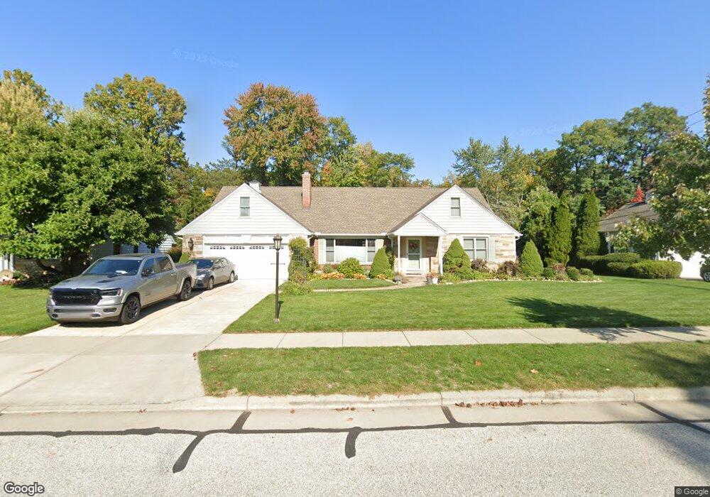
This home is located at 320 Westbridge Dr, Berea, OH 44017 and is currently estimated at $349,633, approximately $114 per square foot. 320 Westbridge Dr is a home located in Cuyahoga County with nearby schools including Grindstone Elementary School, Berea-Midpark Middle School, and Berea-Midpark High School.
Ownership History
Date
Name
Owned For
Owner Type
Purchase Details
Closed on
Aug 28, 2007
Sold by
Estate Of Karen L Schaefer
Bought by
Schaefer Michael L
Current Estimated Value
Purchase Details
Closed on
Jan 22, 2002
Sold by
Phillips Donald B and Phillips Jacob J
Bought by
Schaefer Michael L and Schaefer Karen L
Home Financials for this Owner
Home Financials are based on the most recent Mortgage that was taken out on this home.
Original Mortgage
$191,250
Interest Rate
6.7%
Purchase Details
Closed on
May 19, 1993
Sold by
Phillips David B
Bought by
Phillips David B Trustee
Purchase Details
Closed on
Oct 30, 1991
Sold by
Phillips David B and Phillips Helena J
Bought by
Phillips David B
Purchase Details
Closed on
Jan 1, 1975
Bought by
Phillips David B and Phillips Helena J
Create a Home Valuation Report for This Property
The Home Valuation Report is an in-depth analysis detailing your home's value as well as a comparison with similar homes in the area
Home Values in the Area
Average Home Value in this Area
Purchase History
| Date | Buyer | Sale Price | Title Company |
|---|---|---|---|
| Schaefer Michael L | -- | None Available | |
| Schaefer Michael L | $225,000 | -- | |
| Phillips David B Trustee | -- | -- | |
| Phillips David B | -- | -- | |
| Phillips David B | -- | -- |
Source: Public Records
Mortgage History
| Date | Status | Borrower | Loan Amount |
|---|---|---|---|
| Previous Owner | Schaefer Michael L | $191,250 | |
| Closed | Schaefer Michael L | $17,600 |
Source: Public Records
Tax History
| Year | Tax Paid | Tax Assessment Tax Assessment Total Assessment is a certain percentage of the fair market value that is determined by local assessors to be the total taxable value of land and additions on the property. | Land | Improvement |
|---|---|---|---|---|
| 2024 | $6,245 | $107,835 | $16,205 | $91,630 |
| 2023 | $5,912 | $85,610 | $14,770 | $70,840 |
| 2022 | $5,875 | $85,610 | $14,770 | $70,840 |
| 2021 | $5,825 | $85,610 | $14,770 | $70,840 |
| 2020 | $5,565 | $72,560 | $12,530 | $60,030 |
| 2019 | $5,417 | $207,300 | $35,800 | $171,500 |
| 2018 | $5,400 | $72,560 | $12,530 | $60,030 |
| 2017 | $5,800 | $72,490 | $13,410 | $59,080 |
| 2016 | $5,757 | $72,490 | $13,410 | $59,080 |
| 2015 | $5,440 | $72,490 | $13,410 | $59,080 |
| 2014 | $5,440 | $72,490 | $13,410 | $59,080 |
Source: Public Records
Map
Nearby Homes
- 146 Marian Ln
- 211 W Bridge St
- 160 Marian Ln Unit 6A
- 209 Gibson St
- 216 Kraft St
- 93 W 5th Ave
- 404 Crescent Dr
- 57 Riverside Dr
- 487 Karen Dr
- 300 West St
- 287 Edgewood Dr
- 388 Fairwood Cir
- 56 3rd Ave
- 628 Lindbergh Blvd
- 516 Fair St
- 428 Park Place
- 49 Monroe St
- 0 E Bagley Rd Unit 5111166
- 379 Laurel Dr
- 725 Shakespeare Dr
- 328 Westbridge Dr
- 308 Westbridge Dr
- 323 Westbridge Dr
- 336 Westbridge Dr
- 302 Westbridge Dr
- 250 Oakdale Rd
- 258 Oakdale Rd
- 265 Parkway Dr
- 344 Westbridge Dr
- 296 Westbridge Dr
- 264 Oakdale Rd
- 271 Parkway Dr
- 276 Oakdale Rd
- 290 Westbridge Dr
- 351 Westbridge Dr
- 247 Oakdale Rd
- 239 Oakdale Rd
- 360 Westbridge Dr
- 283 Parkway Dr
- 257 Oakdale Rd
Your Personal Tour Guide
Ask me questions while you tour the home.