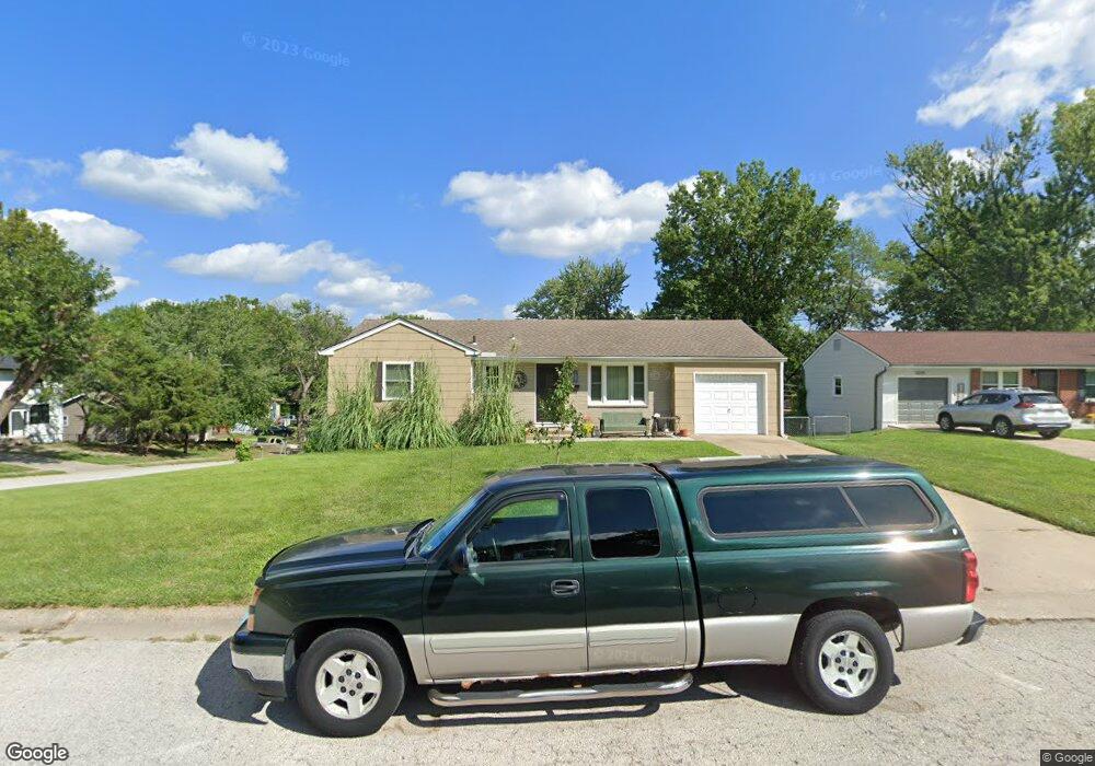
3201 S Jeffrey Cir Independence, MO 64055
Glendale NeighborhoodEstimated Value: $206,000 - $220,000
3
Beds
2
Baths
944
Sq Ft
$228/Sq Ft
Est. Value
About This Home
This home is located at 3201 S Jeffrey Cir, Independence, MO 64055 and is currently estimated at $215,644, approximately $228 per square foot. 3201 S Jeffrey Cir is a home located in Jackson County with nearby schools including Glendale Elementary School, Bridger Middle School, and Pioneer Ridge Middle School.
Ownership History
Date
Name
Owned For
Owner Type
Purchase Details
Closed on
Jun 26, 2002
Sold by
Wagner Tom and Wagner Pat
Bought by
Harmon Paul L and Harmon Cheri D
Current Estimated Value
Home Financials for this Owner
Home Financials are based on the most recent Mortgage that was taken out on this home.
Original Mortgage
$93,951
Outstanding Balance
$39,949
Interest Rate
6.89%
Mortgage Type
Purchase Money Mortgage
Estimated Equity
$175,695
Create a Home Valuation Report for This Property
The Home Valuation Report is an in-depth analysis detailing your home's value as well as a comparison with similar homes in the area
Home Values in the Area
Average Home Value in this Area
Purchase History
| Date | Buyer | Sale Price | Title Company |
|---|---|---|---|
| Harmon Paul L | -- | -- |
Source: Public Records
Mortgage History
| Date | Status | Borrower | Loan Amount |
|---|---|---|---|
| Open | Harmon Paul L | $93,951 | |
| Closed | Harmon Paul L | $5,694 |
Source: Public Records
Tax History Compared to Growth
Tax History
| Year | Tax Paid | Tax Assessment Tax Assessment Total Assessment is a certain percentage of the fair market value that is determined by local assessors to be the total taxable value of land and additions on the property. | Land | Improvement |
|---|---|---|---|---|
| 2025 | $1,756 | $29,154 | $5,634 | $23,520 |
| 2024 | $1,716 | $25,352 | $5,060 | $20,292 |
| 2023 | $1,716 | $25,352 | $4,342 | $21,010 |
| 2022 | $1,782 | $24,130 | $4,392 | $19,738 |
| 2021 | $1,782 | $24,130 | $4,392 | $19,738 |
| 2020 | $1,712 | $22,526 | $4,392 | $18,134 |
| 2019 | $1,684 | $22,526 | $4,392 | $18,134 |
| 2018 | $1,536 | $19,605 | $3,823 | $15,782 |
| 2017 | $1,512 | $19,605 | $3,823 | $15,782 |
| 2016 | $1,512 | $19,114 | $3,327 | $15,787 |
| 2014 | $1,436 | $18,557 | $3,230 | $15,327 |
Source: Public Records
Map
Nearby Homes
- 3209 S Mark Cir
- 3105 Porter Rd
- 16600 E 35th St S
- 16809 E 29th St S
- 3013 S Taylor Dr
- 3308 Trail Ridge Dr
- 16808 E 29th St S
- 16001 E 30th Terrace S
- 17201 E 32nd St S
- 16206 E 35th St S
- 2928 S Brentwood Ct
- 16424 E George Franklyn Dr
- 16121 E 36th St S
- 17410 E 34th Terrace S
- 2820 Berry Ln
- 3420 S Maybrook Ave
- 2737 S Breckenridge Dr
- 15606 E 36th St S
- 3000 Cedar Crest Dr
- 2822 Baker Rd
- 3205 S Jeffrey Cir
- 16605 E 32nd St S
- 3204 Vest Ave
- 3209 S Jeffrey Cir
- 16600 E 32nd St S
- 16604 E 32nd St S
- 16509 E 32nd St S
- 16608 E 32nd St S
- 16508 E 32nd St S
- 16612 E 32nd St S
- 3204 S Jeffrey Cir
- 3213 S Jeffrey Cir
- 16504 E 32nd St S
- 3208 S Jeffrey Cir
- 16501 E 32nd St S
- 16616 E 32nd St S
- 3212 Vest St
- 16613 E 31st Terrace S
- 16609 E 31st Terrace S
- 3212 S Jeffrey Cir