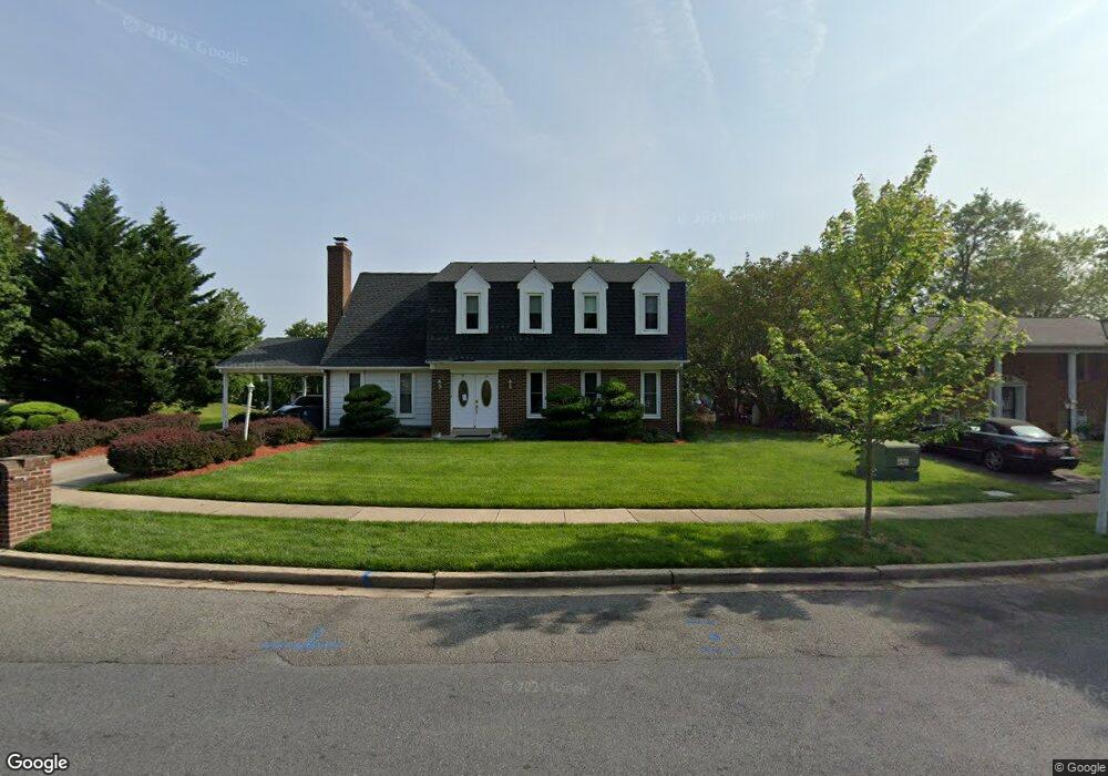
3202 Stonesboro Rd Fort Washington, MD 20744
Estimated Value: $389,025 - $521,000
--
Bed
3
Baths
2,228
Sq Ft
$210/Sq Ft
Est. Value
About This Home
This home is located at 3202 Stonesboro Rd, Fort Washington, MD 20744 and is currently estimated at $468,756, approximately $210 per square foot. 3202 Stonesboro Rd is a home located in Prince George's County with nearby schools including Tayac Elementary School, Friendly High School, and The Messiah Academy.
Ownership History
Date
Name
Owned For
Owner Type
Purchase Details
Closed on
Jun 9, 2000
Sold by
Williams Cheriese M
Bought by
Johnson Annunciata Etal
Current Estimated Value
Purchase Details
Closed on
Dec 10, 1993
Sold by
Nolan Est (By Tr) Sr E M
Bought by
Williams C M
Home Financials for this Owner
Home Financials are based on the most recent Mortgage that was taken out on this home.
Original Mortgage
$111,997
Interest Rate
6.78%
Create a Home Valuation Report for This Property
The Home Valuation Report is an in-depth analysis detailing your home's value as well as a comparison with similar homes in the area
Home Values in the Area
Average Home Value in this Area
Purchase History
| Date | Buyer | Sale Price | Title Company |
|---|---|---|---|
| Johnson Annunciata Etal | $121,000 | -- | |
| Williams C M | $110,000 | -- |
Source: Public Records
Mortgage History
| Date | Status | Borrower | Loan Amount |
|---|---|---|---|
| Previous Owner | Williams C M | $111,997 |
Source: Public Records
Tax History Compared to Growth
Tax History
| Year | Tax Paid | Tax Assessment Tax Assessment Total Assessment is a certain percentage of the fair market value that is determined by local assessors to be the total taxable value of land and additions on the property. | Land | Improvement |
|---|---|---|---|---|
| 2025 | $5,152 | $405,500 | $101,400 | $304,100 |
| 2024 | $5,152 | $384,400 | $0 | $0 |
| 2023 | $4,040 | $363,300 | $0 | $0 |
| 2022 | $3,805 | $342,200 | $101,400 | $240,800 |
| 2021 | $4,564 | $334,567 | $0 | $0 |
| 2020 | $4,502 | $326,933 | $0 | $0 |
| 2019 | $4,572 | $319,300 | $100,700 | $218,600 |
| 2018 | $4,190 | $301,433 | $0 | $0 |
| 2017 | $2,862 | $283,567 | $0 | $0 |
| 2016 | -- | $265,700 | $0 | $0 |
| 2015 | $3,553 | $254,367 | $0 | $0 |
| 2014 | $3,553 | $243,033 | $0 | $0 |
Source: Public Records
Map
Nearby Homes
- 3019 Brodkin Ave
- 0 Allentown Rd Unit MDPG2162754
- 0 Allentown Rd Unit MDPG2161340
- 8515 Allentown Rd
- 3004 Alderton Ave
- 3316 Marston Dr
- 10125 Allentown Rd
- 3407 Wayneswood Rd
- 3105 Calydon Ct
- 3506 Wayneswood Rd
- 8502 Waco Dr
- 8603 Oakdale St
- 8211 Joselle Ct
- 8703 Pamper Ln
- 2804 Testway Ave
- 9202 Pinehurst Dr
- 3910 Oaklawn Rd
- 8136 Comet Dr
- 9012 Doris Dr
- 2409 Mary Place
- 3204 Stonesboro Rd
- 3200 Stonesboro Rd
- 3206 Stonesboro Rd
- 3203 Stonesboro Rd
- 0 Allentown Rd Unit PG7468900
- 0 Allentown Rd Unit PG7564288
- 0 Allentown Rd Unit PG7644073
- 8808 Allentown Rd
- 3300 Stonesboro Rd
- 8801 Allentown Rd
- 8903 Oldfield Ct
- 3301 Stonesboro Rd
- 3302 Stonesboro Rd
- 8812 Allentown Rd
- 8709 Allentown Rd
- 8805 Allentown Rd
- 8902 Oldfield Ct
- 8905 Oldfield Ct
- 8809 Allentown Rd
- 3021 Brodkin Ave