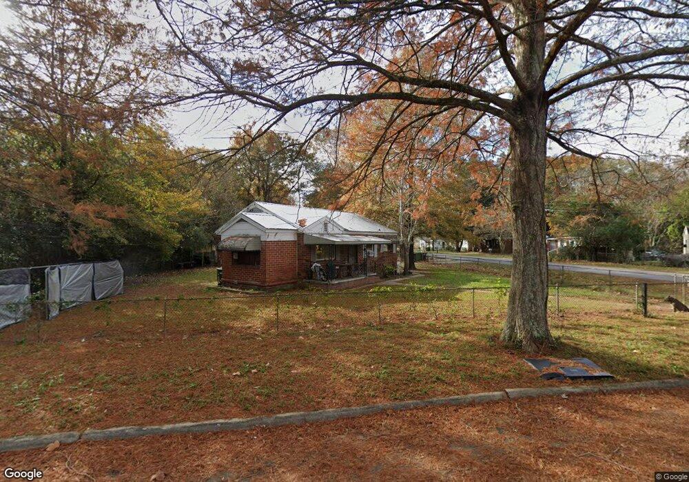
3204 Clay St Columbus, GA 31903
Southern Columbus NeighborhoodEstimated Value: $37,000 - $53,000
2
Beds
2
Baths
942
Sq Ft
$47/Sq Ft
Est. Value
About This Home
This home is located at 3204 Clay St, Columbus, GA 31903 and is currently estimated at $44,141, approximately $46 per square foot. 3204 Clay St is a home located in Muscogee County with nearby schools including Dorothy Height Elementary School, Baker Middle School, and Spencer High School.
Ownership History
Date
Name
Owned For
Owner Type
Purchase Details
Closed on
Jun 8, 2022
Sold by
Darryl Rhodes
Bought by
Moore Quenton
Current Estimated Value
Home Financials for this Owner
Home Financials are based on the most recent Mortgage that was taken out on this home.
Original Mortgage
$30,070
Outstanding Balance
$25,096
Interest Rate
4.32%
Mortgage Type
New Conventional
Estimated Equity
$19,045
Purchase Details
Closed on
Sep 13, 2007
Sold by
Gavin Wanda M and Gavin Michael C
Bought by
Rhodes Darryl
Home Financials for this Owner
Home Financials are based on the most recent Mortgage that was taken out on this home.
Original Mortgage
$31,005
Interest Rate
6.62%
Mortgage Type
Purchase Money Mortgage
Create a Home Valuation Report for This Property
The Home Valuation Report is an in-depth analysis detailing your home's value as well as a comparison with similar homes in the area
Home Values in the Area
Average Home Value in this Area
Purchase History
| Date | Buyer | Sale Price | Title Company |
|---|---|---|---|
| Moore Quenton | $31,000 | O Wayne Spence Pc | |
| Rhodes Darryl | $34,500 | None Available |
Source: Public Records
Mortgage History
| Date | Status | Borrower | Loan Amount |
|---|---|---|---|
| Open | Moore Quenton | $30,070 | |
| Previous Owner | Rhodes Darryl | $31,005 |
Source: Public Records
Tax History Compared to Growth
Tax History
| Year | Tax Paid | Tax Assessment Tax Assessment Total Assessment is a certain percentage of the fair market value that is determined by local assessors to be the total taxable value of land and additions on the property. | Land | Improvement |
|---|---|---|---|---|
| 2025 | $227 | $18,972 | $4,212 | $14,760 |
| 2024 | $225 | $18,972 | $4,212 | $14,760 |
| 2023 | $16 | $18,972 | $4,212 | $14,760 |
| 2022 | $760 | $18,616 | $4,212 | $14,404 |
| 2021 | $702 | $17,196 | $4,212 | $12,984 |
| 2020 | $702 | $17,196 | $4,212 | $12,984 |
| 2019 | $705 | $17,196 | $4,212 | $12,984 |
| 2018 | $705 | $17,196 | $4,212 | $12,984 |
| 2017 | $707 | $17,196 | $4,212 | $12,984 |
| 2016 | $560 | $13,581 | $2,250 | $11,331 |
| 2015 | $561 | $13,581 | $2,250 | $11,331 |
| 2014 | $562 | $13,581 | $2,250 | $11,331 |
| 2013 | -- | $13,581 | $2,250 | $11,331 |
Source: Public Records
Map
Nearby Homes
- 920 Brooks Rd
- 929 Winston Rd
- 906 Winston Rd
- 824 Winston Rd
- 810 Winston Rd
- 917 Fletcher Ave
- 1025 Fletcher Ave
- 3522 Youmans St
- 716 Benning Dr
- 3711 Youmans St
- 3815 Baker Plaza Dr
- 2463 Brownie St
- 2451 Brownie Ln
- 1274 Providence Ln
- 2463 Brownie Ln
- 3110 Victory Dr Unit 90
- 3110 Victory Dr
- 2916 Lee St
- 2823 Lee St
- 2973 Hawthorne Dr