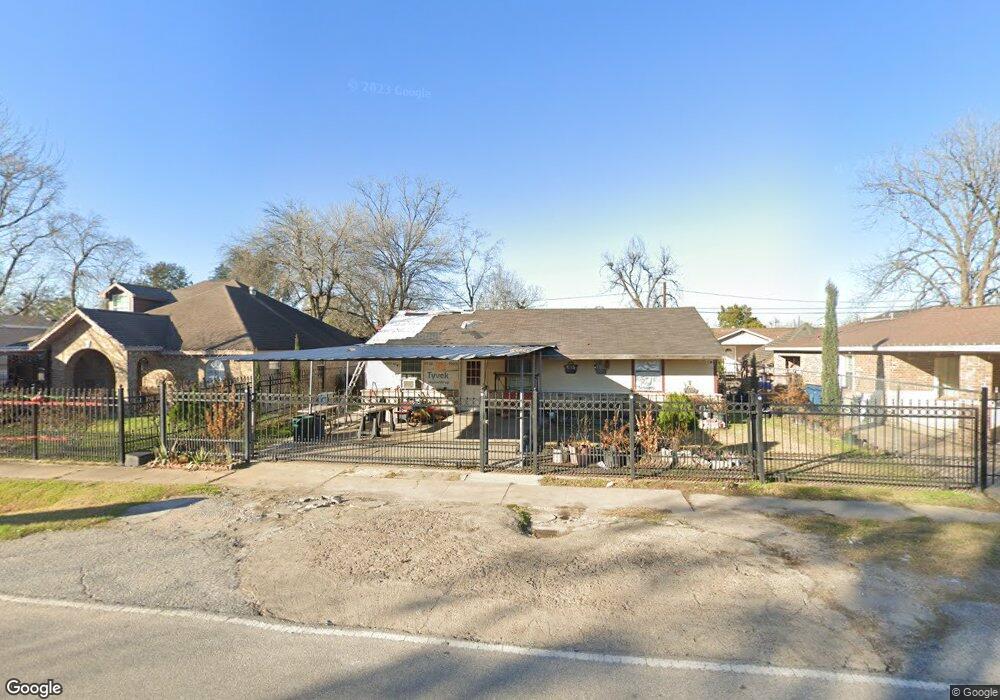
3205 Mohawk St Houston, TX 77093
East Aldine NeighborhoodEstimated Value: $166,000 - $202,000
3
Beds
2
Baths
1,315
Sq Ft
$140/Sq Ft
Est. Value
About This Home
This home is located at 3205 Mohawk St, Houston, TX 77093 and is currently estimated at $184,233, approximately $140 per square foot. 3205 Mohawk St is a home located in Harris County with nearby schools including Scarborough Elementary School, Patrick Henry Middle School, and Sam Houston Math, Science & Technology Center.
Ownership History
Date
Name
Owned For
Owner Type
Purchase Details
Closed on
Oct 28, 1999
Sold by
Southers W C and Mccullar Marie Southers
Bought by
Rojas Rosalio C and Rojas Camila G
Current Estimated Value
Home Financials for this Owner
Home Financials are based on the most recent Mortgage that was taken out on this home.
Original Mortgage
$53,000
Outstanding Balance
$16,304
Interest Rate
7.85%
Estimated Equity
$167,929
Purchase Details
Closed on
Jan 1, 1998
Sold by
Southers W C and Mccullar Marie Southers
Bought by
Taylor Margie
Create a Home Valuation Report for This Property
The Home Valuation Report is an in-depth analysis detailing your home's value as well as a comparison with similar homes in the area
Home Values in the Area
Average Home Value in this Area
Purchase History
| Date | Buyer | Sale Price | Title Company |
|---|---|---|---|
| Rojas Rosalio C | -- | -- | |
| Taylor Margie | -- | -- |
Source: Public Records
Mortgage History
| Date | Status | Borrower | Loan Amount |
|---|---|---|---|
| Open | Rojas Rosalio C | $53,000 |
Source: Public Records
Tax History
| Year | Tax Paid | Tax Assessment Tax Assessment Total Assessment is a certain percentage of the fair market value that is determined by local assessors to be the total taxable value of land and additions on the property. | Land | Improvement |
|---|---|---|---|---|
| 2025 | $206 | $167,331 | $43,240 | $124,091 |
| 2024 | $206 | $167,331 | $43,240 | $124,091 |
| 2023 | $206 | $181,972 | $43,240 | $138,732 |
| 2022 | $1,715 | $148,194 | $33,088 | $115,106 |
| 2021 | $1,655 | $103,900 | $33,088 | $70,812 |
| 2020 | $1,565 | $91,318 | $33,088 | $58,230 |
| 2019 | $1,484 | $91,318 | $33,088 | $58,230 |
| 2018 | $251 | $62,984 | $33,088 | $29,896 |
| 2017 | $1,349 | $62,984 | $33,088 | $29,896 |
| 2016 | $1,330 | $62,984 | $33,088 | $29,896 |
| 2015 | $294 | $56,450 | $20,680 | $35,770 |
| 2014 | $294 | $56,450 | $20,680 | $35,770 |
Source: Public Records
Map
Nearby Homes
- 3119 Brea Crest St
- 2909 Rosemary Ln
- 2915 Brea Crest St
- 3531 Cedar Hill Ln
- 3006 Hartwick Rd
- 3111 Hartwick Rd
- 3007 Trenton Rd
- 2629 Kowis St
- 3804 Cedar Hill Ln
- 3610 Nuggent St
- 2636 Lone Oak Rd
- 1904 Little York Rd
- 2530 Kowis St
- 1728 Little York Rd
- 2527 Lone Oak Rd
- 2523 Lone Oak Rd
- 0 Kowis
- 4007 Wedgewood St
- 4415 Mooney Rd
- 4006 Cedar Hill Ln
Your Personal Tour Guide
Ask me questions while you tour the home.