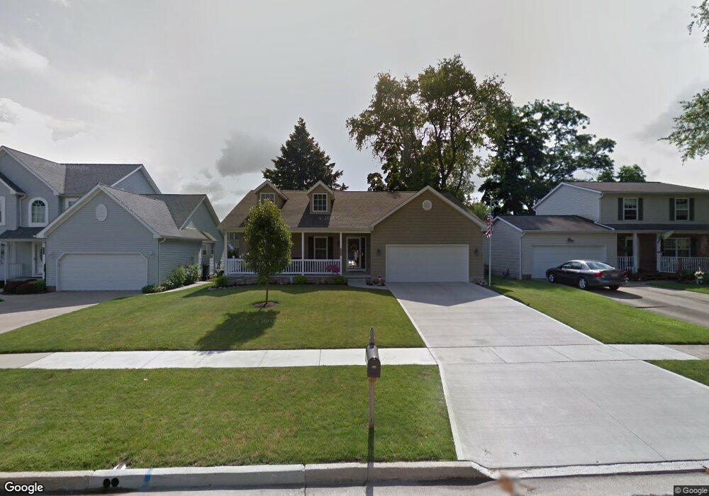
3209 Charles St Cuyahoga Falls, OH 44221
Mud Brook NeighborhoodEstimated Value: $295,000 - $333,000
3
Beds
2
Baths
1,900
Sq Ft
$167/Sq Ft
Est. Value
About This Home
This home is located at 3209 Charles St, Cuyahoga Falls, OH 44221 and is currently estimated at $317,386, approximately $167 per square foot. 3209 Charles St is a home with nearby schools including Lincoln Elementary School, Roberts Middle School, and Cuyahoga Falls High School.
Ownership History
Date
Name
Owned For
Owner Type
Purchase Details
Closed on
Jun 24, 2016
Sold by
Zeller Nancy A
Bought by
Zeller Nancy A and Nancy A Zeller Living Trust
Current Estimated Value
Purchase Details
Closed on
Dec 14, 2010
Sold by
Mascio John H
Bought by
Zeller William J and Zeller Nancy A
Purchase Details
Closed on
Dec 27, 2002
Sold by
Doctor Charles William and Doctor Jeanne
Bought by
Mascio John H and The John H Mascio Living Revocable Trust
Create a Home Valuation Report for This Property
The Home Valuation Report is an in-depth analysis detailing your home's value as well as a comparison with similar homes in the area
Home Values in the Area
Average Home Value in this Area
Purchase History
| Date | Buyer | Sale Price | Title Company |
|---|---|---|---|
| Zeller Nancy A | -- | None Available | |
| Zeller William J | $45,000 | Wigley Title Agency Inc | |
| Mascio John H | $25,000 | Wigley Title Agency Inc |
Source: Public Records
Tax History Compared to Growth
Tax History
| Year | Tax Paid | Tax Assessment Tax Assessment Total Assessment is a certain percentage of the fair market value that is determined by local assessors to be the total taxable value of land and additions on the property. | Land | Improvement |
|---|---|---|---|---|
| 2025 | $4,595 | $94,262 | $17,836 | $76,426 |
| 2024 | $4,595 | $94,262 | $17,836 | $76,426 |
| 2023 | $4,595 | $94,262 | $17,836 | $76,426 |
| 2022 | $4,694 | $79,360 | $14,991 | $64,369 |
| 2021 | $4,694 | $79,360 | $14,991 | $64,369 |
| 2020 | $4,617 | $79,360 | $14,990 | $64,370 |
| 2019 | $4,067 | $65,380 | $6,520 | $58,860 |
| 2018 | $3,454 | $65,380 | $6,520 | $58,860 |
| 2017 | $3,391 | $65,380 | $6,520 | $58,860 |
| 2016 | $3,393 | $65,100 | $6,520 | $58,580 |
| 2015 | $3,391 | $65,100 | $6,520 | $58,580 |
| 2014 | $3,392 | $65,100 | $6,520 | $58,580 |
| 2013 | $3,372 | $65,240 | $6,520 | $58,720 |
Source: Public Records
Map
Nearby Homes
- Greenfield Plan at Miller's Landing
- Riverton Plan at Miller's Landing
- Woodside Plan at Miller's Landing
- Willwood Plan at Miller's Landing
- Westchester Plan at Miller's Landing
- Amberwood Plan at Miller's Landing
- Hilltop Plan at Miller's Landing
- 3044 Millboro Rd
- 2950 Millboro Rd
- 435 Roanoke Ave
- 3320 Hudson Dr
- 306 Hollywood Ave
- 455 Marguerite Ave
- 2934 Silver Lake Blvd
- 419 Keenan Ave
- 2886 Norwood St
- 2870 Kent Rd
- 2834 Norwood St
- 2835 Bailey Rd
- 2890 Bailey Rd
- 3193 Charles St
- 3225 Charles St
- 3189 Charles St
- 3287 Charles St
- 3198 Saunders St
- 3202 Saunders St
- 3194 Saunders St
- 3206 Saunders St
- 3226 Charles St
- 3190 Saunders St
- 3295 Charles St
- 761 Roanoke Ave
- 760 Alameda Ave
- 3173 Charles St
- 3210 Saunders St
- 3305 Charles St
- 755 Roanoke Ave
- 754 Alameda Ave
- 766 Roanoke Ave
- 3186 Saunders St