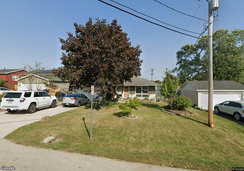
3209 Charleston Rd Waukegan, IL 60087
Estimated Value: $234,382 - $270,000
--
Bed
2
Baths
1,196
Sq Ft
$210/Sq Ft
Est. Value
About This Home
This home is located at 3209 Charleston Rd, Waukegan, IL 60087 and is currently estimated at $251,596, approximately $210 per square foot. 3209 Charleston Rd is a home located in Lake County with nearby schools including H R McCall Elementary School, Jack Benny Middle School, and Waukegan High School.
Ownership History
Date
Name
Owned For
Owner Type
Purchase Details
Closed on
May 8, 2001
Sold by
Bank Of Waukegan
Bought by
Martinez Marcelina and Torres Horacio
Current Estimated Value
Home Financials for this Owner
Home Financials are based on the most recent Mortgage that was taken out on this home.
Original Mortgage
$124,450
Interest Rate
7.07%
Purchase Details
Closed on
Sep 7, 2000
Sold by
Jones Patricia A
Bought by
Bank Of Waukegan and Trust #204380
Create a Home Valuation Report for This Property
The Home Valuation Report is an in-depth analysis detailing your home's value as well as a comparison with similar homes in the area
Home Values in the Area
Average Home Value in this Area
Purchase History
| Date | Buyer | Sale Price | Title Company |
|---|---|---|---|
| Martinez Marcelina | $131,000 | -- | |
| Bank Of Waukegan | -- | -- |
Source: Public Records
Mortgage History
| Date | Status | Borrower | Loan Amount |
|---|---|---|---|
| Closed | Martinez Marcelina | $124,450 |
Source: Public Records
Tax History Compared to Growth
Tax History
| Year | Tax Paid | Tax Assessment Tax Assessment Total Assessment is a certain percentage of the fair market value that is determined by local assessors to be the total taxable value of land and additions on the property. | Land | Improvement |
|---|---|---|---|---|
| 2024 | $4,930 | $67,331 | $7,260 | $60,071 |
| 2023 | $4,865 | $60,282 | $6,500 | $53,782 |
| 2022 | $4,865 | $55,767 | $5,692 | $50,075 |
| 2021 | $4,208 | $46,360 | $4,633 | $41,727 |
| 2020 | $4,216 | $43,190 | $4,316 | $38,874 |
| 2019 | $4,193 | $39,577 | $3,955 | $35,622 |
| 2018 | $5,129 | $46,028 | $5,597 | $40,431 |
| 2017 | $4,942 | $40,722 | $4,952 | $35,770 |
| 2016 | $4,544 | $35,386 | $4,303 | $31,083 |
| 2015 | $4,336 | $31,671 | $3,851 | $27,820 |
| 2014 | $4,203 | $30,381 | $3,222 | $27,159 |
| 2012 | $5,429 | $32,913 | $3,490 | $29,423 |
Source: Public Records
Map
Nearby Homes
- 37966 N Cornell Rd
- 3411 N Lewis Ave
- 3211 Rugby Ct
- 1636 Rice St
- 38127 N Shore Ave
- 38362 N Manor Ave
- 37905 N Loyola Ave
- 1612 Whitney St
- 1730 W Beach Rd
- 3101 Country Club Ln
- 2613 N Lewis Ave
- 38683 N Lewis Ave
- 38697 N Cedar Ave
- 11345 W Carnahan Ave
- 2350 N Lewis Ave
- 12312 W Audrey Ave
- 10241 W Bairstow Ave
- 11342-11364 W Wadsworth Rd
- 2708 Dana Ave
- 2705 Dana Ave
- 3213 Charleston Rd
- 1712 W Yorkhouse Rd
- 1716 W Yorkhouse Rd
- 3212 Cornell Rd
- 3219 Charleston Rd
- 1704 W Yorkhouse Rd
- 3208 Cornell Rd
- 3221 Charleston Rd
- 3216 Cornell Rd
- 3204 Cornell Rd
- 1818 W Yorkhouse Rd
- 3212 Charleston Rd
- 3220 Cornell Rd
- 3211 N Lewis Ave
- 3225 Charleston Rd
- 3224 Cornell Rd
- 1719 W Yorkhouse Rd
- 1713 W Yorkhouse Rd
- 3203 Cornell Rd