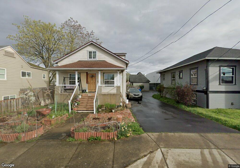
321 12th Ave SW Albany, OR 97321
Central Albany NeighborhoodEstimated Value: $308,000 - $322,043
3
Beds
2
Baths
1,366
Sq Ft
$231/Sq Ft
Est. Value
About This Home
This home is located at 321 12th Ave SW, Albany, OR 97321 and is currently estimated at $315,022, approximately $230 per square foot. 321 12th Ave SW is a home located in Linn County with nearby schools including Central Elementary School, Takena Elementary School, and Memorial Middle School.
Ownership History
Date
Name
Owned For
Owner Type
Purchase Details
Closed on
Oct 7, 2020
Sold by
Mupo Theresa
Bought by
Devriend Maarten Hendrick and Devriend Susan
Current Estimated Value
Home Financials for this Owner
Home Financials are based on the most recent Mortgage that was taken out on this home.
Original Mortgage
$199,966
Outstanding Balance
$177,457
Interest Rate
2.9%
Mortgage Type
New Conventional
Estimated Equity
$137,565
Purchase Details
Closed on
May 21, 2014
Sold by
Wilken Jerry L and Wilken Melanie J
Bought by
Scott & Angelia Foss Living Trust
Home Financials for this Owner
Home Financials are based on the most recent Mortgage that was taken out on this home.
Original Mortgage
$178,000
Interest Rate
4.31%
Mortgage Type
Seller Take Back
Create a Home Valuation Report for This Property
The Home Valuation Report is an in-depth analysis detailing your home's value as well as a comparison with similar homes in the area
Home Values in the Area
Average Home Value in this Area
Purchase History
| Date | Buyer | Sale Price | Title Company |
|---|---|---|---|
| Devriend Maarten Hendrick | $206,150 | Fidelity National Title | |
| Scott & Angelia Foss Living Trust | $210,000 | Ticor Title |
Source: Public Records
Mortgage History
| Date | Status | Borrower | Loan Amount |
|---|---|---|---|
| Open | Devriend Maarten Hendrick | $199,966 | |
| Previous Owner | Scott & Angelia Foss Living Trust | $178,000 |
Source: Public Records
Tax History Compared to Growth
Tax History
| Year | Tax Paid | Tax Assessment Tax Assessment Total Assessment is a certain percentage of the fair market value that is determined by local assessors to be the total taxable value of land and additions on the property. | Land | Improvement |
|---|---|---|---|---|
| 2025 | $2,247 | $112,920 | -- | -- |
| 2024 | $2,182 | $109,640 | -- | -- |
| 2023 | $2,120 | $106,450 | $0 | $0 |
| 2022 | $2,087 | $103,350 | $0 | $0 |
| 2021 | $1,964 | $100,340 | $0 | $0 |
| 2020 | $1,938 | $97,420 | $0 | $0 |
| 2019 | $1,892 | $94,590 | $0 | $0 |
| 2018 | $1,843 | $91,840 | $0 | $0 |
| 2017 | $1,790 | $89,170 | $0 | $0 |
| 2016 | $1,668 | $86,580 | $0 | $0 |
| 2015 | $1,637 | $84,060 | $0 | $0 |
| 2014 | $1,597 | $81,620 | $0 | $0 |
Source: Public Records
Map
Nearby Homes
- 516 12th Ave SW
- 1405 Calapooia St SW
- 718 Washington St SW
- 700 14th Ave SW
- 520 Pacific Blvd SW
- 515 SW Queen Ave
- 834 9th Ave SW
- 906 11th Ave SW
- 220 7th Ave SE
- 870 14th Ave SW
- 1220 Walnut St SW
- 929 10th Ave SW
- 821 7th Ave SW
- 420 4th (-430 1 2) Ave SW
- 1510 Walnut St SW
- 1138 9th Ave SW
- 1625 Jackson St SE
- 1248 Penn St SW
- 1215 10th Ave SW
- 802 7th Ave SE
- 309 12th Ave SW
- 327 12th Ave SW
- 1121 Ferry St SW
- 251 Pacific Blvd SW
- 275 Pacific Blvd SW
- 318 11th Ave SW
- 249 SW Broadalbin St
- 249 Pacific Blvd SW
- 249 Pacific Blvd SW
- 320 11th Ave SW
- 1131 Ferry St SW
- 245 Pacific Blvd SW
- 249 Pacific Blvd SW
- 325 Pacific Blvd SW
- 325 Pacific Blvd SW
- 245 Pacific (1 2) Bl SW
- 325 Pacific Blvd SW
- 306 Pacific Blvd SW
- 1132 Ferry St SW
- 1122 Ferry St SW