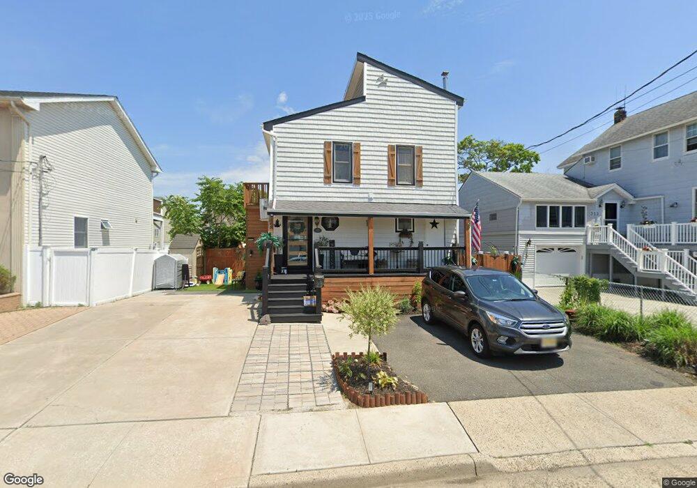
321 Arthur St Freeport, NY 11520
Estimated Value: $606,998 - $689,000
3
Beds
2
Baths
1,372
Sq Ft
$472/Sq Ft
Est. Value
About This Home
This home is located at 321 Arthur St, Freeport, NY 11520 and is currently estimated at $647,999, approximately $472 per square foot. 321 Arthur St is a home located in Nassau County with nearby schools including Columbus Avenue School, Caroline G. Atkinson Intermediate School, and John W Dodd Middle School.
Ownership History
Date
Name
Owned For
Owner Type
Purchase Details
Closed on
Oct 21, 2016
Sold by
Caroleo Philip
Bought by
Hennigan Robert F and Maria-Binet Elizabeth
Current Estimated Value
Home Financials for this Owner
Home Financials are based on the most recent Mortgage that was taken out on this home.
Original Mortgage
$292,000
Outstanding Balance
$234,241
Interest Rate
3.48%
Mortgage Type
New Conventional
Estimated Equity
$413,758
Purchase Details
Closed on
Sep 2, 1998
Sold by
Downs Ruth E
Bought by
Caroleo Philip
Create a Home Valuation Report for This Property
The Home Valuation Report is an in-depth analysis detailing your home's value as well as a comparison with similar homes in the area
Home Values in the Area
Average Home Value in this Area
Purchase History
| Date | Buyer | Sale Price | Title Company |
|---|---|---|---|
| Hennigan Robert F | $312,000 | Continental Abstract | |
| Caroleo Philip | $159,900 | -- |
Source: Public Records
Mortgage History
| Date | Status | Borrower | Loan Amount |
|---|---|---|---|
| Open | Hennigan Robert F | $292,000 |
Source: Public Records
Tax History
| Year | Tax Paid | Tax Assessment Tax Assessment Total Assessment is a certain percentage of the fair market value that is determined by local assessors to be the total taxable value of land and additions on the property. | Land | Improvement |
|---|---|---|---|---|
| 2025 | $7,784 | $365 | $137 | $228 |
| 2024 | $788 | $376 | $141 | $235 |
Source: Public Records
Map
Nearby Homes
- 335 Arthur St
- 208 Sportsmans Ave
- 176 Gordon Place
- 177 Sportsmans Ave
- 254 Arthur St
- 121 Garfield St
- 268 Gordon Place
- 130 Gordon Place
- 22 Wilshire Ct
- 308 Bedell St
- 54 W 2nd St
- 494 S Ocean Ave Unit 1M
- 494 S Ocean Ave Unit 1H
- 494 S Ocean Ave Unit 3A
- 16 Layton St
- 120 Sportsmans Ave
- 39 Layton St
- 310 Miller Ave
- 322 Miller Ave
- 51 Atlantic Ave
Your Personal Tour Guide
Ask me questions while you tour the home.