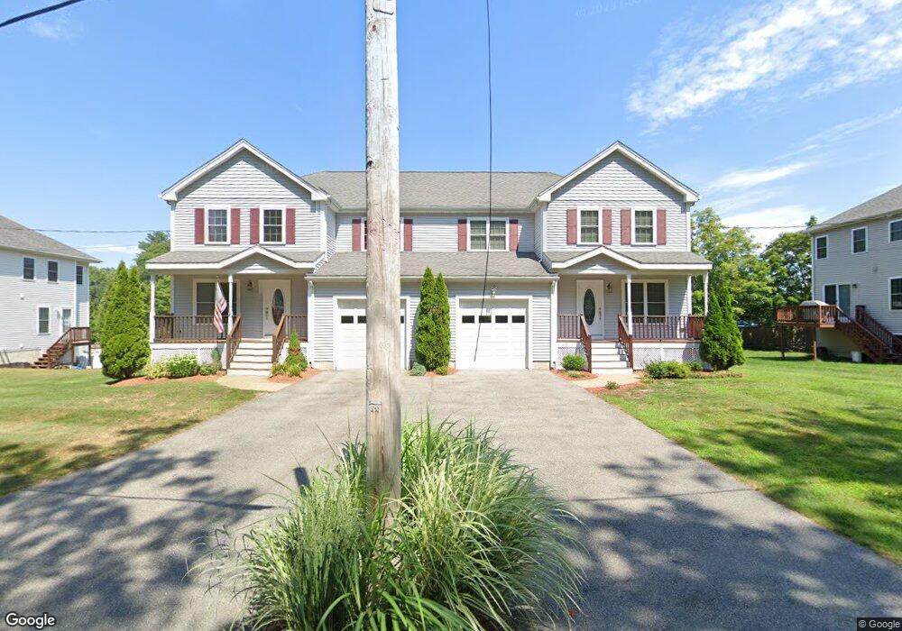
321 Bacon St Unit 321 Natick, MA 01760
Estimated Value: $752,000 - $829,360
3
Beds
3
Baths
1,500
Sq Ft
$522/Sq Ft
Est. Value
About This Home
This home is located at 321 Bacon St Unit 321, Natick, MA 01760 and is currently estimated at $782,340, approximately $521 per square foot. 321 Bacon St Unit 321 is a home located in Middlesex County with nearby schools including Natick High School, Wilson Middle School, and Bennett-Hemenway (Ben-Hem) Elementary School.
Ownership History
Date
Name
Owned For
Owner Type
Purchase Details
Closed on
Nov 25, 2009
Sold by
58 North Main St Rlty
Bought by
Lescoe Matthew J
Current Estimated Value
Home Financials for this Owner
Home Financials are based on the most recent Mortgage that was taken out on this home.
Original Mortgage
$336,600
Outstanding Balance
$219,775
Interest Rate
4.92%
Mortgage Type
Purchase Money Mortgage
Estimated Equity
$562,565
Create a Home Valuation Report for This Property
The Home Valuation Report is an in-depth analysis detailing your home's value as well as a comparison with similar homes in the area
Home Values in the Area
Average Home Value in this Area
Purchase History
| Date | Buyer | Sale Price | Title Company |
|---|---|---|---|
| Lescoe Matthew J | $396,000 | -- |
Source: Public Records
Mortgage History
| Date | Status | Borrower | Loan Amount |
|---|---|---|---|
| Open | Lescoe Matthew J | $336,600 |
Source: Public Records
Tax History Compared to Growth
Tax History
| Year | Tax Paid | Tax Assessment Tax Assessment Total Assessment is a certain percentage of the fair market value that is determined by local assessors to be the total taxable value of land and additions on the property. | Land | Improvement |
|---|---|---|---|---|
| 2025 | $8,321 | $695,700 | $0 | $695,700 |
| 2024 | $7,788 | $635,200 | $0 | $635,200 |
| 2023 | $7,556 | $597,800 | $0 | $597,800 |
| 2022 | $7,353 | $551,200 | $0 | $551,200 |
| 2021 | $6,990 | $513,600 | $0 | $513,600 |
| 2020 | $6,990 | $513,600 | $0 | $513,600 |
| 2019 | $6,528 | $513,600 | $0 | $513,600 |
| 2018 | $6,689 | $512,600 | $0 | $512,600 |
| 2017 | $6,336 | $469,700 | $0 | $469,700 |
| 2016 | $6,238 | $459,700 | $0 | $459,700 |
| 2015 | $5,880 | $425,500 | $0 | $425,500 |
Source: Public Records
Map
Nearby Homes
- 293 Bacon St Unit A
- 287 Bacon St
- 7 Jackson Ct Unit B
- 8 Hartford St
- 12 Linden St
- 8 Flynn St
- 39 Evergreen Rd
- 8 Stanley St
- 278 N Main St
- 18 Magnolia Rd
- 22 Magnolia Rd
- 13 Sheffield Rd
- 7 Sheffield Rd
- 38 Westlake Rd
- 10 Nouvelle Way Unit 803
- 40 Nouvelle Way Unit 441
- 10 Nouvelle Way Unit 923
- 58 N Main St Unit 304
- 10 Kelsey Rd
- 2 Lodge Rd
- 319 Bacon St Unit 1
- 319 Bacon St Unit 319
- 317 Bacon St
- 315 Bacon St Unit 315
- 314 Bacon St
- 316 Bacon St
- 325 Bacon St Unit 325
- 323 Bacon St Unit 323
- 318 Bacon St
- 312 Bacon St
- 320 Bacon St
- 309 Bacon St
- 308 Bacon St
- 71 Lake Shore Rd
- 69 Lake Shore Rd
- 67 Lake Shore Rd
- 306 Bacon St
- 65 Lake Shore Rd
- 991 Worcester St
- 63 Lake Shore Rd