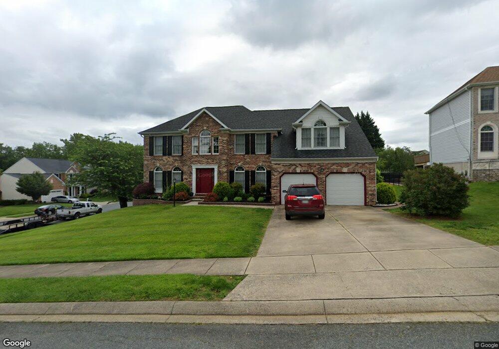
321 Boeing Ct Abingdon, MD 21009
Estimated Value: $639,728 - $725,000
Studio
3
Baths
3,462
Sq Ft
$198/Sq Ft
Est. Value
About This Home
This home is located at 321 Boeing Ct, Abingdon, MD 21009 and is currently estimated at $684,682, approximately $197 per square foot. 321 Boeing Ct is a home located in Harford County with nearby schools including Homestead-Wakefield Elementary School, Patterson Mill Middle School, and Patterson Mill High School.
Ownership History
Date
Name
Owned For
Owner Type
Purchase Details
Closed on
Aug 7, 1992
Sold by
Continental Landmark Inc
Bought by
Brewster James P and Brewster Linda C
Current Estimated Value
Home Financials for this Owner
Home Financials are based on the most recent Mortgage that was taken out on this home.
Original Mortgage
$187,100
Interest Rate
8.06%
Purchase Details
Closed on
May 13, 1992
Sold by
Overview Estates Limited
Bought by
Continental Landmark Inc
Create a Home Valuation Report for This Property
The Home Valuation Report is an in-depth analysis detailing your home's value as well as a comparison with similar homes in the area
Home Values in the Area
Average Home Value in this Area
Purchase History
| Date | Buyer | Sale Price | Title Company |
|---|---|---|---|
| Brewster James P | $237,100 | -- | |
| Continental Landmark Inc | $49,700 | -- |
Source: Public Records
Mortgage History
| Date | Status | Borrower | Loan Amount |
|---|---|---|---|
| Closed | Brewster James P | $187,100 |
Source: Public Records
Tax History
| Year | Tax Paid | Tax Assessment Tax Assessment Total Assessment is a certain percentage of the fair market value that is determined by local assessors to be the total taxable value of land and additions on the property. | Land | Improvement |
|---|---|---|---|---|
| 2025 | $5,236 | $530,433 | $0 | $0 |
| 2024 | $4,875 | $493,267 | $0 | $0 |
| 2023 | $4,875 | $456,100 | $116,500 | $339,600 |
| 2022 | $4,875 | $447,333 | $0 | $0 |
| 2020 | $4,960 | $429,800 | $116,500 | $313,300 |
| 2019 | $4,876 | $422,500 | $0 | $0 |
| 2018 | $4,748 | $415,200 | $0 | $0 |
| 2017 | $4,665 | $407,900 | $0 | $0 |
| 2016 | $140 | $403,867 | $0 | $0 |
| 2015 | $4,923 | $399,833 | $0 | $0 |
| 2014 | $4,923 | $395,800 | $0 | $0 |
Source: Public Records
Map
Nearby Homes
- 922 Sidehill Dr
- 745 Dowers Rd
- 2712 Parallel Path
- 2608 Laurel Valley Garth
- 2513 Kenna Ct Unit 7
- 2934 Strathaven Ln
- 2309 Lily Ct
- 2000 Treese Unit DEVONSHIRE
- 2000 Treese Unit SAVANNAH
- 2000 Treese Unit MAGNOLIA
- 2000 Treese Unit COVINGTON
- 2961 Harrogate Way
- 603 E Wheel Rd
- 20 Huxley Cir
- 2917 Brightwater Ln
- 113 Laurel Valley Ct
- 2923 Alconbury Ct
- 108 Laurel Valley Ct
- 2921 Shelley Ct
- 2930 Haddington Ct
- 319 Boeing Ct
- 2618 Smallwood Dr
- 317 Boeing Ct
- 2617 Smallwood Dr
- 2620 Smallwood Dr
- 2615 Smallwood Dr
- 2619 Smallwood Dr
- 304 Twilight Ct
- 2614 Smallwood Dr
- 322 Boeing Ct
- 2621 Smallwood Dr
- 305 Twilight Ct
- 2613 Smallwood Dr
- 315 Boeing Ct
- 2622 Smallwood Dr
- 302 Twilight Ct
- 320 Boeing Ct
- 2623 Smallwood Dr
- 2611 Smallwood Dr
- 2612 Smallwood Dr
Your Personal Tour Guide
Ask me questions while you tour the home.