Estimated Value: $263,000 - $330,000
3
Beds
2
Baths
1,532
Sq Ft
$196/Sq Ft
Est. Value
About This Home
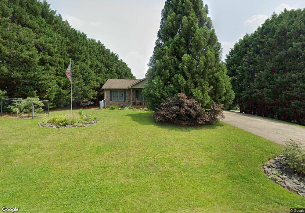
This home is located at 321 Cherokee Ct, King, NC 27021 and is currently estimated at $300,443, approximately $196 per square foot. 321 Cherokee Ct is a home located in Stokes County with nearby schools including Mount Olive Elementary School, Chestnut Grove Middle, and West Stokes High.
Ownership History
Date
Name
Owned For
Owner Type
Purchase Details
Closed on
Nov 30, 2009
Sold by
Finck Jenny S and Finck Jason L
Bought by
Dunkelberger Gregory R and Dunkelberger Laurie L
Current Estimated Value
Purchase Details
Closed on
Mar 7, 2007
Sold by
Jones James Lee and Jones Gail M
Bought by
Fausset Jenny S
Home Financials for this Owner
Home Financials are based on the most recent Mortgage that was taken out on this home.
Original Mortgage
$139,920
Interest Rate
6.3%
Mortgage Type
New Conventional
Create a Home Valuation Report for This Property
The Home Valuation Report is an in-depth analysis detailing your home's value as well as a comparison with similar homes in the area
Home Values in the Area
Average Home Value in this Area
Purchase History
| Date | Buyer | Sale Price | Title Company |
|---|---|---|---|
| Dunkelberger Gregory R | $180,000 | None Available | |
| Fausset Jenny S | $175,000 | None Available |
Source: Public Records
Mortgage History
| Date | Status | Borrower | Loan Amount |
|---|---|---|---|
| Previous Owner | Fausset Jenny S | $139,920 |
Source: Public Records
Tax History
| Year | Tax Paid | Tax Assessment Tax Assessment Total Assessment is a certain percentage of the fair market value that is determined by local assessors to be the total taxable value of land and additions on the property. | Land | Improvement |
|---|---|---|---|---|
| 2025 | $1,988 | $278,100 | $35,000 | $243,100 |
| 2024 | $1,988 | $194,500 | $28,000 | $166,500 |
| 2023 | $1,575 | $194,500 | $28,000 | $166,500 |
| 2022 | $1,439 | $194,500 | $28,000 | $166,500 |
| 2021 | $1,439 | $194,500 | $28,000 | $166,500 |
| 2020 | $1,266 | $171,100 | $25,000 | $146,100 |
| 2019 | $1,266 | $171,100 | $25,000 | $146,100 |
| 2018 | $1,266 | $171,100 | $25,000 | $146,100 |
| 2017 | $1,258 | $171,100 | $25,000 | $146,100 |
| 2016 | $1,249 | $169,900 | $25,000 | $144,900 |
| 2015 | $1,240 | $169,900 | $25,000 | $144,900 |
| 2014 | $1,225 | $169,900 | $25,000 | $144,900 |
Source: Public Records
Map
Nearby Homes
- 1034 Kentland Dr
- 1129 Kentland Dr
- 1208 Kentland Dr
- 5149 N Carolina 66
- 0 Nance Rd
- 113 Ravenwood Ct
- 101 Ravenwood Ct
- 100 Ridgecrest Dr
- 327 Weatherford Dr
- 1739 Denny Rd
- 1025 Wilburn Ln
- Lot 10 Brown Rd
- 103 Jasper Ct
- 310 Cedardale Ln
- 1831 Chestnut Grove Rd
- Lot 9 Brown Rd
- 1880 Chestnut Grove Rd
- 303 Pin Oak Dr
- 1255 Mountain View Rd
- 3125 YMcA Camp Rd
- 317 Cherokee Ct
- 157 Saura View Dr
- 300 Cherokee Ct
- 124 Saura View Dr
- 313 Cherokee Ct
- 212 Saura Ct
- 128 Saura View Dr
- 208 Saura Ct
- 304 Cherokee Ct
- 132 Saura View Dr
- 308 Cherokee Ct
- 120 Saura View Dr
- 204 Saura Ct
- 149 Saura View Dr
- 249 Saura Ct
- 136 Saura View Dr
- 215 Saura Ct
- 116 Saura View Dr
- 145 Saura View Dr
- 221 Saura Ct
Your Personal Tour Guide
Ask me questions while you tour the home.