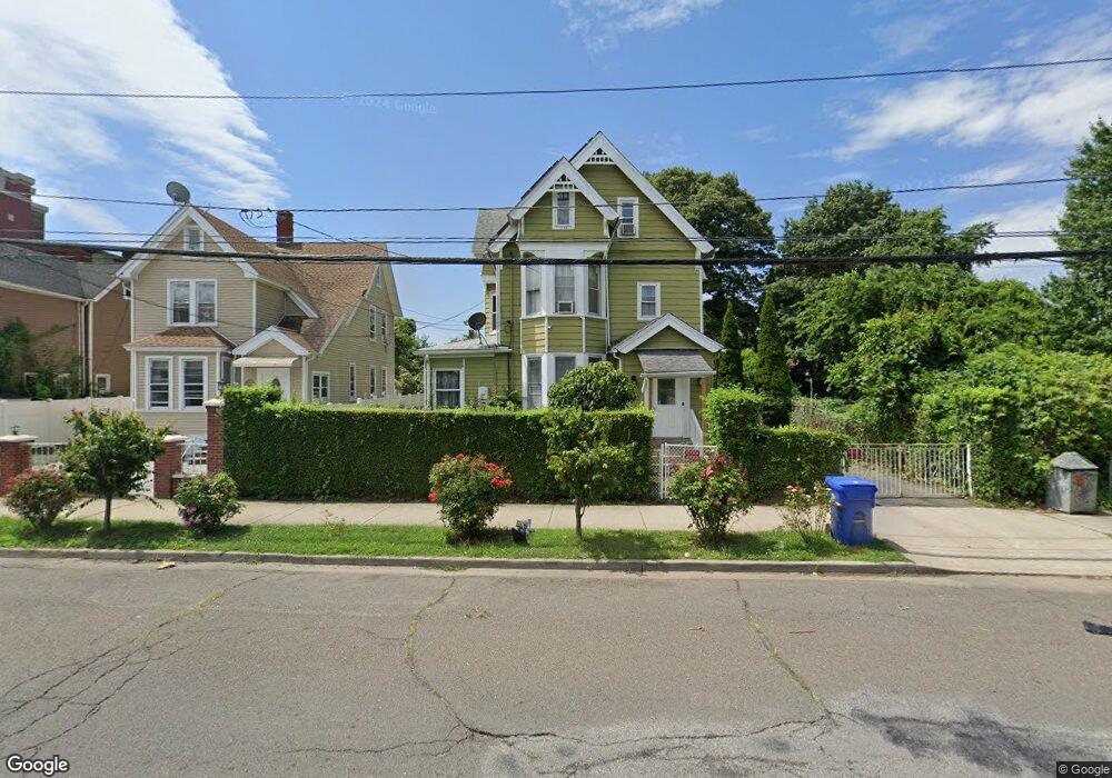
321 Clinton Ave Bridgeport, CT 06605
West End-West Side NeighborhoodEstimated Value: $337,000 - $492,000
5
Beds
2
Baths
2,509
Sq Ft
$173/Sq Ft
Est. Value
About This Home
This home is located at 321 Clinton Ave, Bridgeport, CT 06605 and is currently estimated at $435,073, approximately $173 per square foot. 321 Clinton Ave is a home located in Fairfield County with nearby schools including Cesar Batalla School, Bassick High School, and Park City Prep Charter School.
Ownership History
Date
Name
Owned For
Owner Type
Purchase Details
Closed on
Oct 26, 2006
Sold by
Rodriguez Maria
Bought by
Colon Oliva
Current Estimated Value
Home Financials for this Owner
Home Financials are based on the most recent Mortgage that was taken out on this home.
Original Mortgage
$280,000
Outstanding Balance
$168,124
Interest Rate
6.48%
Estimated Equity
$266,949
Create a Home Valuation Report for This Property
The Home Valuation Report is an in-depth analysis detailing your home's value as well as a comparison with similar homes in the area
Home Values in the Area
Average Home Value in this Area
Purchase History
| Date | Buyer | Sale Price | Title Company |
|---|---|---|---|
| Colon Oliva | $350,000 | -- | |
| Colon Oliva | $350,000 | -- |
Source: Public Records
Mortgage History
| Date | Status | Borrower | Loan Amount |
|---|---|---|---|
| Open | Colon Oliva | $280,000 | |
| Closed | Colon Oliva | $35,000 | |
| Closed | Colon Oliva | $280,000 | |
| Previous Owner | Colon Oliva | $41,600 |
Source: Public Records
Tax History Compared to Growth
Tax History
| Year | Tax Paid | Tax Assessment Tax Assessment Total Assessment is a certain percentage of the fair market value that is determined by local assessors to be the total taxable value of land and additions on the property. | Land | Improvement |
|---|---|---|---|---|
| 2025 | $7,315 | $168,360 | $48,010 | $120,350 |
| 2024 | $7,315 | $168,360 | $48,010 | $120,350 |
| 2023 | $7,315 | $168,360 | $48,010 | $120,350 |
| 2022 | $7,315 | $168,360 | $48,010 | $120,350 |
| 2021 | $7,315 | $168,360 | $48,010 | $120,350 |
| 2020 | $6,918 | $128,140 | $29,090 | $99,050 |
| 2019 | $6,918 | $128,140 | $29,090 | $99,050 |
| 2018 | $6,967 | $128,140 | $29,090 | $99,050 |
| 2017 | $6,967 | $128,140 | $29,090 | $99,050 |
| 2016 | $6,967 | $128,140 | $29,090 | $99,050 |
| 2015 | $6,835 | $161,970 | $44,030 | $117,940 |
| 2014 | $6,835 | $161,970 | $44,030 | $117,940 |
Source: Public Records
Map
Nearby Homes
- 150 Clinton Ave
- 468 Colorado Ave
- 533 Clinton Ave
- 393 Laurel Ave Unit 203
- 393 Laurel Ave Unit 415
- 90 Lee Ave
- 99 Denver Ave Unit 101
- 115 Denver Ave Unit 117
- 357 Norman St
- 899 Hancock Ave
- 47 Lenox Ave
- 212 Denver Ave
- 670 Clinton Ave
- 865 Iranistan Ave
- 757 Iranistan Ave Unit 759
- 255 Poplar St
- 697 Laurel Ave
- 700 Laurel Ave
- 592 Norman St Unit 594
- 195 Lenox Ave Unit 197
- 313 Clinton Ave
- 303 Clinton Ave
- 284 Colorado Ave
- 276 Colorado Ave
- 292 Colorado Ave
- 300 Colorado Ave
- 304 Colorado Ave
- 351 Clinton Ave Unit 353
- 266 Colorado Ave
- 316 Colorado Ave
- 269 Clinton Ave
- 320 Colorado Ave
- 365 Clinton Ave
- 326 Colorado Ave
- 273 Colorado Ave
- 375 Clinton Ave
- 338 Colorado Ave
- 303 Colorado Ave Unit 305
- 226 Colorado Ave
- 293 Colorado Ave