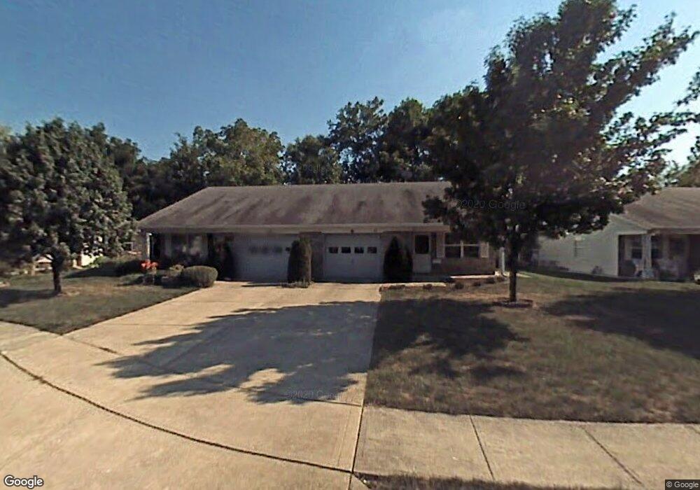
321 Dangerfield Dr Beech Grove, IN 46107
Estimated Value: $165,000 - $172,179
2
Beds
2
Baths
1,006
Sq Ft
$168/Sq Ft
Est. Value
About This Home
This home is located at 321 Dangerfield Dr, Beech Grove, IN 46107 and is currently estimated at $168,545, approximately $167 per square foot. 321 Dangerfield Dr is a home located in Marion County with nearby schools including Hornet Park Elementary School, South Grove Intermediate School, and Central Elementary School.
Ownership History
Date
Name
Owned For
Owner Type
Purchase Details
Closed on
Nov 11, 2005
Sold by
Meadors Freddie M
Bought by
Bradshaw Russell L
Current Estimated Value
Home Financials for this Owner
Home Financials are based on the most recent Mortgage that was taken out on this home.
Original Mortgage
$73,153
Outstanding Balance
$38,485
Interest Rate
5.98%
Mortgage Type
VA
Estimated Equity
$130,060
Create a Home Valuation Report for This Property
The Home Valuation Report is an in-depth analysis detailing your home's value as well as a comparison with similar homes in the area
Home Values in the Area
Average Home Value in this Area
Purchase History
| Date | Buyer | Sale Price | Title Company |
|---|---|---|---|
| Bradshaw Russell L | -- | Stewart Title |
Source: Public Records
Mortgage History
| Date | Status | Borrower | Loan Amount |
|---|---|---|---|
| Open | Bradshaw Russell L | $73,153 |
Source: Public Records
Tax History
| Year | Tax Paid | Tax Assessment Tax Assessment Total Assessment is a certain percentage of the fair market value that is determined by local assessors to be the total taxable value of land and additions on the property. | Land | Improvement |
|---|---|---|---|---|
| 2025 | $1,496 | $152,200 | $14,700 | $137,500 |
| 2024 | $1,467 | $140,200 | $14,700 | $125,500 |
| 2023 | $1,467 | $125,100 | $14,700 | $110,400 |
| 2022 | $1,495 | $113,700 | $14,700 | $99,000 |
| 2021 | $1,145 | $92,900 | $14,700 | $78,200 |
| 2020 | $980 | $84,400 | $14,700 | $69,700 |
| 2019 | $912 | $80,900 | $14,400 | $66,500 |
| 2018 | $849 | $77,300 | $14,400 | $62,900 |
| 2017 | $850 | $76,300 | $14,400 | $61,900 |
| 2016 | $822 | $74,400 | $14,400 | $60,000 |
| 2014 | $770 | $73,300 | $14,400 | $58,900 |
| 2013 | $787 | $73,300 | $14,400 | $58,900 |
Source: Public Records
Map
Nearby Homes
- 413 Dangerfield Dr
- 1428 Yazoo Dr
- 1701 S 9th Ave
- 4633 Shelbyville Rd
- 939 Stave Oak Dr
- 617 Grovewood Dr
- 5321 S Linwood Ave
- 1247 Smoketree Dr
- 5435 Coventry Park Way
- 5133 Gray Rd
- 4930 Candy Spots Dr
- 5514 Coventry Park Way
- 5147 Antigua Trail
- 4921 Candy Spots Dr
- 5551 Personality Ct
- 5534 Hill Rise Dr
- 4945 Royal Orbit Ct
- 749 S 4th Ave
- 5617 S Emerson Ave
- 5334 Straw Hat Ct
- 319 Dangerfield Dr
- 327 Dangerfield Dr
- 315 Dangerfield Dr
- 405 Dangerfield Dr
- 407 Dangerfield Dr
- 313 Dangerfield Dr
- 411 Dangerfield Dr
- 309 Dangerfield Dr
- 320 Dangerfield Dr
- 307 Dangerfield Dr
- 324 Dangerfield Dr
- 318 Dangerfield Dr
- 326 Dangerfield Dr
- 306 Dangerfield Dr
- 404 Dangerfield Dr
- 314 Dangerfield Dr
- 308 Dangerfield Dr
- 410 Dangerfield Dr
- 312 Dangerfield Dr
- 417 Dangerfield Dr
Your Personal Tour Guide
Ask me questions while you tour the home.