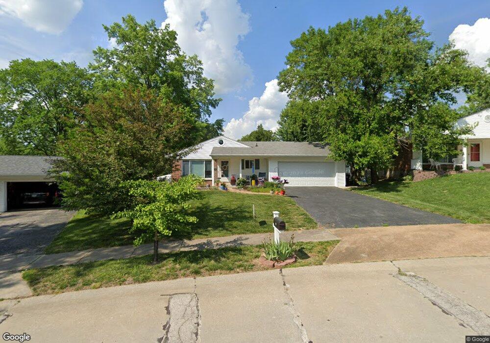
321 Danworth Ct Saint Louis, MO 63122
Estimated Value: $284,101 - $386,000
3
Beds
2
Baths
1,176
Sq Ft
$275/Sq Ft
Est. Value
About This Home
This home is located at 321 Danworth Ct, Saint Louis, MO 63122 and is currently estimated at $323,275, approximately $274 per square foot. 321 Danworth Ct is a home located in St. Louis County with nearby schools including George R. Robinson Elementary School, Nipher Middle School, and Kirkwood Senior High School.
Ownership History
Date
Name
Owned For
Owner Type
Purchase Details
Closed on
May 20, 2005
Sold by
Reed Robert M and Reed Carlyn L
Bought by
Roldan Laura Jane
Current Estimated Value
Home Financials for this Owner
Home Financials are based on the most recent Mortgage that was taken out on this home.
Original Mortgage
$124,000
Outstanding Balance
$63,738
Interest Rate
5.62%
Mortgage Type
Fannie Mae Freddie Mac
Estimated Equity
$259,537
Create a Home Valuation Report for This Property
The Home Valuation Report is an in-depth analysis detailing your home's value as well as a comparison with similar homes in the area
Home Values in the Area
Average Home Value in this Area
Purchase History
| Date | Buyer | Sale Price | Title Company |
|---|---|---|---|
| Roldan Laura Jane | $155,000 | -- |
Source: Public Records
Mortgage History
| Date | Status | Borrower | Loan Amount |
|---|---|---|---|
| Open | Roldan Laura Jane | $124,000 | |
| Closed | Roldan Laura Jane | $23,250 |
Source: Public Records
Tax History
| Year | Tax Paid | Tax Assessment Tax Assessment Total Assessment is a certain percentage of the fair market value that is determined by local assessors to be the total taxable value of land and additions on the property. | Land | Improvement |
|---|---|---|---|---|
| 2025 | $3,127 | $55,220 | $54,020 | $1,200 |
| 2024 | $3,127 | $49,680 | $34,710 | $14,970 |
| 2023 | $3,078 | $49,680 | $34,710 | $14,970 |
| 2022 | $2,856 | $39,720 | $30,880 | $8,840 |
| 2021 | $2,584 | $39,720 | $30,880 | $8,840 |
| 2020 | $2,640 | $39,040 | $23,710 | $15,330 |
| 2019 | $2,668 | $39,040 | $23,710 | $15,330 |
| 2018 | $2,581 | $33,350 | $18,530 | $14,820 |
| 2017 | $2,577 | $33,350 | $18,530 | $14,820 |
| 2016 | $2,788 | $36,390 | $15,430 | $20,960 |
Source: Public Records
Map
Nearby Homes
- 322 Midway Ave
- 233 Midway Ave
- 338 W Rose Hill Ave
- 420 W Rose Hill Ave
- 1140 S Geyer Rd
- 635 Maple Forest Unit 24
- 621 S Kirkwood Rd Unit 202
- 667 S Kirkwood Rd Unit 102
- 630 Candleberry Ct Unit D
- 709 S Fillmore Ave
- 629 S Fillmore Ave
- 36 Orchard Ln
- 320 Saratoga St
- 341 New York St
- 301 Memphis St
- 335 Electric St
- 540 Hickory Hollow Ln
- 524 Hickory Hollow Ln
- 318 Chicago St
- 1059 Huthmaker Ave
- 315 Danworth Ct
- 1002 Danworth Ct
- 10908 Big Bend Rd
- 309 Danworth Ct
- 10917 Big Bend Rd
- 328 Danworth Ct
- 10902 Big Bend Rd
- 1016 Danworth Ct
- 1001 Danworth Ct
- 322 Danworth Ct
- 1007 Danworth Ct
- 10927 Big Bend Rd
- 10844 Big Bend Rd Unit 10844D
- 10844 Big Bend Rd Unit 10844C
- 10844 Big Bend Rd Unit 10844B
- 10844 Big Bend Rd Unit 10844A
- 10844 Big Bend Rd Unit A
- 10909 Big Bend Rd
- 316 Danworth Ct
- 1022 Danworth Ct
Your Personal Tour Guide
Ask me questions while you tour the home.