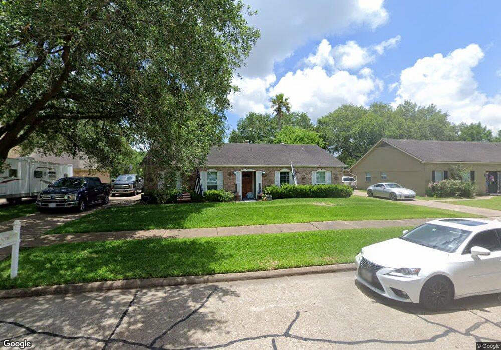
321 Dawn Hill Dr Friendswood, TX 77546
Estimated Value: $277,299 - $315,000
--
Bed
2
Baths
1,932
Sq Ft
$153/Sq Ft
Est. Value
About This Home
This home is located at 321 Dawn Hill Dr, Friendswood, TX 77546 and is currently estimated at $295,075, approximately $152 per square foot. 321 Dawn Hill Dr is a home located in Galveston County with nearby schools including C.W. Cline Elementary School, Windsong Elementary School, and Friendswood Junior High School.
Ownership History
Date
Name
Owned For
Owner Type
Purchase Details
Closed on
Jun 21, 2016
Sold by
Tnt Land & Minerals Inc
Bought by
Frazier Ronald
Current Estimated Value
Home Financials for this Owner
Home Financials are based on the most recent Mortgage that was taken out on this home.
Original Mortgage
$161,500
Outstanding Balance
$128,536
Interest Rate
3.57%
Mortgage Type
New Conventional
Estimated Equity
$166,539
Purchase Details
Closed on
May 13, 2014
Sold by
Todd Michael and Todd Matt
Bought by
Tnt Land & Minerals Inc
Purchase Details
Closed on
Sep 2, 2003
Sold by
Williams Sally S Hocking
Bought by
Todd Michael and Todd Matt
Home Financials for this Owner
Home Financials are based on the most recent Mortgage that was taken out on this home.
Original Mortgage
$60,000
Interest Rate
7.25%
Mortgage Type
Purchase Money Mortgage
Create a Home Valuation Report for This Property
The Home Valuation Report is an in-depth analysis detailing your home's value as well as a comparison with similar homes in the area
Home Values in the Area
Average Home Value in this Area
Purchase History
| Date | Buyer | Sale Price | Title Company |
|---|---|---|---|
| Frazier Ronald | -- | Alamo Title Company | |
| Tnt Land & Minerals Inc | -- | Stewart Title | |
| Todd Michael | $117,900 | Chicago Title |
Source: Public Records
Mortgage History
| Date | Status | Borrower | Loan Amount |
|---|---|---|---|
| Open | Frazier Ronald | $161,500 | |
| Previous Owner | Todd Michael | $60,000 | |
| Closed | Tnt Land & Minerals Inc | $0 |
Source: Public Records
Tax History Compared to Growth
Tax History
| Year | Tax Paid | Tax Assessment Tax Assessment Total Assessment is a certain percentage of the fair market value that is determined by local assessors to be the total taxable value of land and additions on the property. | Land | Improvement |
|---|---|---|---|---|
| 2025 | $1,642 | $295,600 | $42,750 | $252,850 |
| 2024 | $1,642 | $276,106 | -- | -- |
| 2023 | $1,642 | $251,005 | $0 | $0 |
| 2022 | $5,026 | $228,186 | $0 | $0 |
| 2021 | $4,845 | $262,940 | $42,750 | $220,190 |
| 2020 | $4,543 | $224,410 | $42,750 | $181,660 |
| 2019 | $4,353 | $171,440 | $34,200 | $137,240 |
| 2018 | $4,424 | $173,200 | $34,200 | $139,000 |
| 2017 | $4,543 | $174,930 | $34,200 | $140,730 |
| 2016 | $4,243 | $163,380 | $34,200 | $129,180 |
| 2015 | $1,634 | $143,890 | $34,200 | $109,690 |
| 2014 | $1,366 | $116,160 | $34,200 | $81,960 |
Source: Public Records
Map
Nearby Homes
- 2512 Ravenna Ct
- 110 Dorado Dr
- 251 Saint Cloud Dr
- Amalfi Plan at Friendswood Trails
- Portofino Plan at Friendswood Trails
- Postiano Plan at Friendswood Trails
- Capri Plan at Friendswood Trails
- Ravello Plan at Friendswood Trails
- 1508 Harvest Vine Ct
- 2829 Fairway Dr
- 40 Windsong Ln
- 601 E Castle Harbour Dr
- 2904 Bridle Path Ln
- 2605 S Mission Cir
- 644 E Castle Harbour Dr
- 2211 S Mission Cir
- 2847 Everett Dr
- 2871 Love Ln
- 1910 N Mission Cir
- 1913 Lundy Ln
- 317 Dawn Hill Dr
- 325 Dawn Hill Dr
- 329 Dawn Hill Dr
- 313 Dawn Hill Dr
- 318 Dawn Hill Dr
- 322 Dawn Hill Dr
- 314 Dawn Hill Dr
- 326 Dawn Hill Dr
- 333 Dawn Hill Dr
- 309 Dawn Hill Dr
- 330 Dawn Hill Dr
- 305 W Castle Harbour Dr
- 309 W Castle Harbour Dr
- 337 Dawn Hill Dr
- 305 Dawn Hill Dr
- 313 W Castle Harbour Dr
- 334 Dawn Hill Dr
- 301 Dawn Hill Dr
- 317 W Castle Harbour Dr
- 341 Dawn Hill Dr