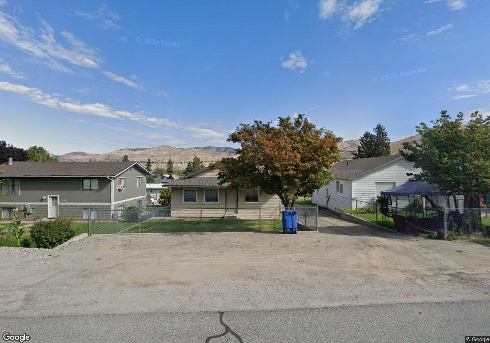
321 E Nebraska Ave Chelan, WA 98816
Estimated Value: $788,000
--
Bed
--
Bath
--
Sq Ft
0.27
Acres
About This Home
This home is located at 321 E Nebraska Ave, Chelan, WA 98816 and is currently estimated at $788,000. 321 E Nebraska Ave is a home located in Chelan County with nearby schools including Morgen Owings Elementary School, Holden Village Community School, and Chelan Middle School.
Ownership History
Date
Name
Owned For
Owner Type
Purchase Details
Closed on
Jan 2, 2015
Sold by
Bradley Linda D
Bought by
Dearmond David and Mai Truc Phuong
Current Estimated Value
Home Financials for this Owner
Home Financials are based on the most recent Mortgage that was taken out on this home.
Original Mortgage
$207,500
Interest Rate
5.5%
Mortgage Type
Seller Take Back
Purchase Details
Closed on
Nov 27, 2013
Sold by
Bradley Linda D
Bought by
City Of Chelan
Purchase Details
Closed on
Sep 21, 2005
Sold by
Clayson Charles E
Bought by
Bradley Linda D
Create a Home Valuation Report for This Property
The Home Valuation Report is an in-depth analysis detailing your home's value as well as a comparison with similar homes in the area
Home Values in the Area
Average Home Value in this Area
Purchase History
| Date | Buyer | Sale Price | Title Company |
|---|---|---|---|
| Dearmond David | $207,500 | None Available | |
| City Of Chelan | -- | Accommodation | |
| Bradley Linda D | -- | Accommodation | |
| Bradley Linda D | -- | None Available |
Source: Public Records
Mortgage History
| Date | Status | Borrower | Loan Amount |
|---|---|---|---|
| Closed | Dearmond David | $207,500 |
Source: Public Records
Tax History Compared to Growth
Tax History
| Year | Tax Paid | Tax Assessment Tax Assessment Total Assessment is a certain percentage of the fair market value that is determined by local assessors to be the total taxable value of land and additions on the property. | Land | Improvement |
|---|---|---|---|---|
| 2021 | $475 | $53,148 | $45,450 | $7,698 |
| 2020 | $483 | $55,009 | $47,250 | $7,759 |
| 2019 | $623 | $50,356 | $47,250 | $3,106 |
| 2018 | $587 | $67,560 | $64,872 | $2,688 |
| 2017 | $529 | $57,302 | $54,468 | $2,834 |
| 2016 | $462 | $55,120 | $52,065 | $3,055 |
| 2015 | $462 | $31,017 | $28,035 | $2,982 |
| 2013 | $462 | $30,176 | $26,775 | $3,401 |
Source: Public Records
Map
Nearby Homes
- 0 NNA E Iowa St
- 227 E Franklin Ave
- 0 NNA E Franklin St
- 116 E Raymond Ave
- 214 S Bradley St
- 104 Vineyard Ln Unit 5A
- 19694 State Highway 97a
- 174 Easton Way
- 178 Easton Way
- 183 Easton Way
- 184 Easton Way
- 203 Easton Way
- 404 S 3rd St
- 4060 State Highway 97a
- 804 E Woodin Ave
- 519 E Woodin Ave
- 804 E Wapato Ave
- 322 W Woodin Ave Unit 521
- 322 W Woodin Ave Unit 528
- 322 W Woodin Ave Unit 711
- 325 E Nebraska Ave
- 325 E Nebraska St
- 309 E Nebraska Ave
- 331 E Nebraska Ave
- 320 E Iowa Ave
- 1019 S Saunders St
- 1015 S Saunders St
- 312 E Iowa Ave
- 332 E Nebraska Ave
- 304 E Nebraska St
- 304 E Nebraska Ave
- 308 E Iowa Ave
- 334 E Iowa Ave
- 302 E Nebraska Ave
- 304 E Iowa Ave
- 330 E Iowa Ave
- 323 E Iowa St
- 1018 S Saunders St
- 1012 S Saunders St
- 1008 S Saunders St