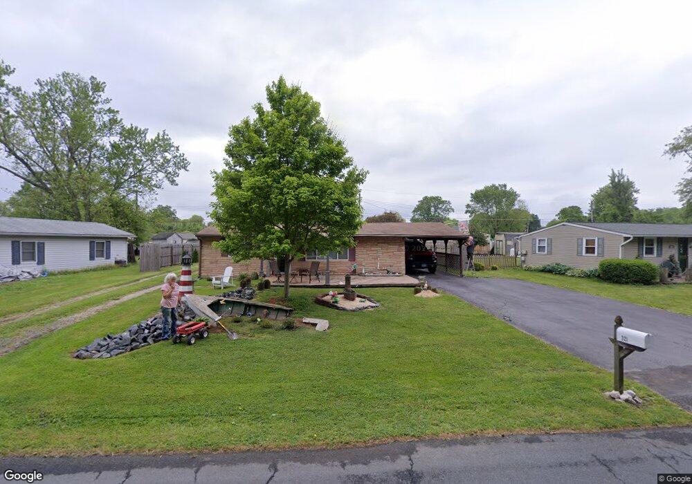
321 Flying Point Rd Edgewood, MD 21040
Estimated Value: $219,783 - $299,000
Studio
1
Bath
944
Sq Ft
$273/Sq Ft
Est. Value
About This Home
This home is located at 321 Flying Point Rd, Edgewood, MD 21040 and is currently estimated at $257,446, approximately $272 per square foot. 321 Flying Point Rd is a home located in Harford County with nearby schools including Deerfield Elementary School, Edgewood Middle School, and Edgewood High School.
Ownership History
Date
Name
Owned For
Owner Type
Purchase Details
Closed on
Sep 5, 2007
Sold by
Hofmeister John E
Bought by
Hofmeister John E and Hofmeister Judith A
Current Estimated Value
Purchase Details
Closed on
Aug 16, 2007
Sold by
Hofmeister John E
Bought by
Hofmeister John E and Hofmeister Judith A
Purchase Details
Closed on
Apr 12, 2005
Sold by
Hofmeister John E
Bought by
Hofmeister John E
Purchase Details
Closed on
Nov 18, 1992
Sold by
Bensel Eliot M
Bought by
Hofmeister John E
Home Financials for this Owner
Home Financials are based on the most recent Mortgage that was taken out on this home.
Original Mortgage
$90,485
Interest Rate
8.32%
Create a Home Valuation Report for This Property
The Home Valuation Report is an in-depth analysis detailing your home's value as well as a comparison with similar homes in the area
Home Values in the Area
Average Home Value in this Area
Purchase History
| Date | Buyer | Sale Price | Title Company |
|---|---|---|---|
| Hofmeister John E | -- | -- | |
| Hofmeister John E | -- | -- | |
| Hofmeister John E | -- | -- | |
| Hofmeister John E | $90,500 | -- |
Source: Public Records
Mortgage History
| Date | Status | Borrower | Loan Amount |
|---|---|---|---|
| Previous Owner | Hofmeister John E | $90,485 |
Source: Public Records
Tax History
| Year | Tax Paid | Tax Assessment Tax Assessment Total Assessment is a certain percentage of the fair market value that is determined by local assessors to be the total taxable value of land and additions on the property. | Land | Improvement |
|---|---|---|---|---|
| 2025 | $1,700 | $171,767 | $0 | $0 |
| 2024 | $1,700 | $159,933 | $0 | $0 |
| 2023 | $1,614 | $148,100 | $60,200 | $87,900 |
| 2022 | $791 | $145,200 | $0 | $0 |
| 2021 | $804 | $142,300 | $0 | $0 |
| 2020 | $804 | $139,400 | $60,200 | $79,200 |
| 2019 | $1,609 | $139,400 | $60,200 | $79,200 |
| 2018 | $1,594 | $139,400 | $60,200 | $79,200 |
| 2017 | $1,671 | $146,100 | $0 | $0 |
| 2016 | -- | $146,100 | $0 | $0 |
| 2015 | $1,915 | $146,100 | $0 | $0 |
| 2014 | $1,915 | $147,800 | $0 | $0 |
Source: Public Records
Map
Nearby Homes
- 3905 Love Ave
- 3913 Love Ct
- 3901 Walters Rd
- 1114 E Viking Ct
- 1000 W Viking Ct
- 308 Laburnum Rd
- 2961 Siwanoy Dr
- 606 Harbour Oak Dr
- 2970 Siwanoy Dr
- 357 Marina Ave
- 2935 Ancon Ct
- 3800 & 3804 Pulaski Hwy
- 4017 E Baker Ave
- 62 Little Creek Ln
- 303 Lord Willoughby Way
- 3620-3628 Sewell Rd
- 4054 Smiths Landing Ct
- 408 Bauers Dr
- 4035 Sharilyn Dr
- 1071 Sand Pebble Dr
- 319 Flying Point Rd
- 323 Flying Point Rd
- 317 Flying Point Rd
- 320 Crestwood Dr
- 318 Crestwood Dr
- 325 Flying Point Rd
- 322 Crestwood Dr
- 316 Crestwood Dr
- 315 Flying Point Rd
- 324 Crestwood Dr
- 314 Crestwood Dr
- 327 Flying Point Rd
- 313 Flying Point Rd
- 312 Crestwood Dr
- 326 Crestwood Dr
- 315 Crestwood Dr
- 313 Crestwood Dr
- 311 Flying Point Rd
- 319 Crestwood Dr
- 329 Flying Point Rd
Your Personal Tour Guide
Ask me questions while you tour the home.