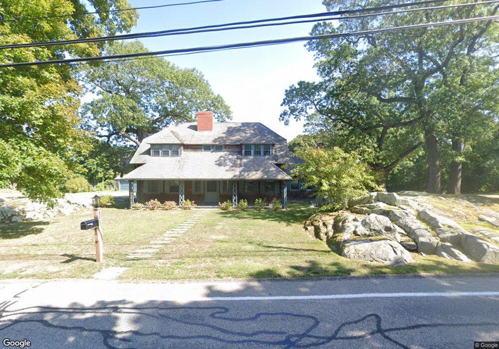
321 Forest Ave Cohasset, MA 02025
Estimated Value: $1,431,868 - $1,710,000
6
Beds
4
Baths
3,404
Sq Ft
$447/Sq Ft
Est. Value
About This Home
This home is located at 321 Forest Ave, Cohasset, MA 02025 and is currently estimated at $1,520,717, approximately $446 per square foot. 321 Forest Ave is a home located in Norfolk County with nearby schools including Joseph Osgood School, Deer Hill School, and Cohasset Middle School.
Ownership History
Date
Name
Owned For
Owner Type
Purchase Details
Closed on
Aug 19, 2016
Sold by
Froio Agnes M
Bought by
Agnes M Frio Irt and Froio
Current Estimated Value
Purchase Details
Closed on
Dec 7, 2012
Sold by
Froio Agnes M
Bought by
Froio Paul G and Froio Kim D
Home Financials for this Owner
Home Financials are based on the most recent Mortgage that was taken out on this home.
Original Mortgage
$750,000
Interest Rate
3.44%
Mortgage Type
Stand Alone Refi Refinance Of Original Loan
Create a Home Valuation Report for This Property
The Home Valuation Report is an in-depth analysis detailing your home's value as well as a comparison with similar homes in the area
Home Values in the Area
Average Home Value in this Area
Purchase History
| Date | Buyer | Sale Price | Title Company |
|---|---|---|---|
| Agnes M Frio Irt | -- | -- | |
| Froio Paul G | $225,000 | -- | |
| Froio Paul G | $225,000 | -- |
Source: Public Records
Mortgage History
| Date | Status | Borrower | Loan Amount |
|---|---|---|---|
| Previous Owner | Froio Paul G | $750,000 |
Source: Public Records
Tax History
| Year | Tax Paid | Tax Assessment Tax Assessment Total Assessment is a certain percentage of the fair market value that is determined by local assessors to be the total taxable value of land and additions on the property. | Land | Improvement |
|---|---|---|---|---|
| 2025 | $12,415 | $1,072,100 | $604,900 | $467,200 |
| 2024 | $11,575 | $951,100 | $483,900 | $467,200 |
| 2023 | $11,197 | $948,900 | $483,800 | $465,100 |
| 2022 | $11,470 | $913,200 | $483,800 | $429,400 |
| 2021 | $11,334 | $869,200 | $483,800 | $385,400 |
| 2020 | $11,274 | $869,200 | $483,800 | $385,400 |
| 2019 | $11,213 | $869,200 | $483,800 | $385,400 |
| 2018 | $11,117 | $869,200 | $483,800 | $385,400 |
| 2017 | $11,038 | $845,200 | $454,400 | $390,800 |
| 2016 | $10,886 | $845,200 | $454,400 | $390,800 |
| 2015 | $10,411 | $819,100 | $428,300 | $390,800 |
| 2014 | $10,272 | $819,100 | $428,300 | $390,800 |
Source: Public Records
Map
Nearby Homes
- 54 Old Coach Rd
- 597 Jerusalem Rd
- 130 Forest Ave
- 96 Forest Ave
- 45 Ocean Ledge Dr
- 14 Cedarledge Village
- 18 Valley Beach Ave
- 48 Valley Beach Ave Unit 2
- 506-512 N Main St
- 59 Wheelwright Unit 59
- 6 State Park Rd Unit 2
- 166 Hull St
- 62 Oceanside Dr
- 1 Longbeach Ave Unit 202
- 107 Hull St
- 121 Nantasket Ave Unit 503
- 114 Hull St
- 4 Atherton Rd
- 22 Berkley Rd Unit B
- 137 Fairoaks Ln