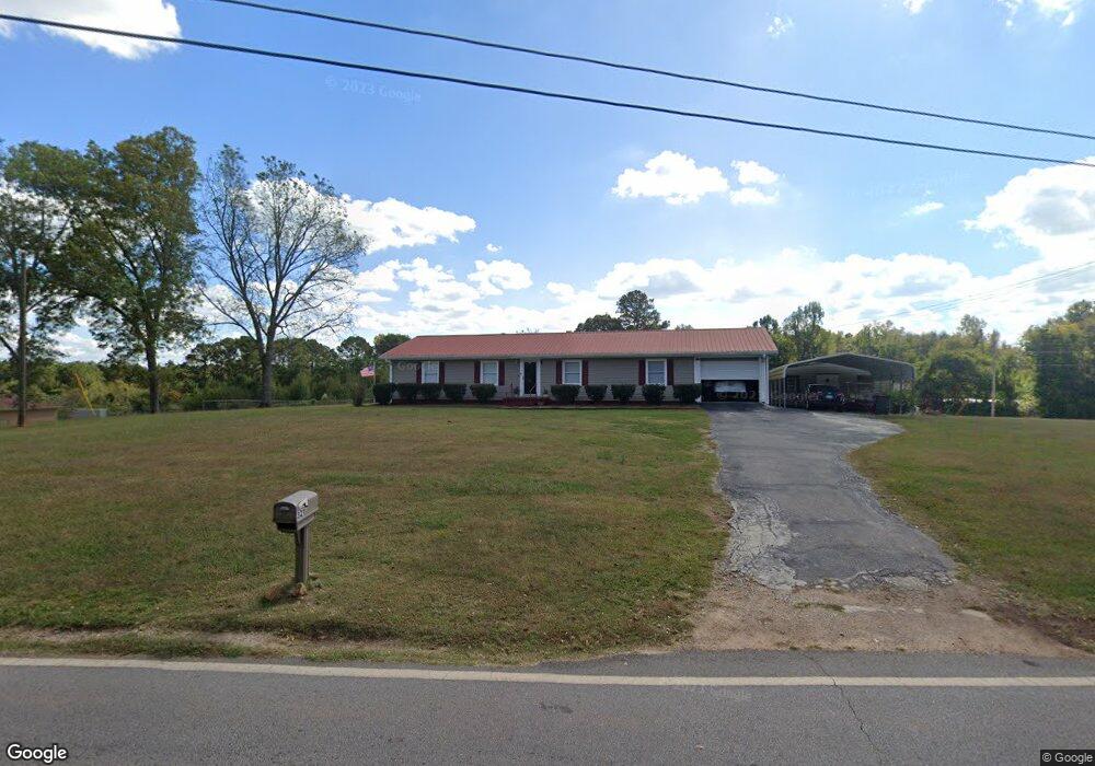
321 Glass Bridge Rd Lagrange, GA 30240
Estimated Value: $231,000 - $265,000
3
Beds
2
Baths
1,709
Sq Ft
$144/Sq Ft
Est. Value
About This Home
This home is located at 321 Glass Bridge Rd, Lagrange, GA 30240 and is currently estimated at $246,773, approximately $144 per square foot. 321 Glass Bridge Rd is a home located in Troup County with nearby schools including Long Cane Elementary School, Berta Weathersbee Elementary School, and Whitesville Road Elementary School.
Ownership History
Date
Name
Owned For
Owner Type
Purchase Details
Closed on
May 4, 2020
Sold by
Johnston Joseph Stell
Bought by
Thomas Annette J
Current Estimated Value
Purchase Details
Closed on
Aug 24, 1983
Sold by
Johnston Lois D
Bought by
Johnston Betty Janice H
Purchase Details
Closed on
Jul 3, 1983
Sold by
Johnston Lois D
Bought by
Johnston Lois D
Purchase Details
Closed on
Jan 2, 1976
Sold by
Heflin J G
Bought by
Johnston Lois D
Create a Home Valuation Report for This Property
The Home Valuation Report is an in-depth analysis detailing your home's value as well as a comparison with similar homes in the area
Home Values in the Area
Average Home Value in this Area
Purchase History
| Date | Buyer | Sale Price | Title Company |
|---|---|---|---|
| Thomas Annette J | -- | -- | |
| Johnston Betty Janice H | -- | -- | |
| Johnston Lois D | -- | -- | |
| Johnston Lois D | $5,000 | -- |
Source: Public Records
Tax History Compared to Growth
Tax History
| Year | Tax Paid | Tax Assessment Tax Assessment Total Assessment is a certain percentage of the fair market value that is determined by local assessors to be the total taxable value of land and additions on the property. | Land | Improvement |
|---|---|---|---|---|
| 2024 | $950 | $61,736 | $5,920 | $55,816 |
| 2023 | $476 | $62,268 | $5,920 | $56,348 |
| 2022 | $926 | $59,548 | $5,920 | $53,628 |
| 2021 | $1,019 | $60,280 | $5,040 | $55,240 |
| 2020 | $1,026 | $34,016 | $4,440 | $29,576 |
| 2019 | $1,015 | $33,660 | $4,440 | $29,220 |
| 2018 | $936 | $31,028 | $4,440 | $26,588 |
| 2017 | $876 | $31,028 | $4,440 | $26,588 |
| 2016 | $853 | $30,282 | $4,460 | $25,822 |
| 2015 | $855 | $30,282 | $4,460 | $25,822 |
| 2014 | $815 | $28,923 | $4,460 | $24,463 |
| 2013 | -- | $30,458 | $4,460 | $25,998 |
Source: Public Records
Map
Nearby Homes
- 105 Hawthorne Cir
- 103 Hawthorne Cir
- 110 Hawthorne Cir
- 141 Plymouth Dr
- 102 Franklin Place
- 119 Plymouth Dr
- 100 Huntcliff Ct
- 124 Foxdale Dr
- 190 Hill Rd
- 101 Ivy Springs Dr
- 808 S Fling Rd
- 135 Planters Ridge Dr
- 509 Connie Dr
- 474 Newton Rd
- 22 Freeman Rd
- 40 River Point Dr
- 37 Overbrook Dr
- 61 Freeman Rd
- 0 Bradfield Dr Unit 10568803
- 0 Deming St Unit 10550189
- 321 Glass Bridge Rd
- 324 Glass Bridge Rd
- 289 Upper Glass Bridge Rd
- 328 Glass Bridge Rd
- 328 Upper Glass Bridge Rd
- 328 Upper Glass Bridge
- 328 Glass Bridge Rd
- 332 Glass Bridge Rd
- 332 Glass Bridge Rd
- 634 Hudson Rd
- 262 Upper Glass Bridge Rd
- 263 Glass Bridge Rd
- 266 Glass Bridge Rd
- 262 Glass Bridge Rd
- 3682 W Point Rd
- 636 Hudson Rd
- 3644 West Point Rd
- 657 Hudson Rd
- 638 Hudson Rd
- 390 Glass Bridge Rd