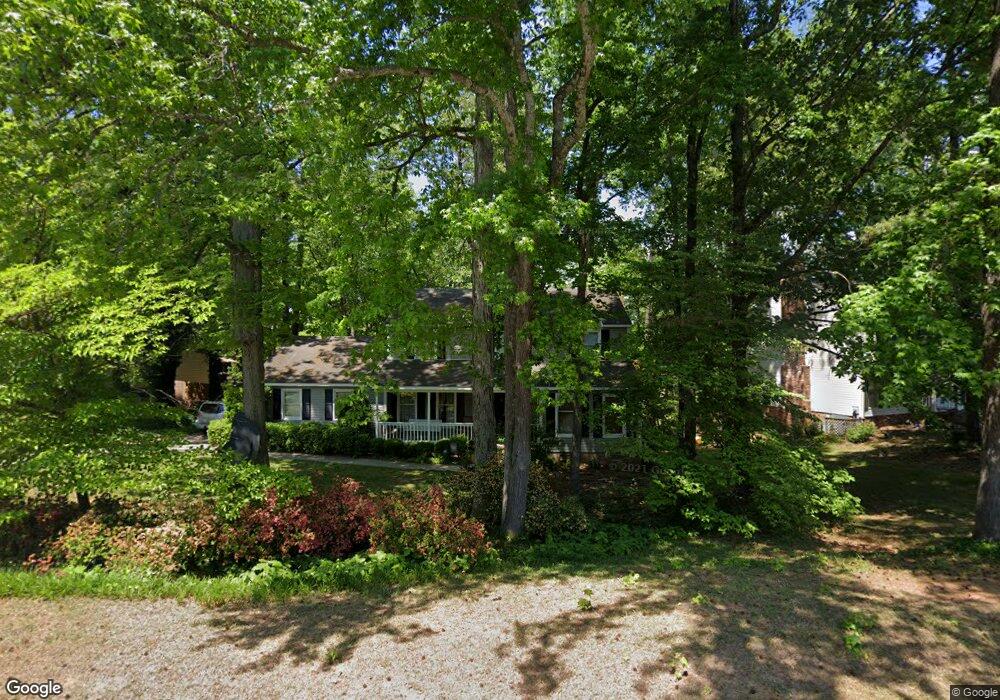
321 Gloucester Rd Augusta, GA 30907
Estimated Value: $278,000 - $360,000
4
Beds
3
Baths
1,937
Sq Ft
$165/Sq Ft
Est. Value
About This Home
This home is located at 321 Gloucester Rd, Augusta, GA 30907 and is currently estimated at $320,102, approximately $165 per square foot. 321 Gloucester Rd is a home located in Columbia County with nearby schools including Stevens Creek Elementary School, Stallings Island Middle School, and Lakeside High School.
Ownership History
Date
Name
Owned For
Owner Type
Purchase Details
Closed on
May 28, 2004
Sold by
Primacy Closing Corp
Bought by
Swanson Mark A and Swanson Nicole E
Current Estimated Value
Home Financials for this Owner
Home Financials are based on the most recent Mortgage that was taken out on this home.
Original Mortgage
$23,950
Outstanding Balance
$11,607
Interest Rate
5.98%
Mortgage Type
Stand Alone Second
Estimated Equity
$308,495
Create a Home Valuation Report for This Property
The Home Valuation Report is an in-depth analysis detailing your home's value as well as a comparison with similar homes in the area
Home Values in the Area
Average Home Value in this Area
Purchase History
| Date | Buyer | Sale Price | Title Company |
|---|---|---|---|
| Swanson Mark A | $159,900 | -- | |
| Primacy Closing Corp | $159,900 | -- |
Source: Public Records
Mortgage History
| Date | Status | Borrower | Loan Amount |
|---|---|---|---|
| Open | Primacy Closing Corp | $23,950 | |
| Open | Primacy Closing Corp | $127,900 |
Source: Public Records
Tax History
| Year | Tax Paid | Tax Assessment Tax Assessment Total Assessment is a certain percentage of the fair market value that is determined by local assessors to be the total taxable value of land and additions on the property. | Land | Improvement |
|---|---|---|---|---|
| 2025 | $2,769 | $115,608 | $25,204 | $90,404 |
| 2024 | $2,588 | $103,192 | $21,304 | $81,888 |
| 2023 | $2,588 | $102,107 | $20,604 | $81,503 |
| 2022 | $2,536 | $97,282 | $21,204 | $76,078 |
| 2021 | $2,464 | $90,434 | $17,204 | $73,230 |
| 2020 | $2,337 | $84,007 | $15,404 | $68,603 |
| 2019 | $2,505 | $90,062 | $18,804 | $71,258 |
| 2018 | $2,294 | $82,144 | $18,804 | $63,340 |
| 2017 | $2,299 | $82,060 | $14,604 | $67,456 |
| 2016 | $2,064 | $76,387 | $14,080 | $62,307 |
| 2015 | $1,932 | $71,371 | $13,880 | $57,491 |
| 2014 | $1,966 | $71,753 | $16,480 | $55,273 |
Source: Public Records
Map
Nearby Homes
- 248 Watervale Rd
- 451 Highlands Ct
- 316 Wakefield Ln N
- 3667 Foxfire Place
- 309 Old Salem Way
- 345 Old Salem Way
- 4120 Shady Oaks Dr
- 414 Parliament Rd
- 308 Valhalla Ct
- 412 Hastings Place
- 433 Cambridge Cir
- 3615 Parliament Ln
- 705 Cool Brook Ct
- 716 Cool Brook Dr
- 315 Rabun Valley Ln
- 1119 Hampstead Place
- 317 Furys Ferry Rd
- 1123 Hampstead Place
- 429 Wexford Ct
- 719 Gentlewind Ln
- 323 Gloucester Rd
- 319 Gloucester Rd
- 3638 Highlands Cir
- 325 Gloucester Rd
- 317 Gloucester Rd
- 318 Gloucester Rd
- 3636 Highlands Cir
- 3640 Highlands Cir
- 316 Gloucester Rd
- 322 Gloucester Rd
- 312 Gloucester Rd
- 327 Gloucester Rd
- 315 Gloucester Rd
- 3634 Highlands Cir
- 324 Gloucester Rd
- 310 Gloucester Rd
- 457 Highlands Ct
- 313 Gloucester Rd
- 458 Highlands Ct
- 311 Gloucester Rd
Your Personal Tour Guide
Ask me questions while you tour the home.