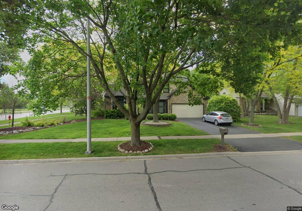
321 Kingsbury Dr Schaumburg, IL 60193
West Schaumburg NeighborhoodEstimated Value: $546,528 - $630,000
3
Beds
3
Baths
2,248
Sq Ft
$262/Sq Ft
Est. Value
About This Home
This home is located at 321 Kingsbury Dr, Schaumburg, IL 60193 and is currently estimated at $588,632, approximately $261 per square foot. 321 Kingsbury Dr is a home located in Cook County with nearby schools including Albert Einstein Elementary School, Jane Addams Junior High School, and Hoffman Estates High School.
Ownership History
Date
Name
Owned For
Owner Type
Purchase Details
Closed on
Sep 11, 2017
Sold by
Odrin John T
Bought by
Lesniak John E and Lesniak Hanan J
Current Estimated Value
Home Financials for this Owner
Home Financials are based on the most recent Mortgage that was taken out on this home.
Original Mortgage
$249,000
Outstanding Balance
$208,489
Interest Rate
4%
Mortgage Type
New Conventional
Estimated Equity
$380,143
Purchase Details
Closed on
Jan 9, 1998
Sold by
Odrlin John A and Odrlin Rosemarie B
Bought by
Odrlin John A and Odrlin Rosemarie B
Create a Home Valuation Report for This Property
The Home Valuation Report is an in-depth analysis detailing your home's value as well as a comparison with similar homes in the area
Home Values in the Area
Average Home Value in this Area
Purchase History
| Date | Buyer | Sale Price | Title Company |
|---|---|---|---|
| Lesniak John E | $332,000 | First American Title Insuran | |
| Odrlin John A | -- | -- |
Source: Public Records
Mortgage History
| Date | Status | Borrower | Loan Amount |
|---|---|---|---|
| Open | Lesniak John E | $249,000 |
Source: Public Records
Tax History Compared to Growth
Tax History
| Year | Tax Paid | Tax Assessment Tax Assessment Total Assessment is a certain percentage of the fair market value that is determined by local assessors to be the total taxable value of land and additions on the property. | Land | Improvement |
|---|---|---|---|---|
| 2024 | $9,777 | $40,870 | $10,837 | $30,033 |
| 2023 | $10,008 | $43,000 | $10,837 | $32,163 |
| 2022 | $10,008 | $43,000 | $10,837 | $32,163 |
| 2021 | $8,094 | $32,700 | $7,414 | $25,286 |
| 2020 | $8,816 | $32,700 | $7,414 | $25,286 |
| 2019 | $8,820 | $36,334 | $7,414 | $28,920 |
| 2018 | $11,890 | $39,617 | $6,273 | $33,344 |
| 2017 | $10,705 | $39,617 | $6,273 | $33,344 |
| 2016 | $10,253 | $39,617 | $6,273 | $33,344 |
| 2015 | $9,067 | $32,931 | $5,418 | $27,513 |
| 2014 | $8,984 | $32,931 | $5,418 | $27,513 |
| 2013 | $8,736 | $32,931 | $5,418 | $27,513 |
Source: Public Records
Map
Nearby Homes
- 200 Columbia Ct Unit 5
- 8138 N Carrolton Ct
- 2404 Baldwin Ct
- 136 Caryville Ln
- 7837 Huntington Cir S
- 7873 Asbury Cir S
- 8181 Northway Dr
- 7843 Kensington Ln
- 2902 Belle Ln
- 2868 Belle Ln Unit 143B28
- 195 Island Ct
- 1316 Kingsbury Dr Unit 1
- 1307 Kingsbury Dr Unit A
- 1323 Kingsbury Dr Unit 2
- 1933 Whittier Ln
- 227 S Walnut Ln
- 2317 Broadway Ln
- 135 S Walnut Ln
- 1939 Weston Ln
- 577 East Ave
- 325 Kingsbury Dr
- 324 Russellwood Ct
- 328 Russellwood Ct
- 329 Kingsbury Dr
- 320 Kingsbury Dr
- 324 Kingsbury Dr
- 332 Russellwood Ct
- 333 Kingsbury Dr
- 328 Kingsbury Dr
- 337 Kingsbury Dr
- 2500 Lawn Ct
- 329 Pembroke Ct Unit 17228
- 329 Pembroke Ct Unit 17227
- 329 Pembroke Ct Unit 17226
- 329 Pembroke Ct Unit 17225
- 329 Pembroke Ct
- 329 Pembroke Ct Unit 8
- 336 Russellwood Ct
- 325 Russellwood Ct
- 321 Pembroke Ct Unit 17221