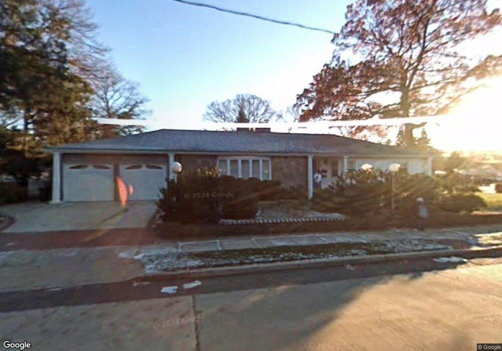
321 Lena Ave Freeport, NY 11520
Estimated Value: $732,807 - $754,000
Studio
4
Baths
2,120
Sq Ft
$351/Sq Ft
Est. Value
About This Home
This home is located at 321 Lena Ave, Freeport, NY 11520 and is currently estimated at $743,404, approximately $350 per square foot. 321 Lena Ave is a home located in Nassau County with nearby schools including Caroline G. Atkinson Intermediate School, Columbus Avenue School, and John W Dodd Middle School.
Ownership History
Date
Name
Owned For
Owner Type
Purchase Details
Closed on
Nov 7, 2019
Sold by
Dorns Adrienne
Bought by
321 Lena Llc
Current Estimated Value
Purchase Details
Closed on
Jul 12, 2012
Sold by
Crawford James
Bought by
Dorris Adrienne
Purchase Details
Closed on
Sep 1, 2004
Sold by
Dobbins Enos
Purchase Details
Closed on
May 21, 1999
Purchase Details
Closed on
Nov 3, 1997
Sold by
Williams Hilja
Bought by
Dobbins Enos
Purchase Details
Closed on
Feb 27, 1997
Create a Home Valuation Report for This Property
The Home Valuation Report is an in-depth analysis detailing your home's value as well as a comparison with similar homes in the area
Home Values in the Area
Average Home Value in this Area
Purchase History
| Date | Buyer | Sale Price | Title Company |
|---|---|---|---|
| 321 Lena Llc | -- | Judicial Title | |
| 321 Lena Llc | -- | Judicial Title | |
| 321 Lena Llc | -- | Judicial Title | |
| Dorris Adrienne | -- | -- | |
| Dorris Adrienne | -- | -- | |
| Dorris Adrienne | -- | -- | |
| -- | -- | -- | |
| -- | -- | -- | |
| -- | -- | -- | |
| -- | -- | -- | |
| Dobbins Enos | $201,000 | -- | |
| Dobbins Enos | $201,000 | -- | |
| -- | -- | -- | |
| -- | -- | -- |
Source: Public Records
Tax History
| Year | Tax Paid | Tax Assessment Tax Assessment Total Assessment is a certain percentage of the fair market value that is determined by local assessors to be the total taxable value of land and additions on the property. | Land | Improvement |
|---|---|---|---|---|
| 2025 | $11,104 | $515 | $207 | $308 |
| 2024 | $1,111 | $515 | $207 | $308 |
Source: Public Records
Map
Nearby Homes
- 6 Beverly Pkwy
- 2098 Felix Ct
- 883 Mckenna Ave
- 215 N Brookside Ave
- 89 Delaware Ave
- 15 Mckenna Ave
- 858 Seaman Ave E
- 60 Connecticut Ave
- 107 California Ave
- 101 Wallace St
- 1 Willowbrook Ln
- 161 Wallace St
- 139 New York Ave
- 28 Lexington Ave
- 1850 Voshage St
- 235 Pine St
- 27 W Woodbine Dr
- 251 N Long Beach Ave
- 115 N Bergen Place
- 99 Randall Ave Unit 1Q
- 309 Lena Ave
- 134 N Bayview Ave
- 335 Lena Ave
- 326 Lena Ave
- 149 N Bayview Ave
- 320 Lena Ave
- 158 N Bayview Ave
- 293 Lena Ave
- 131 N Bayview Ave
- 293 Lena Ave
- 339 Lena Ave
- 322 Randall Ave
- 314 Lena Ave
- 336 Randall Ave
- 318 Randall Ave
- 344 Lena Ave
- 289 Lena Ave
- 193 Wilson Place
- 157 N Bayview Ave
- 195 Wilson Place
Your Personal Tour Guide
Ask me questions while you tour the home.