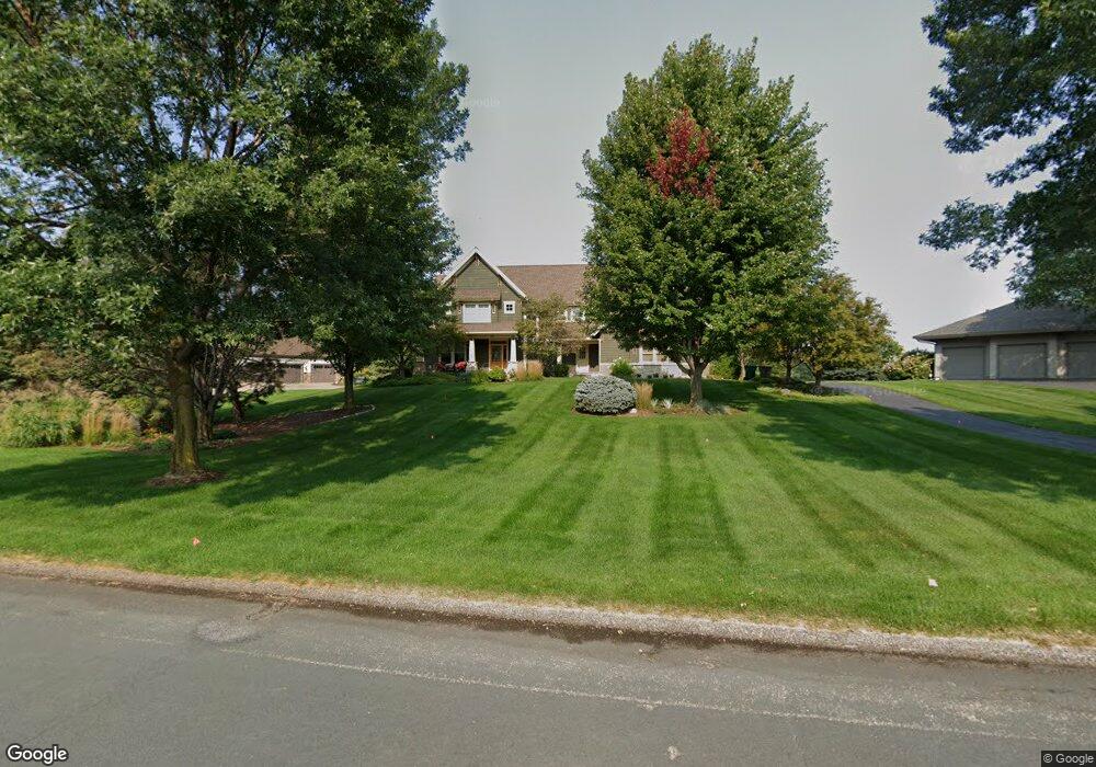
321 Lindsay Rd Hudson, WI 54016
Troy NeighborhoodEstimated Value: $986,038 - $1,152,000
4
Beds
4
Baths
3,815
Sq Ft
$276/Sq Ft
Est. Value
About This Home
This home is located at 321 Lindsay Rd, Hudson, WI 54016 and is currently estimated at $1,053,260, approximately $276 per square foot. 321 Lindsay Rd is a home located in St. Croix County with nearby schools including Westside Elementary School, Meyer Middle School, and River Falls High School.
Ownership History
Date
Name
Owned For
Owner Type
Purchase Details
Closed on
Jul 6, 2021
Sold by
Dehler Charles and Dehler Family Trust
Bought by
Eilitz Christopher A and Eilitz Stephanie L
Current Estimated Value
Home Financials for this Owner
Home Financials are based on the most recent Mortgage that was taken out on this home.
Original Mortgage
$265,000
Outstanding Balance
$240,446
Interest Rate
2.9%
Mortgage Type
Construction
Estimated Equity
$812,814
Purchase Details
Closed on
Jun 1, 2017
Sold by
Dehler Charles L
Bought by
The Dehler Family Trust
Create a Home Valuation Report for This Property
The Home Valuation Report is an in-depth analysis detailing your home's value as well as a comparison with similar homes in the area
Home Values in the Area
Average Home Value in this Area
Purchase History
| Date | Buyer | Sale Price | Title Company |
|---|---|---|---|
| Eilitz Christopher A | $761,500 | None Available | |
| The Dehler Family Trust | -- | -- |
Source: Public Records
Mortgage History
| Date | Status | Borrower | Loan Amount |
|---|---|---|---|
| Open | Eilitz Christopher A | $265,000 |
Source: Public Records
Tax History Compared to Growth
Tax History
| Year | Tax Paid | Tax Assessment Tax Assessment Total Assessment is a certain percentage of the fair market value that is determined by local assessors to be the total taxable value of land and additions on the property. | Land | Improvement |
|---|---|---|---|---|
| 2024 | $88 | $848,000 | $184,200 | $663,800 |
| 2023 | $8,718 | $848,000 | $184,200 | $663,800 |
| 2022 | $10,327 | $848,000 | $184,200 | $663,800 |
| 2021 | $10,098 | $706,500 | $215,000 | $491,500 |
| 2020 | $10,563 | $706,500 | $215,000 | $491,500 |
| 2019 | $10,049 | $706,500 | $215,000 | $491,500 |
| 2018 | $9,876 | $706,500 | $215,000 | $491,500 |
| 2017 | $9,742 | $706,500 | $215,000 | $491,500 |
| 2016 | $9,742 | $706,500 | $215,000 | $491,500 |
| 2015 | $10,228 | $706,500 | $215,000 | $491,500 |
| 2014 | $9,565 | $706,500 | $215,000 | $491,500 |
| 2013 | $10,238 | $706,500 | $215,000 | $491,500 |
Source: Public Records
Map
Nearby Homes
- 315 Lindsay Rd
- 309 Lindsay Rd
- 264 Saint Annes Pkwy
- 241A Glen Cir
- XXX Plainview Dr
- 270 Turnberry Ct
- 268 Saint Andrews Dr
- 316 Saint Annes Pkwy
- 266 Troon Ct
- XXX Glen Cir
- 24x Cove Rd
- 294 Cove Rd
- 326 S Cove Rd
- 15955 35th St S
- 15945 35th St S
- 3343 Saint Croix Trail S
- 2179 River Rd S
- 16460 Upper 22nd St S
- 406 S Fork Dr
- 312 Shelby Court Lot 32
- 319 Lindsay Rd
- 318 Lindsay Rd
- 317 Lindsay Rd
- 323 Lindsay Rd
- 316 Lindsay Rd
- 320 Lindsay Rd
- 320 Lindsay Rd
- 202 Muirfield Trail
- 314 Lindsay Rd
- 322 Lindsay Rd
- 325 Lindsay Rd
- 312 Lindsay Rd
- 204 Muirfield Trail
- 313 Lindsay Rd
- 324 Lindsay Rd
- 287 Plainview Dr
- 206 Muirfield Trail
- 310 Lindsay Rd
- 311 Lindsay Rd
- 327 Lindsay Rd