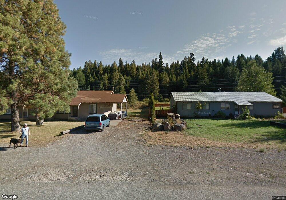
321 Madison St Cle Elum, WA 98922
Estimated Value: $516,767 - $586,000
3
Beds
2
Baths
1,792
Sq Ft
$310/Sq Ft
Est. Value
About This Home
This home is located at 321 Madison St, Cle Elum, WA 98922 and is currently estimated at $555,442, approximately $309 per square foot. 321 Madison St is a home located in Kittitas County with nearby schools including Cle Elum Roslyn Elementary School, Walter Strom Middle School, and Cle Elum Roslyn High School.
Ownership History
Date
Name
Owned For
Owner Type
Purchase Details
Closed on
Sep 18, 2022
Sold by
Trokey Sean M and Trokey Heather M
Bought by
Trokey Heather M
Current Estimated Value
Purchase Details
Closed on
Jul 30, 2012
Sold by
Schneider Ronald R and Schneider Ellen I
Bought by
Trokey Sean M and Trokey Heather M
Home Financials for this Owner
Home Financials are based on the most recent Mortgage that was taken out on this home.
Original Mortgage
$241,836
Interest Rate
3.62%
Mortgage Type
New Conventional
Create a Home Valuation Report for This Property
The Home Valuation Report is an in-depth analysis detailing your home's value as well as a comparison with similar homes in the area
Home Values in the Area
Average Home Value in this Area
Purchase History
| Date | Buyer | Sale Price | Title Company |
|---|---|---|---|
| Trokey Heather M | -- | None Listed On Document | |
| Trokey Sean M | $237,000 | Amerititle |
Source: Public Records
Mortgage History
| Date | Status | Borrower | Loan Amount |
|---|---|---|---|
| Previous Owner | Trokey Sean M | $241,836 |
Source: Public Records
Tax History
| Year | Tax Paid | Tax Assessment Tax Assessment Total Assessment is a certain percentage of the fair market value that is determined by local assessors to be the total taxable value of land and additions on the property. | Land | Improvement |
|---|---|---|---|---|
| 2025 | $270 | $513,840 | $146,160 | $367,680 |
| 2023 | $270 | $450,970 | $113,660 | $337,310 |
| 2022 | $2,499 | $363,160 | $78,420 | $284,740 |
| 2021 | $2,537 | $355,750 | $75,420 | $280,330 |
| 2019 | $2,450 | $307,530 | $58,420 | $249,110 |
| 2018 | $1,602 | $175,840 | $84,790 | $91,050 |
| 2017 | $1,602 | $175,840 | $84,790 | $91,050 |
| 2016 | $1,598 | $175,840 | $84,790 | $91,050 |
| 2015 | $1,622 | $175,840 | $84,790 | $91,050 |
| 2013 | -- | $175,840 | $84,790 | $91,050 |
Source: Public Records
Map
Nearby Homes
- 423 Lincoln Ave
- 208 Sage Brook Ln
- 513 Cleveland Ave
- 491 Pease Rd
- 70 Gobblers Knob Rd
- 811 Lincoln Ave
- 66 x5 Upper Peoh Point Rd
- 66 x1 Upper Peoh Point Rd
- 66 x6 Upper Peoh Point Rd
- 66 x3 Upper Peoh Point Rd
- 66 x2 Upper Peoh Point Rd
- 66 x4 Upper Peoh Point Rd
- 302 River Trail Dr Unit C
- 1030 Pease Rd
- 510 Power St
- 0 XXX Unknown
- 511 W 2nd St
- 302 N Stafford Ave
- 202 E 3rd St Unit 210
- 202 E 3rd St Unit 215
- 323 Madison Ave
- 323 Madison Ave
- 317 Madison Ave
- 317 Madison Ave S
- 317 Madison St
- 317 319 Madison St
- 219 Madison Ave
- 219 Madison St
- 4 Kokanee Lp
- 1 Lower Peoh Point Rd
- 9 Lower Peoh Point Rd
- 0 Lot 7 Garfield Ave Unit 955712
- 3 Lower Peoh Point Rd
- 2 Lower Peoh Point Rd
- 320 Madison St
- 0 Lower Peoh Point Rd
- 403 Madison St
- 324 Madison St
- 318 Madison St
- 326 Madison St
Your Personal Tour Guide
Ask me questions while you tour the home.