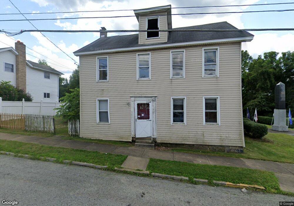
321 Main St Youngstown, PA 15696
Estimated Value: $104,000 - $282,000
--
Bed
--
Bath
2,034
Sq Ft
$94/Sq Ft
Est. Value
About This Home
This home is located at 321 Main St, Youngstown, PA 15696 and is currently estimated at $191,327, approximately $94 per square foot. 321 Main St is a home with nearby schools including Greater Latrobe Junior High School, Greater Latrobe Senior High School, and Christ the Divine Teacher School.
Ownership History
Date
Name
Owned For
Owner Type
Purchase Details
Closed on
Nov 13, 2020
Sold by
Kla Construction Inc
Bought by
Rush Scot and Rush Raelynn
Current Estimated Value
Home Financials for this Owner
Home Financials are based on the most recent Mortgage that was taken out on this home.
Original Mortgage
$156,000
Outstanding Balance
$138,818
Interest Rate
2.8%
Mortgage Type
New Conventional
Estimated Equity
$52,509
Purchase Details
Closed on
Nov 15, 2019
Sold by
Tiaa
Bought by
Kla Construction Inc
Purchase Details
Closed on
May 4, 2018
Sold by
Shurie Randy R
Bought by
Everbank
Purchase Details
Closed on
Sep 26, 2001
Sold by
Jones Nancy
Bought by
Shurie Randy R
Home Financials for this Owner
Home Financials are based on the most recent Mortgage that was taken out on this home.
Original Mortgage
$80,176
Interest Rate
6.91%
Mortgage Type
FHA
Create a Home Valuation Report for This Property
The Home Valuation Report is an in-depth analysis detailing your home's value as well as a comparison with similar homes in the area
Home Values in the Area
Average Home Value in this Area
Purchase History
| Date | Buyer | Sale Price | Title Company |
|---|---|---|---|
| Rush Scot | $195,000 | None Available | |
| Kla Construction Inc | $35,000 | Servicelink Llc | |
| Everbank | $1,368 | None Available | |
| Shurie Randy R | $40,000 | -- |
Source: Public Records
Mortgage History
| Date | Status | Borrower | Loan Amount |
|---|---|---|---|
| Open | Rush Scot | $156,000 | |
| Previous Owner | Shurie Randy R | $80,176 |
Source: Public Records
Tax History Compared to Growth
Tax History
| Year | Tax Paid | Tax Assessment Tax Assessment Total Assessment is a certain percentage of the fair market value that is determined by local assessors to be the total taxable value of land and additions on the property. | Land | Improvement |
|---|---|---|---|---|
| 2025 | $1,409 | $11,500 | $2,180 | $9,320 |
| 2024 | $1,409 | $11,500 | $2,180 | $9,320 |
| 2023 | $1,294 | $11,500 | $2,180 | $9,320 |
| 2022 | $1,416 | $12,700 | $2,180 | $10,520 |
| 2021 | $1,416 | $12,700 | $2,180 | $10,520 |
| 2020 | $1,394 | $12,700 | $2,180 | $10,520 |
| 2019 | $1,375 | $12,700 | $2,180 | $10,520 |
| 2018 | $1,356 | $12,700 | $2,180 | $10,520 |
| 2017 | $1,333 | $12,700 | $2,180 | $10,520 |
| 2016 | $1,321 | $12,700 | $2,180 | $10,520 |
| 2015 | $1,321 | $12,700 | $2,180 | $10,520 |
| 2014 | $1,308 | $12,700 | $2,180 | $10,520 |
Source: Public Records
Map
Nearby Homes
- 1003 Youngstown Ridge Rd
- 206 Apple Hill Dr
- 321 Riverside Dr
- 1630 Lois Rd Unit Lot 22 B
- 1590 Lois Rd Unit Lot 13 B
- 1618 Lois Road Lot 19 B
- 1616 Lois Road Lot 18 A
- 1201 Wayne Road Lot 62 A
- 1302 Roger Drive Lot 55 B
- 1305 Roger Drive Lot 51 A
- Lot 22 Spruce St
- RT 130-Bell Memorial
- 221 Malvina Ln
- 631 Rose Garden Terrace
- 1555 Theatre St
- 1525 Latrobe St
- 0 Tanner Ln
- 1213 W Fir Dr
- 2713 Wilson St
- 410 Smith St