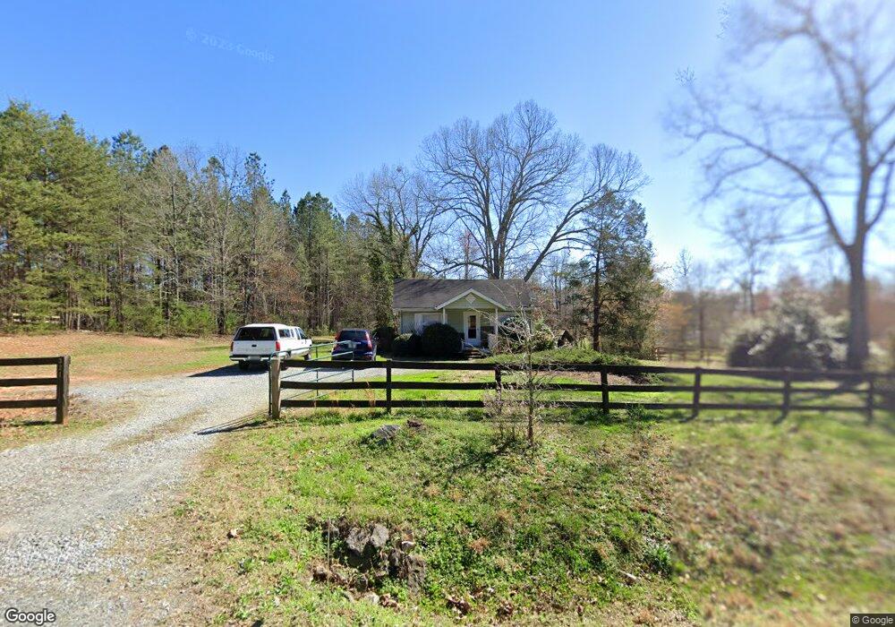
321 Mason Rd Columbus, NC 28722
Estimated Value: $1,027,000 - $3,756,061
2
Beds
1
Bath
744
Sq Ft
$3,214/Sq Ft
Est. Value
About This Home
This home is located at 321 Mason Rd, Columbus, NC 28722 and is currently estimated at $2,391,531, approximately $3,214 per square foot. 321 Mason Rd is a home.
Ownership History
Date
Name
Owned For
Owner Type
Purchase Details
Closed on
Mar 16, 2022
Sold by
Faye Mcabee Virginia
Bought by
Mcabee Virginia
Current Estimated Value
Purchase Details
Closed on
Apr 4, 2017
Sold by
Biali Llc
Bought by
Biali Farms Llc
Purchase Details
Closed on
Jan 13, 2010
Sold by
Collins W C W and Collins Fannie S
Bought by
Collins Fannie S and Omicrom Systems Irrevocable Tr
Purchase Details
Closed on
Jul 6, 2007
Sold by
Lucre Llc
Bought by
Thompson Earl O and Thompson Emily L
Create a Home Valuation Report for This Property
The Home Valuation Report is an in-depth analysis detailing your home's value as well as a comparison with similar homes in the area
Home Values in the Area
Average Home Value in this Area
Purchase History
| Date | Buyer | Sale Price | Title Company |
|---|---|---|---|
| Mcabee Virginia | -- | Chicago Title | |
| Biali Farms Llc | -- | None Available | |
| Collins Fannie S | -- | None Available | |
| Thompson Earl O | $112,500 | None Available |
Source: Public Records
Tax History
| Year | Tax Paid | Tax Assessment Tax Assessment Total Assessment is a certain percentage of the fair market value that is determined by local assessors to be the total taxable value of land and additions on the property. | Land | Improvement |
|---|---|---|---|---|
| 2025 | $12,101 | $2,277,198 | $438,900 | $1,838,298 |
| 2024 | $10,120 | $1,561,289 | $274,200 | $1,287,089 |
| 2023 | $9,999 | $1,561,289 | $274,200 | $1,287,089 |
| 2022 | $9,687 | $1,561,289 | $274,200 | $1,287,089 |
| 2021 | $9,196 | $1,561,289 | $274,200 | $1,287,089 |
| 2020 | $8,759 | $1,404,601 | $298,000 | $1,106,601 |
| 2019 | $8,902 | $1,404,601 | $298,000 | $1,106,601 |
| 2018 | $1,856 | $312,783 | $278,000 | $34,783 |
| 2017 | $1,830 | $162,953 | $124,200 | $38,753 |
| 2016 | $982 | $162,953 | $124,200 | $38,753 |
| 2015 | $926 | $0 | $0 | $0 |
| 2014 | $926 | $0 | $0 | $0 |
| 2013 | -- | $0 | $0 | $0 |
Source: Public Records
Map
Nearby Homes
- 663 Landrum Rd
- 6505 S Hwy 9 Hwy
- 591 Landrum Rd
- 100 Gilbert Rd
- 1146 Landrum Rd
- 0 Mapleton Ln Unit CAR4257492
- 0 Mapleton Ln Unit 6
- Lot 36 Mapleton Ln
- Lot 20 Mapleton Ln
- 36 Skylane Ct
- Lot 18 Mapleton Ln Unit 18
- 523 Mcdade Rd
- 490 Mapleton Ln
- 66 Ashlyn Ln
- 139 Clarkson Ln
- 110 Mandy Ln
- 749 Henry Thompson Rd
- 1183 Sandy Plains Rd
- 201 Hughes Cr Rd
- 2597 Green Creek Dr
- 271 Collinsville Rd
- 7400 S 9 Nc Hwy
- 196 Collinsville Rd
- 76 Collinsville Rd
- 7400 S Nc 9 Hwy
- 266 Collinsville Rd
- 166 Collinsville Rd
- 331 Collinsville Rd
- 282 Collinsville Rd
- 34 Collinsville Rd
- 32 Collinsville Rd
- 6190 S Nc 9 Hwy
- 000 S Nc 9 Hwy
- 999 S Nc 9 Hwy Unit A
- 0 S Nc 9 Hwy Unit 1329210
- 7470 S Nc 9 Hwy
- 7470 S Nc-9 Hwy
- 7391 N Carolina 9
- 7391 S Nc 9 Hwy
- 7423 S Nc 9 Hwy
Your Personal Tour Guide
Ask me questions while you tour the home.