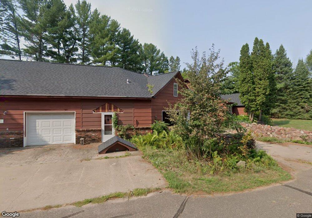
321 Miller Ave Unit 1-3 Spooner, WI 54801
Estimated Value: $276,698 - $335,000
--
Bed
--
Bath
5,196
Sq Ft
$58/Sq Ft
Est. Value
About This Home
This home is located at 321 Miller Ave Unit 1-3, Spooner, WI 54801 and is currently estimated at $302,675, approximately $58 per square foot. 321 Miller Ave Unit 1-3 is a home located in Washburn County with nearby schools including Spooner Elementary School, Spooner Middle School, and Spooner High School.
Ownership History
Date
Name
Owned For
Owner Type
Purchase Details
Closed on
Dec 16, 2022
Sold by
Vonnie Durand Revocable Trust Dated Janu
Bought by
Jonjak Stanley R
Current Estimated Value
Purchase Details
Closed on
Jan 28, 2022
Sold by
Vonnie Durand Revocable Trust Dated Janu
Bought by
R. Jonjak Stanley
Purchase Details
Closed on
Feb 23, 2005
Sold by
Durand Jack and Durand Vonnie
Bought by
Durand Vonnie
Create a Home Valuation Report for This Property
The Home Valuation Report is an in-depth analysis detailing your home's value as well as a comparison with similar homes in the area
Home Values in the Area
Average Home Value in this Area
Purchase History
| Date | Buyer | Sale Price | Title Company |
|---|---|---|---|
| Jonjak Stanley R | $200,000 | Banana Abstract, Inc. | |
| R. Jonjak Stanley | $200,000 | Banana Abstract, Inc. | |
| Durand Vonnie | -- | -- |
Source: Public Records
Tax History Compared to Growth
Tax History
| Year | Tax Paid | Tax Assessment Tax Assessment Total Assessment is a certain percentage of the fair market value that is determined by local assessors to be the total taxable value of land and additions on the property. | Land | Improvement |
|---|---|---|---|---|
| 2023 | $4,349 | $172,000 | $15,200 | $156,800 |
| 2022 | $4,100 | $172,000 | $15,200 | $156,800 |
| 2021 | $3,856 | $172,000 | $15,200 | $156,800 |
| 2020 | $3,937 | $172,000 | $15,200 | $156,800 |
| 2019 | $3,764 | $172,000 | $15,200 | $156,800 |
| 2018 | $3,681 | $172,000 | $15,200 | $156,800 |
| 2017 | $3,675 | $172,000 | $15,200 | $156,800 |
| 2016 | $3,648 | $172,000 | $15,200 | $156,800 |
| 2015 | $3,505 | $172,000 | $15,200 | $156,800 |
| 2014 | $3,426 | $172,000 | $15,200 | $156,800 |
| 2012 | $3,471 | $172,000 | $15,200 | $156,800 |
Source: Public Records
Map
Nearby Homes
- 106 S Summit St
- Lot 1 Lois Lane S Lois Ln SW
- XXX Dur A Bilt Rd
- XXX Pine Dr
- 222 Spruce St
- 0 Hwy 70 Unit 1594695
- 607 College St
- 409 Poplar St
- 924 Superior St
- Lot 2 Grant St
- 0 Northland Dr
- xxx Trails End
- 0 U S 53
- N5781 County Highway K
- 7395 Miller Rd
- N4821 Tozer Lake Rd
- N5603 Tower Hill Rd
- 5810 Bear Path Ln
- N4461 Tozer Lake Rd
- 00 Cable Car Ln
- 321 Miller Ave
- 326 Miller Ave
- 514 Miller Ave
- 312 Miller Ave
- 312 Miller Ave Unit 78-87
- 00 Beaver St
- 425 E Beaver St
- 411 E Beaver St
- 211 Miller Ave
- 107 Miller Ave
- 311 Miller Ave
- 227 Miller Ave
- 206 Miller Ave
- 321 E Beaver St
- 323 E Beaver St
- 122 Miller Ave
- 417 E Beaver St
- 216 E Beaver St
- 216 E Beaver St Unit 3
- 219 Beaver St