Estimated Value: $105,482 - $214,000
2
Beds
2
Baths
1,160
Sq Ft
$124/Sq Ft
Est. Value
About This Home
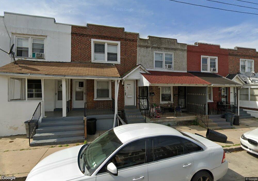
This home is located at 321 N 10th St, Darby, PA 19023 and is currently estimated at $143,621, approximately $123 per square foot. 321 N 10th St is a home located in Delaware County with nearby schools including Park Lane Elementary School, Penn Wood Middle School, and Penn Wood High School - Cypress Street Campus.
Ownership History
Date
Name
Owned For
Owner Type
Purchase Details
Closed on
Sep 14, 2022
Sold by
Seitz Carl W
Bought by
51St Street Llc
Current Estimated Value
Purchase Details
Closed on
Feb 27, 2012
Sold by
Seitz Marianne L
Bought by
Seitz Carl W and Seitz Marianne L
Purchase Details
Closed on
Jun 7, 2000
Sold by
Pratt Charles A
Bought by
Seitz Marianne L
Create a Home Valuation Report for This Property
The Home Valuation Report is an in-depth analysis detailing your home's value as well as a comparison with similar homes in the area
Home Values in the Area
Average Home Value in this Area
Purchase History
| Date | Buyer | Sale Price | Title Company |
|---|---|---|---|
| 51St Street Llc | $160,000 | -- | |
| Seitz Carl W | -- | None Available | |
| Seitz Marianne L | $50,000 | Credit Lenders Title Agency |
Source: Public Records
Tax History Compared to Growth
Tax History
| Year | Tax Paid | Tax Assessment Tax Assessment Total Assessment is a certain percentage of the fair market value that is determined by local assessors to be the total taxable value of land and additions on the property. | Land | Improvement |
|---|---|---|---|---|
| 2025 | $1,706 | $34,445 | $13,620 | $20,825 |
| 2024 | $1,706 | $34,445 | $13,620 | $20,825 |
| 2023 | $1,605 | $34,445 | $13,620 | $20,825 |
| 2022 | $1,561 | $34,445 | $13,620 | $20,825 |
| 2021 | $2,178 | $34,445 | $13,620 | $20,825 |
| 2020 | $539 | $7,380 | $7,380 | $0 |
| 2019 | $516 | $7,380 | $7,380 | $0 |
| 2018 | $510 | $7,380 | $0 | $0 |
| 2017 | $501 | $7,380 | $0 | $0 |
| 2016 | $40 | $35,000 | $0 | $0 |
| 2015 | $196 | $35,000 | $0 | $0 |
| 2014 | $196 | $35,000 | $0 | $0 |
Source: Public Records
Map
Nearby Homes
- 908 Cedar Ave
- 252 N 9th St
- 909 Maple Terrace
- 1203 Edgehill Rd
- 902 Maple Terrace
- 221 N 9th St
- 1237 Edgehill Rd
- 1232 Edgehill Rd
- 209 Weymouth Rd
- 1246 Wycombe Ave
- 225 Wright Ave
- 214 N 6th St
- 200 N 6th St
- 1210 Berkley Rd
- 112 Ridge Ave
- 14 N Macdade Blvd
- 1125 Main St
- 210 Londonderry Ln
- 704 Main St
- 306 Golf Rd