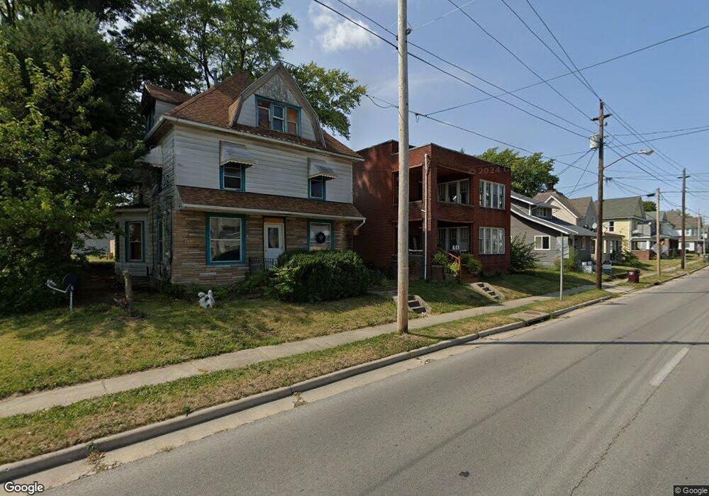
321 N Jameson Ave Lima, OH 45805
Central Lima NeighborhoodEstimated Value: $84,273 - $116,000
4
Beds
2
Baths
2,846
Sq Ft
$36/Sq Ft
Est. Value
About This Home
This home is located at 321 N Jameson Ave, Lima, OH 45805 and is currently estimated at $102,568, approximately $36 per square foot. 321 N Jameson Ave is a home located in Allen County with nearby schools including Heritage Elementary School, Lima West Middle School, and Lima North Middle School.
Ownership History
Date
Name
Owned For
Owner Type
Purchase Details
Closed on
Aug 19, 2021
Sold by
Lima Properties Ltd
Bought by
Houston Ahmad Ali
Current Estimated Value
Home Financials for this Owner
Home Financials are based on the most recent Mortgage that was taken out on this home.
Original Mortgage
$61,750
Outstanding Balance
$55,540
Interest Rate
2.9%
Mortgage Type
New Conventional
Estimated Equity
$47,028
Purchase Details
Closed on
Sep 24, 2001
Sold by
Bowman Thomas M
Bought by
Dickason Miner O
Purchase Details
Closed on
Jun 22, 1984
Bought by
Bowman Thomas M
Create a Home Valuation Report for This Property
The Home Valuation Report is an in-depth analysis detailing your home's value as well as a comparison with similar homes in the area
Home Values in the Area
Average Home Value in this Area
Purchase History
| Date | Buyer | Sale Price | Title Company |
|---|---|---|---|
| Houston Ahmad Ali | $65,000 | None Available | |
| Houston Ahmad Ali | $195 | None Listed On Document | |
| Dickason Miner O | $59,000 | -- | |
| Bowman Thomas M | $30,000 | -- |
Source: Public Records
Mortgage History
| Date | Status | Borrower | Loan Amount |
|---|---|---|---|
| Open | Houston Ahmad Ali | $61,750 | |
| Closed | Houston Ahmad Ali | $61,750 |
Source: Public Records
Tax History
| Year | Tax Paid | Tax Assessment Tax Assessment Total Assessment is a certain percentage of the fair market value that is determined by local assessors to be the total taxable value of land and additions on the property. | Land | Improvement |
|---|---|---|---|---|
| 2024 | $761 | $20,130 | $2,700 | $17,430 |
| 2023 | $822 | $19,150 | $2,560 | $16,590 |
| 2022 | $876 | $19,150 | $2,560 | $16,590 |
| 2021 | $887 | $19,150 | $2,560 | $16,590 |
| 2020 | $824 | $15,680 | $2,450 | $13,230 |
| 2019 | $824 | $15,680 | $2,450 | $13,230 |
| 2018 | $821 | $15,680 | $2,450 | $13,230 |
| 2017 | $827 | $15,680 | $2,450 | $13,230 |
| 2016 | $838 | $15,680 | $2,450 | $13,230 |
| 2015 | $855 | $15,680 | $2,450 | $13,230 |
| 2014 | $953 | $17,710 | $2,520 | $15,190 |
| 2013 | $928 | $17,710 | $2,520 | $15,190 |
Source: Public Records
Map
Nearby Homes
- 1023 Brice Ave
- 1027 Brice Ave
- 1160 W High St
- 503 N Charles St
- 513 N Charles St
- 1160 Richie Ave
- 974 Richie Ave
- 956 Rice Ave
- 1209 Rice Ave
- 618 Woodward Ave
- 949 Leland Ave
- 508 N Collett St
- 615 N Collett St
- 703 N Collett St
- 1508 Oakland Pkwy
- 233 S Kenilworth Ave
- 753 Brice Ave
- 1517 Allentown Rd
- 0 Latham
- 1211 W Elm St
- 319 N Jameson Ave
- 329 N Jameson Ave
- 329 N Jameson Ave
- 331 N Jameson Ave
- 331 N Jameson Ave Unit Top
- 5 Parcel - Corner NW
- 1118 W North St
- 335 N Jameson Ave
- 1115 W Wayne St
- 1119 W Wayne St
- 1128 W North St
- 337 N Jameson Ave
- 320 N Jameson Ave
- 330 N Jameson Ave
- 330 N Jameson Ave
- 318 N Jameson Ave
- 1129 W Wayne St
- 1039 W Wayne St
- 00 N St Jameson
- XXX Jameson N North W
Your Personal Tour Guide
Ask me questions while you tour the home.