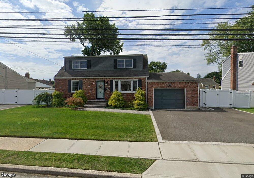
321 N Niagara Ave Lindenhurst, NY 11757
Estimated Value: $556,000 - $646,000
4
Beds
1
Bath
1,752
Sq Ft
$348/Sq Ft
Est. Value
About This Home
This home is located at 321 N Niagara Ave, Lindenhurst, NY 11757 and is currently estimated at $609,466, approximately $347 per square foot. 321 N Niagara Ave is a home located in Suffolk County with nearby schools including Daniel Street School, Lindenhurst Middle School, and Lindenhurst Senior High School.
Ownership History
Date
Name
Owned For
Owner Type
Purchase Details
Closed on
Mar 21, 2017
Sold by
Mcdermott Brian G
Bought by
Korytkowski Pawel and Korytkowski Anna
Current Estimated Value
Home Financials for this Owner
Home Financials are based on the most recent Mortgage that was taken out on this home.
Original Mortgage
$216,000
Outstanding Balance
$175,685
Interest Rate
3.5%
Mortgage Type
Adjustable Rate Mortgage/ARM
Estimated Equity
$433,781
Purchase Details
Closed on
Dec 27, 2013
Sold by
Mcdermott Brian G and Mcdermott William F
Bought by
Mcdermott Brian G
Create a Home Valuation Report for This Property
The Home Valuation Report is an in-depth analysis detailing your home's value as well as a comparison with similar homes in the area
Home Values in the Area
Average Home Value in this Area
Purchase History
| Date | Buyer | Sale Price | Title Company |
|---|---|---|---|
| Korytkowski Pawel | $270,000 | Fidelity National Title | |
| Mcdermott Brian G | -- | -- |
Source: Public Records
Mortgage History
| Date | Status | Borrower | Loan Amount |
|---|---|---|---|
| Open | Korytkowski Pawel | $216,000 |
Source: Public Records
Tax History Compared to Growth
Tax History
| Year | Tax Paid | Tax Assessment Tax Assessment Total Assessment is a certain percentage of the fair market value that is determined by local assessors to be the total taxable value of land and additions on the property. | Land | Improvement |
|---|---|---|---|---|
| 2024 | $13,052 | $3,530 | $340 | $3,190 |
| 2023 | $11,804 | $3,530 | $340 | $3,190 |
| 2022 | $3,337 | $3,530 | $340 | $3,190 |
| 2021 | $3,337 | $3,530 | $340 | $3,190 |
| 2020 | $10,955 | $3,530 | $340 | $3,190 |
| 2019 | $12,056 | $0 | $0 | $0 |
| 2018 | $10,541 | $3,530 | $340 | $3,190 |
| 2017 | $10,541 | $3,530 | $340 | $3,190 |
| 2016 | $14,512 | $3,530 | $340 | $3,190 |
| 2015 | -- | $3,530 | $340 | $3,190 |
| 2014 | -- | $3,530 | $340 | $3,190 |
Source: Public Records
Map
Nearby Homes
- 417 N Monroe Ave
- 404 N Putnam Ave
- 436 N Ontario Ave
- 457 N Monroe Ave
- 465 N Monroe Ave
- 475 N Putnam Ave
- 449 N Indiana Ave
- 833 Bermuda Rd
- 145 Centre Ave
- 557 N Kings Ave
- 468 N Greene Ave
- 480 N Greene Ave
- 805 Arlington Rd
- 247 N Greene Ave
- 380 N Delaware Ave
- 1701 Alto St
- 792 Glendale Rd
- 405 N Clinton Ave
- 136 N Delaware Ave
- 656 N Greene Ave
- 333 N Niagara Ave
- 309 N Niagara Ave
- 320 N Monroe Ave
- 332 N Monroe Ave
- 310 N Monroe Ave
- 320 N Niagara Ave
- 345 N Niagara Ave
- 342 Byrd St
- 310 N Niagara Ave
- 332 N Niagara Ave
- 344 N Monroe Ave
- 332 Byrd St
- 352 Byrd St
- 344 N Niagara Ave
- 356 N Monroe Ave
- 321 N Ontario Ave
- 321 N Monroe Ave
- 309 N Ontario Ave
- 333 N Ontario Ave
- 333 N Monroe Ave