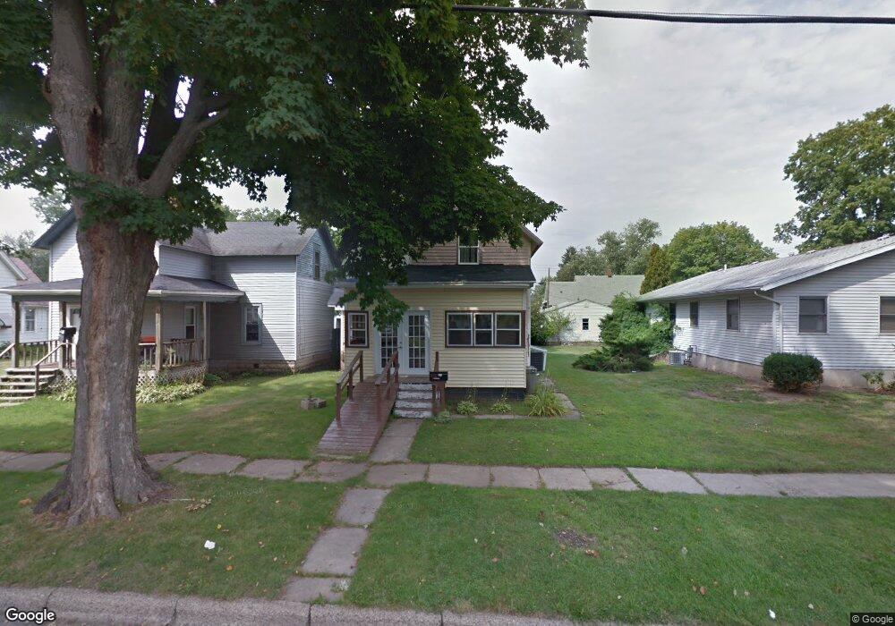
321 Niles St La Porte, IN 46350
Estimated Value: $109,000 - $159,000
3
Beds
2
Baths
1,166
Sq Ft
$114/Sq Ft
Est. Value
About This Home
This home is located at 321 Niles St, La Porte, IN 46350 and is currently estimated at $133,403, approximately $114 per square foot. 321 Niles St is a home located in LaPorte County with nearby schools including Carver Elementary School, Hailmann Elementary School, and Lincoln Elementary School.
Ownership History
Date
Name
Owned For
Owner Type
Purchase Details
Closed on
Mar 1, 2006
Sold by
Wort Jay B and Wort Carol S
Bought by
Cunningham Bruce and Cunningham Ramona
Current Estimated Value
Home Financials for this Owner
Home Financials are based on the most recent Mortgage that was taken out on this home.
Original Mortgage
$30,000
Interest Rate
6.2%
Mortgage Type
Seller Take Back
Create a Home Valuation Report for This Property
The Home Valuation Report is an in-depth analysis detailing your home's value as well as a comparison with similar homes in the area
Home Values in the Area
Average Home Value in this Area
Purchase History
| Date | Buyer | Sale Price | Title Company |
|---|---|---|---|
| Cunningham Bruce | $30,000 | None Available |
Source: Public Records
Mortgage History
| Date | Status | Borrower | Loan Amount |
|---|---|---|---|
| Closed | Cunningham Bruce | $30,000 |
Source: Public Records
Tax History Compared to Growth
Tax History
| Year | Tax Paid | Tax Assessment Tax Assessment Total Assessment is a certain percentage of the fair market value that is determined by local assessors to be the total taxable value of land and additions on the property. | Land | Improvement |
|---|---|---|---|---|
| 2024 | $583 | $58,800 | $11,600 | $47,200 |
| 2023 | $504 | $56,800 | $9,600 | $47,200 |
| 2022 | $639 | $67,000 | $9,600 | $57,400 |
| 2021 | $668 | $68,700 | $9,600 | $59,100 |
| 2020 | $658 | $68,700 | $9,600 | $59,100 |
| 2019 | $702 | $69,200 | $9,500 | $59,700 |
| 2018 | $537 | $61,700 | $7,500 | $54,200 |
| 2017 | $582 | $59,400 | $7,500 | $51,900 |
| 2016 | $528 | $53,900 | $6,600 | $47,300 |
| 2014 | $1,028 | $51,300 | $6,600 | $44,700 |
Source: Public Records
Map
Nearby Homes
- 330 Virginia Ave
- 208 Norton St
- 910 Scott St
- 206 Ohio St
- 403 Rose St
- 202 Jefferson Ave
- 906 Linwood Ave
- 414 Allen St
- 602 Plain St
- 807 Division St
- 810 Virginia Ave
- 107 Lincolnway
- 205 Lawrence St
- 503 Grove St
- 0 Brighton St Unit NRA542345
- 706 Detroit St
- 413 Jefferson Ave
- 907 Division St
- 916 Ohio St
- 0 E Jefferson Ave