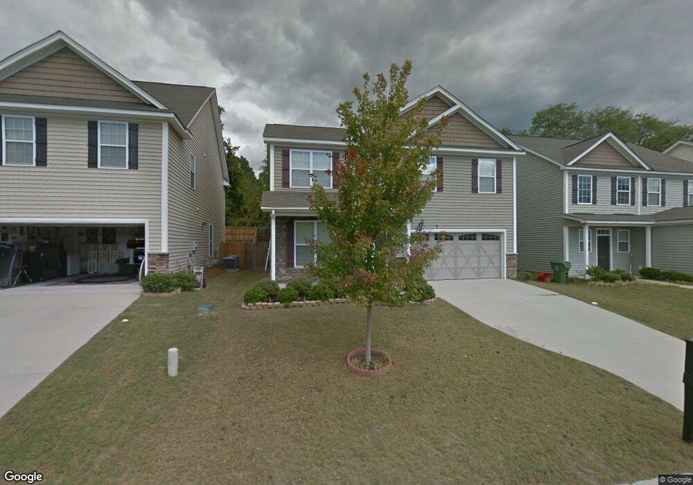
321 Patrick Dr Columbia, SC 29223
Northeast Columbia NeighborhoodEstimated Value: $260,000 - $313,000
4
Beds
3
Baths
2,281
Sq Ft
$127/Sq Ft
Est. Value
About This Home
This home is located at 321 Patrick Dr, Columbia, SC 29223 and is currently estimated at $288,553, approximately $126 per square foot. 321 Patrick Dr is a home located in Richland County with nearby schools including L. B. Nelson Elementary School, E. L. Wright Middle School, and Spring Valley High School.
Ownership History
Date
Name
Owned For
Owner Type
Purchase Details
Closed on
Mar 27, 2024
Sold by
Horne Azalia and Horne Bernard
Bought by
Olivia Hazel South Carolina Llc
Current Estimated Value
Purchase Details
Closed on
Aug 31, 2021
Sold by
Montes Carlos Mariano
Bought by
Horne Azalia and Horne Bernard
Home Financials for this Owner
Home Financials are based on the most recent Mortgage that was taken out on this home.
Original Mortgage
$242,451
Interest Rate
2.8%
Mortgage Type
VA
Purchase Details
Closed on
May 27, 2011
Sold by
D R Horton Inc
Bought by
Montes Carlos Mariano
Home Financials for this Owner
Home Financials are based on the most recent Mortgage that was taken out on this home.
Original Mortgage
$153,122
Interest Rate
4.71%
Mortgage Type
VA
Create a Home Valuation Report for This Property
The Home Valuation Report is an in-depth analysis detailing your home's value as well as a comparison with similar homes in the area
Home Values in the Area
Average Home Value in this Area
Purchase History
| Date | Buyer | Sale Price | Title Company |
|---|---|---|---|
| Olivia Hazel South Carolina Llc | $249,506 | South Carolina Title | |
| Horne Azalia | $238,500 | None Available | |
| Montes Carlos Mariano | $149,900 | -- |
Source: Public Records
Mortgage History
| Date | Status | Borrower | Loan Amount |
|---|---|---|---|
| Previous Owner | Horne Azalia | $242,451 | |
| Previous Owner | Montes Carlos Mariano | $153,122 |
Source: Public Records
Tax History
| Year | Tax Paid | Tax Assessment Tax Assessment Total Assessment is a certain percentage of the fair market value that is determined by local assessors to be the total taxable value of land and additions on the property. | Land | Improvement |
|---|---|---|---|---|
| 2024 | $7,627 | $224,600 | $35,800 | $188,800 |
| 2023 | $7,436 | $9,540 | $0 | $0 |
| 2022 | $2,301 | $238,500 | $25,000 | $213,500 |
| 2021 | $1,588 | $6,040 | $0 | $0 |
| 2020 | $1,611 | $6,040 | $0 | $0 |
| 2019 | $1,588 | $6,040 | $0 | $0 |
| 2018 | $1,465 | $5,480 | $0 | $0 |
| 2017 | $1,437 | $5,480 | $0 | $0 |
| 2016 | $1,432 | $5,480 | $0 | $0 |
| 2015 | $1,437 | $5,480 | $0 | $0 |
| 2014 | $1,435 | $136,900 | $0 | $0 |
| 2013 | -- | $5,480 | $0 | $0 |
Source: Public Records
Map
Nearby Homes
- 329 Patrick Dr
- 213 Pond Ridge Rd E
- 231 Pond Ridge Rd E
- 136 Mcneely Rd
- 313 Thornridge Rd
- 31 Dove Park Cir
- 116 Fishers Shore Rd
- 502 Dove Park Rd
- 307 E Springs Rd
- 308 Valley Springs Rd
- 300 Valley Springs Rd
- 512 Humble Dr
- 27 Foxhill Ct
- 505 Humble Dr
- 816 Kinlock Ct
- 2224 Westbranch Rd
- 2413 Bermuda Hills Rd
- 501 Sheridan Dr
- 214 Woodlands Village Dr
- 305 Concourse Dr
Your Personal Tour Guide
Ask me questions while you tour the home.