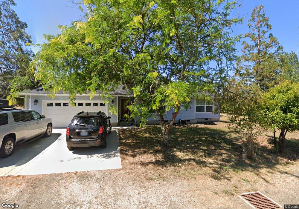
321 Plat M Rd Sutherlin, OR 97479
Estimated Value: $355,000 - $462,000
2
Beds
1
Bath
960
Sq Ft
$428/Sq Ft
Est. Value
About This Home
This home is located at 321 Plat M Rd, Sutherlin, OR 97479 and is currently estimated at $410,989, approximately $428 per square foot. 321 Plat M Rd is a home located in Douglas County with nearby schools including East Sutherlin Primary School, West Sutherlin Intermediate School, and Sutherlin Middle School.
Ownership History
Date
Name
Owned For
Owner Type
Purchase Details
Closed on
Aug 17, 2021
Sold by
Haley Adam Andrew and Haley Nanette Faye
Bought by
Robinson Sam C and Robinson Gladys F
Current Estimated Value
Purchase Details
Closed on
Jul 25, 2018
Sold by
Haley Adam Andrew and Haley Nanette Faye
Bought by
Rice Virginia Lee and Virginia Lee Rice Living Trust
Purchase Details
Closed on
Mar 9, 2012
Sold by
Rice Virginia L
Bought by
Gillian Andrew R and Stinnett Sheri L
Create a Home Valuation Report for This Property
The Home Valuation Report is an in-depth analysis detailing your home's value as well as a comparison with similar homes in the area
Home Values in the Area
Average Home Value in this Area
Purchase History
| Date | Buyer | Sale Price | Title Company |
|---|---|---|---|
| Robinson Sam C | -- | None Available | |
| Rice Virginia Lee | -- | Amerititle | |
| Haley Adam Andrew | $85,000 | Amerititle | |
| Gillian Andrew R | $95,000 | First American Title Ins Co |
Source: Public Records
Tax History Compared to Growth
Tax History
| Year | Tax Paid | Tax Assessment Tax Assessment Total Assessment is a certain percentage of the fair market value that is determined by local assessors to be the total taxable value of land and additions on the property. | Land | Improvement |
|---|---|---|---|---|
| 2024 | $1,776 | $227,719 | -- | -- |
| 2023 | $1,726 | $221,087 | $0 | $0 |
| 2022 | $1,678 | $214,648 | $0 | $0 |
| 2021 | $1,631 | $208,397 | $0 | $0 |
| 2020 | $1,585 | $202,328 | $0 | $0 |
| 2019 | $1,182 | $148,621 | $0 | $0 |
| 2018 | $775 | $94,339 | $0 | $0 |
| 2017 | $840 | $91,592 | $0 | $0 |
| 2016 | $818 | $88,925 | $0 | $0 |
| 2015 | $796 | $86,335 | $0 | $0 |
| 2014 | $774 | $83,821 | $0 | $0 |
| 2013 | -- | $81,380 | $0 | $0 |
Source: Public Records
Map
Nearby Homes
- 135 Elkton St
- 154 Coles Valley St
- 126 Coles Valley St
- 149 Coles Valley St
- 336 Schudeiske Rd
- 892 Fir Grove Ln
- 908 Fir Grove Ln
- 1688 W Central Ave
- 181 SW Hutchins St
- 0 Dakota St Unit B 500248401
- 1878 Trails End Ln
- 420 Backwater Loop
- 307 Cambridge Dr
- 910 Swallow Ave
- 819 S Comstock Ave Unit 13
- 2730 Golfview Ave
- 1386 Airway Ave
- 702 Divot Loop
- 851 S Comstock Rd
- 122 Lilly Ct