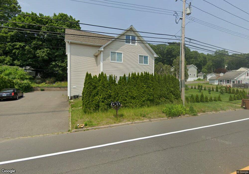
321 River Rd Unit 2 Shelton, CT 06484
Estimated Value: $442,000 - $596,000
2
Beds
1
Bath
1,000
Sq Ft
$532/Sq Ft
Est. Value
About This Home
This home is located at 321 River Rd Unit 2, Shelton, CT 06484 and is currently estimated at $532,000, approximately $532 per square foot. 321 River Rd Unit 2 is a home located in Fairfield County with nearby schools including Sunnyside Elementary School, Perry Hill School, and Shelton Intermediate School.
Ownership History
Date
Name
Owned For
Owner Type
Purchase Details
Closed on
Sep 9, 2010
Sold by
Deutsche Bank Natl T C
Bought by
Druzdz Mark
Current Estimated Value
Purchase Details
Closed on
Aug 20, 2010
Sold by
Das Santanu
Bought by
Deutsche Bk
Purchase Details
Closed on
Jul 30, 2010
Sold by
Stepan Zoe and Stepan Russell
Bought by
Deutsche Bank Natl T C
Purchase Details
Closed on
Jan 27, 1987
Sold by
Drozdowski Frank
Bought by
Pillai Suresh
Home Financials for this Owner
Home Financials are based on the most recent Mortgage that was taken out on this home.
Original Mortgage
$153,700
Interest Rate
9.36%
Mortgage Type
Purchase Money Mortgage
Create a Home Valuation Report for This Property
The Home Valuation Report is an in-depth analysis detailing your home's value as well as a comparison with similar homes in the area
Home Values in the Area
Average Home Value in this Area
Purchase History
| Date | Buyer | Sale Price | Title Company |
|---|---|---|---|
| Druzdz Mark | $80,000 | -- | |
| Druzdz Mark | $80,000 | -- | |
| Deutsche Bk | -- | -- | |
| Deutsche Bk | -- | -- | |
| Deutsche Bank Natl T C | -- | -- | |
| Deutsche Bank Natl T C | -- | -- | |
| Pillai Suresh | $215,000 | -- |
Source: Public Records
Mortgage History
| Date | Status | Borrower | Loan Amount |
|---|---|---|---|
| Open | Pillai Suresh | $220,000 | |
| Previous Owner | Pillai Suresh | $206,250 | |
| Previous Owner | Pillai Suresh | $153,700 |
Source: Public Records
Tax History Compared to Growth
Tax History
| Year | Tax Paid | Tax Assessment Tax Assessment Total Assessment is a certain percentage of the fair market value that is determined by local assessors to be the total taxable value of land and additions on the property. | Land | Improvement |
|---|---|---|---|---|
| 2025 | $4,542 | $241,360 | $73,920 | $167,440 |
| 2024 | $4,629 | $241,360 | $73,920 | $167,440 |
| 2023 | $4,217 | $241,360 | $73,920 | $167,440 |
| 2022 | $4,217 | $241,360 | $73,920 | $167,440 |
| 2021 | $4,518 | $205,100 | $49,980 | $155,120 |
| 2020 | $4,598 | $205,100 | $49,980 | $155,120 |
| 2019 | $4,598 | $205,100 | $49,980 | $155,120 |
| 2017 | $4,555 | $205,100 | $49,980 | $155,120 |
| 2015 | $4,774 | $213,990 | $48,160 | $165,830 |
| 2014 | $4,774 | $213,990 | $48,160 | $165,830 |
Source: Public Records
Map
Nearby Homes
- 223 River Rd
- 20 3rd Ave
- 175 Coram Rd
- 178 River Rd
- 52 Katherine Ct
- 50 Katherine Ct Unit 50
- 112 River Rd
- 74 Victory St
- 1 Windward Way Unit 1
- 2 Windward Way Unit 2
- 5 Windward Way Unit 5
- 4 Windward Way Unit 4
- 3 Windward Way Unit 3
- 819 Quarter Mile Rd
- 965 Red Fox Rd
- 28 Edgewood Ave
- 196 New Haven Ave Unit 322
- 0 Harvard Ave
- 204 New Haven Ave Unit 2G
- 560 River Rd Unit 1