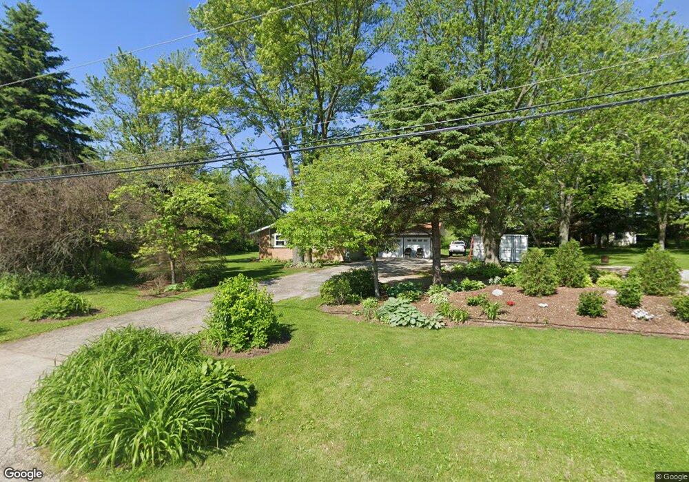
321 S Draper Rd McHenry, IL 60050
Estimated Value: $294,000 - $315,000
3
Beds
4
Baths
1,420
Sq Ft
$215/Sq Ft
Est. Value
About This Home
This home is located at 321 S Draper Rd, McHenry, IL 60050 and is currently estimated at $305,340, approximately $215 per square foot. 321 S Draper Rd is a home located in McHenry County with nearby schools including Valley View Elementary School, Parkland School, and McHenry Community High School - Upper Campus.
Ownership History
Date
Name
Owned For
Owner Type
Purchase Details
Closed on
Mar 30, 2018
Sold by
Feldt Ricahrd R
Bought by
Clark Charles W and The Draper 321 Trust
Current Estimated Value
Home Financials for this Owner
Home Financials are based on the most recent Mortgage that was taken out on this home.
Original Mortgage
$122,600
Outstanding Balance
$89,200
Interest Rate
4.46%
Mortgage Type
New Conventional
Estimated Equity
$216,140
Purchase Details
Closed on
Jul 30, 2002
Sold by
Feldt Cynthia G
Bought by
Feldt Richard R
Home Financials for this Owner
Home Financials are based on the most recent Mortgage that was taken out on this home.
Original Mortgage
$50,000
Interest Rate
6.56%
Mortgage Type
Purchase Money Mortgage
Create a Home Valuation Report for This Property
The Home Valuation Report is an in-depth analysis detailing your home's value as well as a comparison with similar homes in the area
Home Values in the Area
Average Home Value in this Area
Purchase History
| Date | Buyer | Sale Price | Title Company |
|---|---|---|---|
| Clark Charles W | $160,000 | Attorney | |
| Feldt Richard R | -- | Universal Title Services Inc |
Source: Public Records
Mortgage History
| Date | Status | Borrower | Loan Amount |
|---|---|---|---|
| Open | Clark Charles W | $122,600 | |
| Previous Owner | Feldt Richard R | $50,000 |
Source: Public Records
Tax History Compared to Growth
Tax History
| Year | Tax Paid | Tax Assessment Tax Assessment Total Assessment is a certain percentage of the fair market value that is determined by local assessors to be the total taxable value of land and additions on the property. | Land | Improvement |
|---|---|---|---|---|
| 2024 | $4,557 | $73,276 | $28,007 | $45,269 |
| 2023 | $4,320 | $65,712 | $25,116 | $40,596 |
| 2022 | $4,381 | $60,093 | $22,968 | $37,125 |
| 2021 | $4,156 | $56,341 | $21,534 | $34,807 |
| 2020 | $4,099 | $54,653 | $20,889 | $33,764 |
| 2019 | $7,073 | $79,311 | $24,608 | $54,703 |
| 2018 | $7,359 | $74,499 | $23,115 | $51,384 |
| 2017 | $7,891 | $71,373 | $22,145 | $49,228 |
| 2016 | $7,799 | $68,098 | $21,129 | $46,969 |
| 2013 | -- | $64,808 | $20,108 | $44,700 |
Source: Public Records
Map
Nearby Homes
- 7200 Millburne Ct
- 7207 Millburne Ct
- 7208 Millburne Ct
- 6911 Galway Dr
- 6722 Killala Ln
- 7111 Forest Oak Dr
- 7212 Forest Oak Dr
- 7110 Forest Oak Dr
- 7106 Forest Oak Dr
- 7407 Forest Oak Dr
- 7220 Forest Oak Dr
- 7319 Forest Oak Dr
- 7304 Forest Oak Dr
- 6409 Donegal Ln
- 7316 Forest Oak Dr
- 7402 Forest Oak Dr
- 7408 Forest Oak Dr
- 6411 Longford Dr
- 6407 Longford Dr
- 8206 Bull Valley Rd
- 401 S Draper Rd
- 219 S Draper Rd
- 219 S Draper Rd
- 7041 Liam Ln
- LOT 16 Millburne Ct
- Lot 7 Millburne Ct
- 7033 Liam Ln
- 7203 Millburne Ct
- 7204 Millburne Ct
- 419 S Draper Rd
- 7029 Liam Ln
- 207 S Draper Rd
- 7211 Millburne Ct
- 7028 Liam Ln
- 7101 Wexford Ct
- 7300 Stirlingshire Ct
- 7025 Liam Ln
- 7212 Millburne Ct
- 7215 Millburne Ct
- 7024 Liam Ln