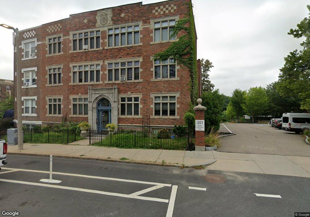
321 S Huntington Ave Unit 15 Jamaica Plain, MA 02130
Jamaica Plain NeighborhoodEstimated Value: $360,000 - $463,000
1
Bed
1
Bath
680
Sq Ft
$624/Sq Ft
Est. Value
About This Home
This home is located at 321 S Huntington Ave Unit 15, Jamaica Plain, MA 02130 and is currently estimated at $424,613, approximately $624 per square foot. 321 S Huntington Ave Unit 15 is a home located in Suffolk County with nearby schools including Roxbury Preparatory Charter School and Nativity Preparatory School.
Ownership History
Date
Name
Owned For
Owner Type
Purchase Details
Closed on
Jun 11, 2001
Sold by
Broad Michael
Bought by
Hatcher Andrew H
Current Estimated Value
Home Financials for this Owner
Home Financials are based on the most recent Mortgage that was taken out on this home.
Original Mortgage
$88,000
Outstanding Balance
$33,374
Interest Rate
7.08%
Mortgage Type
Purchase Money Mortgage
Estimated Equity
$391,239
Purchase Details
Closed on
Mar 22, 1995
Sold by
Gilliland Eric J
Bought by
Broad Michael
Create a Home Valuation Report for This Property
The Home Valuation Report is an in-depth analysis detailing your home's value as well as a comparison with similar homes in the area
Home Values in the Area
Average Home Value in this Area
Purchase History
| Date | Buyer | Sale Price | Title Company |
|---|---|---|---|
| Hatcher Andrew H | $110,000 | -- | |
| Broad Michael | $8,936 | -- |
Source: Public Records
Mortgage History
| Date | Status | Borrower | Loan Amount |
|---|---|---|---|
| Open | Broad Michael | $88,000 |
Source: Public Records
Tax History Compared to Growth
Tax History
| Year | Tax Paid | Tax Assessment Tax Assessment Total Assessment is a certain percentage of the fair market value that is determined by local assessors to be the total taxable value of land and additions on the property. | Land | Improvement |
|---|---|---|---|---|
| 2025 | $3,879 | $335,000 | $0 | $335,000 |
| 2024 | $3,989 | $366,000 | $0 | $366,000 |
| 2023 | $3,741 | $348,300 | $0 | $348,300 |
| 2022 | $3,575 | $328,600 | $0 | $328,600 |
| 2021 | $3,438 | $322,200 | $0 | $322,200 |
| 2020 | $2,688 | $254,500 | $0 | $254,500 |
| 2019 | $2,483 | $235,600 | $0 | $235,600 |
| 2018 | $2,421 | $231,000 | $0 | $231,000 |
| 2017 | $2,353 | $222,200 | $0 | $222,200 |
| 2016 | $2,306 | $209,600 | $0 | $209,600 |
| 2015 | $2,338 | $193,100 | $0 | $193,100 |
| 2014 | $2,229 | $177,200 | $0 | $177,200 |
Source: Public Records
Map
Nearby Homes
- 90 Bynner St Unit 7
- 343 S Huntington Ave Unit 7
- 24 Castleton St Unit C
- 31 Evergreen St Unit 1
- 33 Evergreen St Unit 1
- 24 Evergreen St Unit 2
- 12 Zamora St
- 68 Perkins St Unit 1
- 111 Perkins St Unit 152
- 111 Perkins St Unit 269
- 111 Perkins St Unit 108
- 10 Bynner St
- 70 Day St Unit 2
- 70 Day St
- 70 Day St Unit 1
- 31 Highland Unit 1
- 332 Jamaicaway Unit 406
- 60 Glen Rd Unit 101
- 60 Glen Rd Unit 206
- 81 Glen Rd Unit S2
- 321 S Huntington Ave Unit 12
- 321 S Huntington Ave Unit 11
- 321 S Huntington Ave Unit 10
- 321 S Huntington Ave Unit 9
- 321 S Huntington Ave Unit 8
- 321 S Huntington Ave Unit 7
- 321 S Huntington Ave Unit 6
- 321 S Huntington Ave Unit 5
- 321 S Huntington Ave Unit 4
- 321 S Huntington Ave Unit 3
- 321 S Huntington Ave Unit 2
- 321 S Huntington Ave Unit 1
- 321 S Huntington Ave Unit 14
- 321 S Huntington Ave Unit 5,321
- 321 S Huntington Ave
- 321 S Huntington Ave Unit 30
- 321 S Huntington Ave Unit 12,321
- 91 Bynner St Unit 1
- 91 Bynner St Unit 91B
- 91 Bynner St Unit 9