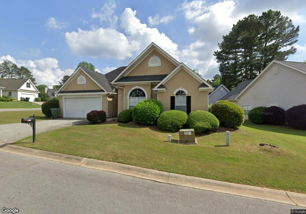
321 Turtle Pointe Dr Carrollton, GA 30116
Estimated Value: $275,000 - $290,000
3
Beds
2
Baths
1,464
Sq Ft
$193/Sq Ft
Est. Value
About This Home
This home is located at 321 Turtle Pointe Dr, Carrollton, GA 30116 and is currently estimated at $282,298, approximately $192 per square foot. 321 Turtle Pointe Dr is a home located in Carroll County with nearby schools including Carrollton Elementary School, Carrollton Upper Elementary School, and Carrollton Middle School.
Ownership History
Date
Name
Owned For
Owner Type
Purchase Details
Closed on
Oct 15, 2018
Sold by
Arrington Romie
Bought by
Arrington Esther
Current Estimated Value
Purchase Details
Closed on
Jan 4, 2002
Sold by
Malloy Patrick Comm
Bought by
Arrington Romie and Arrington Esther
Purchase Details
Closed on
Jul 25, 2001
Sold by
Turtle Pointe Dev
Bought by
Malloy Patrick Comm
Purchase Details
Closed on
Jul 23, 2001
Sold by
Malloy Patrick Comm
Bought by
Malloy Patrick Comm Inc
Create a Home Valuation Report for This Property
The Home Valuation Report is an in-depth analysis detailing your home's value as well as a comparison with similar homes in the area
Home Values in the Area
Average Home Value in this Area
Purchase History
| Date | Buyer | Sale Price | Title Company |
|---|---|---|---|
| Arrington Esther | -- | -- | |
| Arrington Romie | $119,200 | -- | |
| Malloy Patrick Comm | $48,000 | -- | |
| Malloy Patrick Comm Inc | -- | -- |
Source: Public Records
Tax History
| Year | Tax Paid | Tax Assessment Tax Assessment Total Assessment is a certain percentage of the fair market value that is determined by local assessors to be the total taxable value of land and additions on the property. | Land | Improvement |
|---|---|---|---|---|
| 2025 | $709 | $115,868 | $6,000 | $109,868 |
| 2024 | $718 | $115,868 | $6,000 | $109,868 |
| 2023 | $702 | $105,846 | $6,000 | $99,846 |
| 2022 | $671 | $86,131 | $6,000 | $80,131 |
| 2021 | $619 | $74,612 | $6,000 | $68,612 |
| 2020 | $563 | $61,897 | $6,000 | $55,897 |
| 2019 | $554 | $56,680 | $6,000 | $50,680 |
| 2018 | $481 | $52,718 | $6,000 | $46,718 |
| 2017 | $487 | $52,718 | $6,000 | $46,718 |
| 2016 | $489 | $52,718 | $6,000 | $46,718 |
| 2015 | $462 | $45,610 | $6,000 | $39,610 |
| 2014 | $465 | $45,610 | $6,000 | $39,610 |
Source: Public Records
Map
Nearby Homes
- 310 Turtle Pointe Dr
- 255 Morgan Rd
- 255 Morgan D2 Rd
- 211 Stoney Point Cove
- 383 Morgan Rd
- 108 Hunter Way
- 10 King Dr
- 0 Knight Dr W
- 0 Old Airport Rd Unit 10599783
- 0 Old Airport Rd Unit 7642238
- 0 Old Airport Rd Unit 7642301
- 0 Old Airport Rd Unit 7642336
- 0 Old Airport Rd Unit 10599779
- 231 N Lakeshore Dr
- 1711B Bankhead Hwy
- 0 Bankhead Hwy Unit 7682582
- 0 Shady Grove Rd Unit 7734570
- 00 Shady Grove Rd
- 0 Shady Grove Rd Unit 10709609
- 0 Shady Grove Rd Unit 10709664
- 321 Turtle Pointe Dr
- 321 Turtle Pointe Dr
- 321 Turtle Pointe Dr
- 319 Turtle Pointe Dr
- 320 Turtle Pointe Dr
- 311 Turtle Point
- 311 Turtle Pointe Dr
- 106 Terrapin Ct
- 106 Terrapin Ct Unit 26
- 402 Turtle Pointe Dr
- 318 Turtle Pointe Dr Unit 17
- 318 Turtle Pointe Dr
- 108 Terrapin Ct
- 103 Terrapin Ct
- 309 Turtle Pointe Dr
- 309 Turtle Pointe Dr Unit 32
- 107 Terrapin Ct
- 105 Terrapin Ct
- 314 Turtle Pointe Dr
- 307 Turtle Pointe Dr
Your Personal Tour Guide
Ask me questions while you tour the home.